Thunderstorms, rain and strong winds expected for Tasmania Thursday and Friday
A strong low pressure system and a series of cold fronts are expected to move across TAS during...
Tropical Cyclone Seroja and Tropical Cyclone Odette are currently lying off the coast of northwestern Australia, and are likely to pose a risk to the Australian mainland over the coming days.
Satellite imagery and computer models demonstrate how these two cyclones are entangled as they orbit each other, known also as the Fujiwhara effect, and are helping push each other towards the nation's west coast.
Odette, currently a category 1 system, is the smaller of the two systems and as it circles Tropical Cyclone Seroja in a clockwise direction, will pass close to the Australian mainland and weaken into a tropical low. Whilst a direct impact is unlikely, an increase in rain and a burst of wind is likely, with a severe weather warning in place for gusts reaching around 90km/h between Exmouth and Coral Bay during Saturday afternoon and evening.
As this system moves south and weakens further, Seroja (currently a category 1 system) is likely to gain strength and begin heading towards the Australian mainland. At this stage, it may become a category 3 system as early as tomorrow, before rapidly moving towards the mainland as a category 2 system later on Sunday and into Monday.
A tropical cyclone watch is currently in force from Coral Bay to Lancelin including Carnarvon, Denham, Kalbarri and Geraldton and extending inland to include Gascoyne Junction, Cue, Mount Magnet, Paynes Find and Dalwallinu. Destructive gusts to 150km/h are forecast near the centre of Seroja, as well as heavy to intense rainfall, flash flooding and abnormally high tides. Serious flooding is possible in the Denham and Shark Bay region.
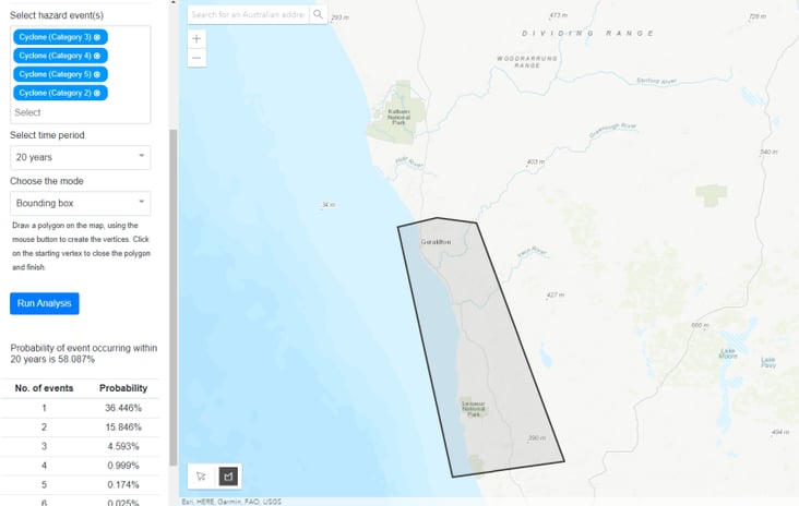
Using our Climate Risk Reporting Platform (CRRP), we can see that whilst category 2 cyclones are common across the Pilbara and the northwest Gascoyne, they become increasingly less common further down the coast. Particularly in the central west and the Geraldton region, which is expected to be near the centre of Seroja, cyclones of category 2 strength and above are uncommon.
Our alert operators and forecasters work around the clock to ensure all our clients are alerted as fast as possible. You can also keep up to date with latest warnings on our social media pages
Image 1: Bureau of Meteorology forecast track map of Tropical Cyclone Seroja
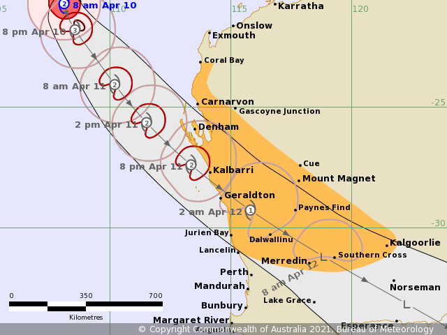 Image 2: Satellite Image showing twin cyclones Odette and Seroja
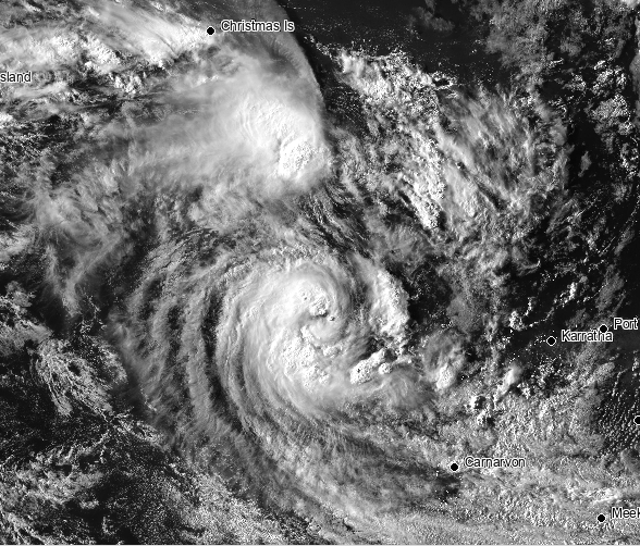 Image 3: Forecast wind gusts at 1am Monday 12 April, 2021 from the ECMWF Model (Source: Windy)
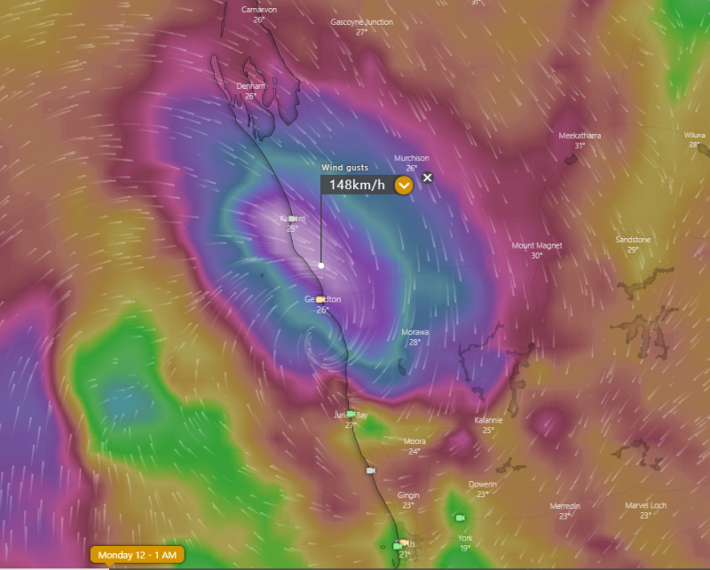 Image 4: Past tracks of category 2 tropical cyclones from EWN's Climate Risk Reporting Platform
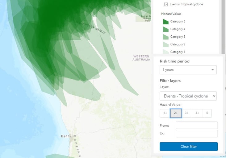 Image 5: Probabilities of a category 2 system or stronger in a 20 year period or longer in the Geraldton region, from EWN's Climate Risk Reporting Platform
A strong low pressure system and a series of cold fronts are expected to move across TAS during...
A destabilising atmosphere across northern NSW brought some showers and very isolated thunderstorms...
A large upper trough across Queensland led to unstable conditions through central and southern...