The rains have returned to thunderous applause
It was the most hotly-discussed weather content on the internet for the better part of a week, and...
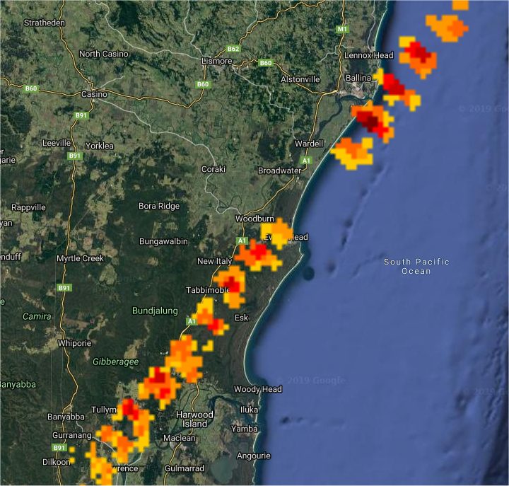
A destabilising atmosphere across northern NSW brought some showers and very isolated thunderstorms during the afternoon and evening.
Most cells were very weak however a low-topped thunderstorm developed near Grafton and tracked towards the northeast. Small hail was reported at several locations including Tabbimoble (southwest of Evans Head) and at East Ballina.
There was great display of lightning along the coast.
Image 1: Radar derived thunderstorm track
It was the most hotly-discussed weather content on the internet for the better part of a week, and...
The Early Warning Network is proud to announce a new Corporate Partnership with Bush Heritage...
Parts of central Australia, particularly South Australia, are in for a good soaking later this week...