Thunderstorms sweep through SE South Australia
A secondary cold front is expected through parts of southern and southeastern SA today after a wild...
A series of cold fronts will sweep across southern Australia, producing showers, storms, hail and snow for parts of VIC, southern NSW, TAS and southeastern SA over the coming days.
Strong to locally damaging winds are expected to develop for exposed coastal parts, elevated terrain and Alpine regions of VIC, TAS and southern NSW, extending up towards the Blue Mountains late into the weekend. Gusts of up to 100km/h will be possible, potentially stronger for Alpine regions.
Widespread showers and rain periods are expected to develop, particularly across western parts of TAS where accumulated rainfall totals of up to 150mm will be possible during the next 7 to 10 days, which may lead to flash flooding and minor riverine flooding. Further widespread falls of 10-30mm likely for southern VIC.
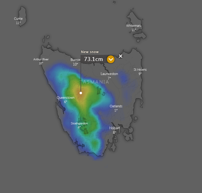
Ski resorts will be smiling, with the prospect of 20-60cm of snow expected over the next week, setting the foundations for the upcoming season.
Image 1: Predicted snowfall for VIC and NSW
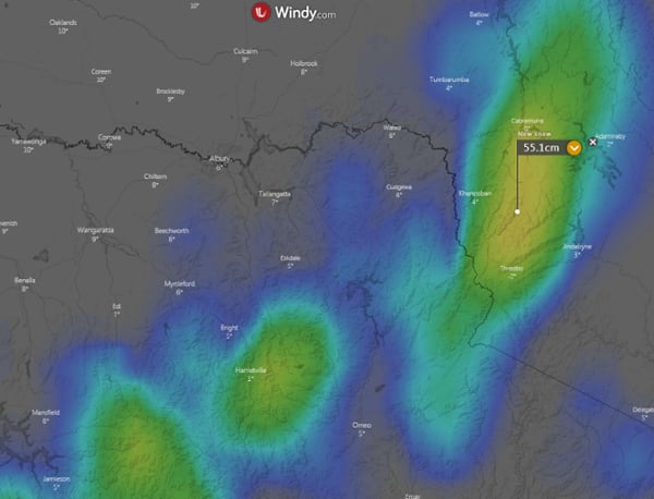
Image 2: Predicted snowfall for TAS
A secondary cold front is expected through parts of southern and southeastern SA today after a wild...
Cold air aloft in combination with moisture from a south-easterly change has generated weak...
Parts of central and southern Queensland will see an increase in rain and storms this weekend as a...