Heavy thunderstorm unloads a quickfire 89.8mm of rainfall over Brisbane in an hour
- Severe Thunderstorms affected parts of the Southeast and Brisbane CBD
- Damaging winds, giant hail...
A secondary cold front is expected through parts of southern and southeastern SA today after a wild night of thunderstorm activity across a vast portion southeastern Australia.
Due to the quick moving nature of the thunderstorm activity last night, these delivered very small rainfall totals, with some containing hail with very modest wind gusts.
The Adelaide Airport recorded a peak gust of 50km/h from the southwest at 1:03am this morning. Hindmarsh Island recorded the highest gust for the Adelaide and Mount Lofty Ranges region with 59km/h at 12:36am.
A broad mass of cold air from the Southern Ocean will succeed the cold front across the rest of southeastern Australia, effectively increasing the potential for hail and snow today and into tomorrow for elevated regions, along with a noticeable drop in daytime temperatures into this coming weekend.
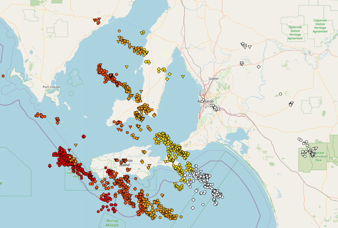
Image 1: Adelaide and surrounds GIS Lightning Data. EWN. Adelaide, SA. May 19/20, 2020.
As the southeast of Australia experienced days of strong winds, showers and the heaviest snow in...
After a hot and muggy weekend, thunderstorms will return to South East Queensland on Tuesday...