Winter is coming!!
A series of cold fronts will sweep across southern Australia, producing showers, storms, hail and...
Cold air aloft in combination with moisture from a south-easterly change has generated weak instability across southern QLD.
In response, scattered shower and thunderstorm activity is currently ongoing across parts of the Warrego and Marrano and Darling Downs regions.
Whilst storm activity is not expected to become severe across these regions, bursts of heavy rain and small hail may accompany activity this afternoon and evening, before dissipating during the night.
Image: EWN satellite image with radar and lightning overlay at 2.30pm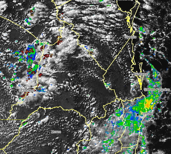
A series of cold fronts will sweep across southern Australia, producing showers, storms, hail and...
Torrential rain is likely over parts of the New South Wales coast over the next few days, with...
Yet another heavy rain event with flooding potential is aiming its sights on the southern coast of...