Weather News Archive 2019 October
Image 1: Forest Fire Danger Index for South Australia for 31 October, 2019 (Source: Bureau of...
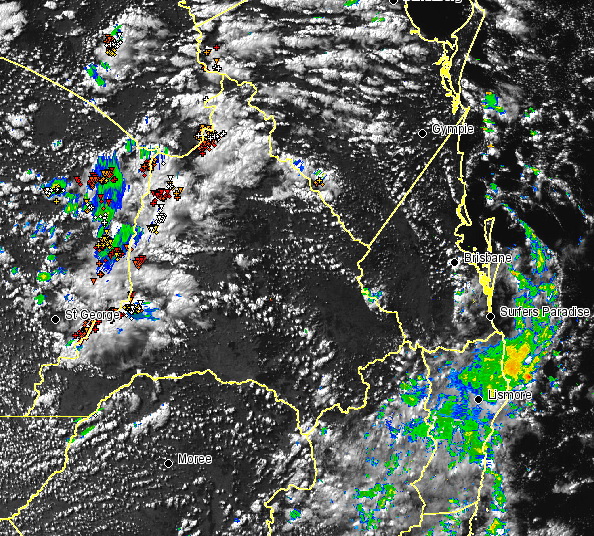
Image: EWN satellite image with radar and lightning overlay at 2.30pm
Cold air aloft in combination with moisture from a south-easterly change has generated weak instability across southern QLD.
In response, scattered shower and thunderstorm activity is currently ongoing across parts of the Warrego and Marrano and Darling Downs regions.
Whilst storm activity is not expected to become severe across these regions, bursts of heavy rain and small hail may accompany activity this afternoon and evening, before dissipating during the night.
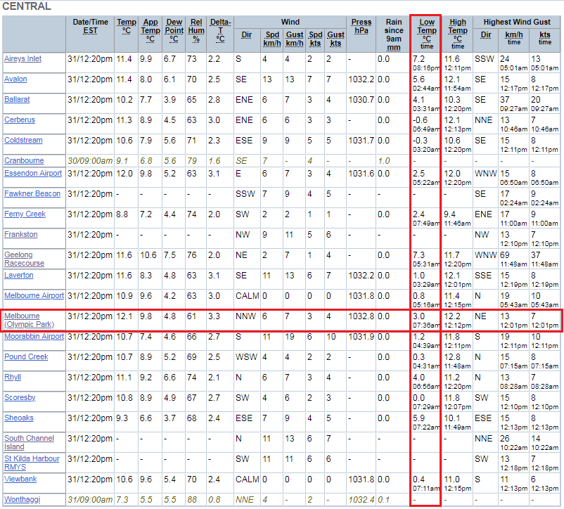
Image: BoM Greater Melbourne observations
Melbourne residents have woken to the coldest morning of the year. The CBD dropped down to 3.0C after 6am this morning, cooler than any other morning so far in 2019 by 0.5 of a degree.
The outer suburbs felt the pinch a little more, with Scoresby dropping to 0C, Viewbank 0.4C and Cerberus -0.6C. Meanwhile Alpine regions recorded the coldest temperatures across the state, with Mt Hotham dropping to -4.4C and Falls Creek to -4.3C.
These cold and settled conditions are due to a large, slow moving high pressure system sitting across The Bight. This ridge will continue to maintain light winds with very isolated showers across exposed coastal regions through until the weekend, before a cold front moves into the region early next week.
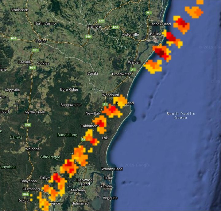
Image 1: Radar derived thunderstorm track
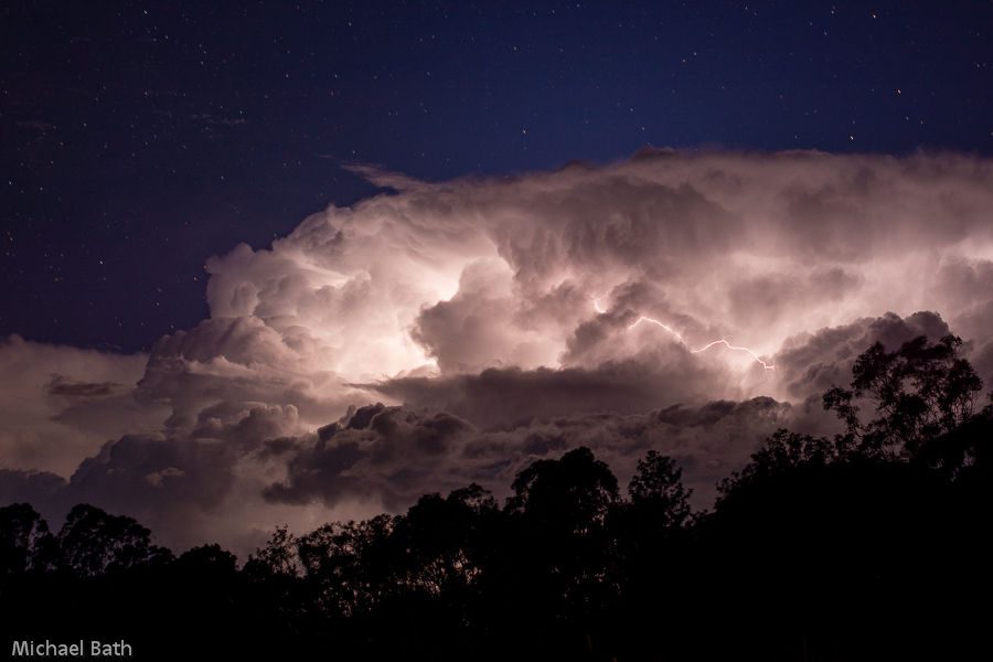
Image 2: Lightning illuminates the storm clouds near Ballina
A destabilising atmosphere across northern NSW brought some showers and very isolated thunderstorms during the afternoon and evening.
Most cells were very weak however a low-topped thunderstorm developed near Grafton and tracked towards the northeast. Small hail was reported at several locations including Tabbimoble (southwest of Evans Head) and at East Ballina.
There was great display of lightning along the coast.
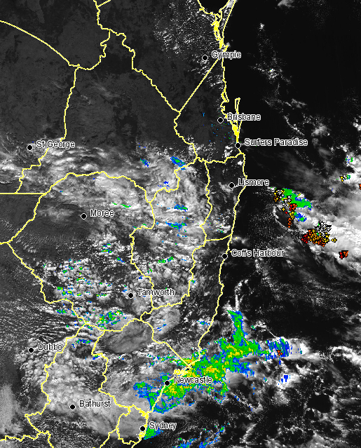
Image 1: EWN satellite image with radar and lightning overlay at 1pm
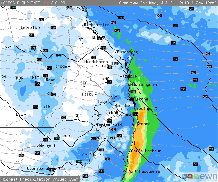
Image 2: Access R 24 hour precipitation for Wednesday
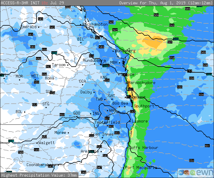
Image 3: Access R 24 hour precipitation for Thursday
Showers are set to develop across parts of northern NSW and SE QLD from late this evening until the end of the week.
A southerly change will move up the NSW coast during Tuesday and into southern QLD this evening. Isolated shower activity is expected to develop behind this change, with the potential for an isolated storm or two, most likely offshore.
During Wednesday and Thursday, a cold pool of air in the upper atmosphere will move into the region, generating weak instability. This will enhance shower activity, particularly for coastal locations, along with the potential for an isolated weak thunderstorm or two.
Shower activity will gradually ease during Friday and into Saturday, however a couple of millimeters will still be possible, particularly across exposed coastal locations in northern NSW and SE QLD.
Whilst drought breaking rain isn't expected for inland locations, 5-10mm will be possible, increasing to 10-25mm for coastal locations.
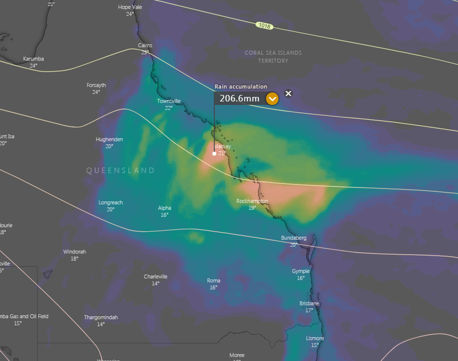
Image 1: EC accumulated forecast rainfall
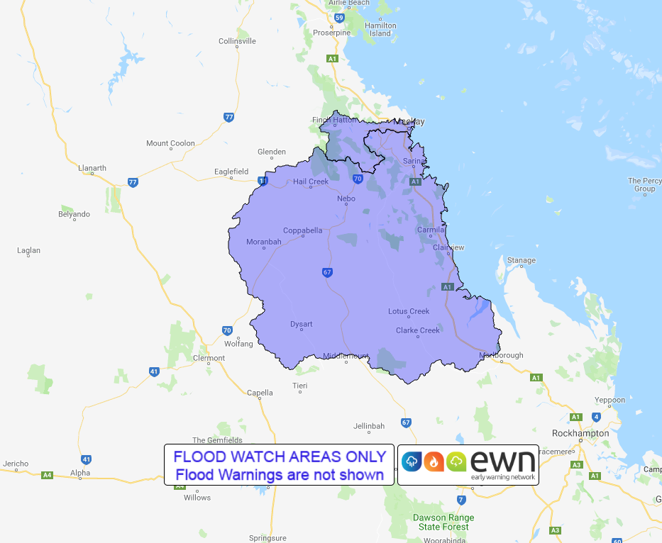
Image 2: Flood watch areas
A rare dry season rainfall event is set to unfold across parts of the Central QLD coast over the next several days.
An upper trough moving across eastern Australia will induce a surface trough across the central QLD coast. This in combination with moist south-easterly winds will lead to an increase in shower and rain activity late this afternoon and into Friday.
Widespread falls of 50-100mm are expected, with isolated heavier falls of up to 200mm possible through until Saturday along with the risk of isolated thunderstorms. This may lead to flash flooding and minor river flooding across parts of the Whitsunday and Capricorn Coast.
Conditions should gradually ease late Saturday and into Sunday, as the upper trough moves off the east coast, with onshore showers likely to persist into early next week as a high pressure system in the Tasman Sea maintains a ridge across the QLD Coast.
A flood watch remains current for parts of the Whitsunday and Capricorn Coast, with the Pioneer River, Connors, Isaac and Styx River and Plane Creek catchments likely to be affected.
Image 1: Forest Fire Danger Index for South Australia for 31 October, 2019 (Source: Bureau of...
It was the most hotly-discussed weather content on the internet for the better part of a week, and...
Parts of South East Queensland will begin to clean up the mess left after savage May thunderstorms...