Welcome rainfall on the way for northern NSW and southern Queensland
After 20 consecutive days without rain, the longest period since a 21-day stretch over May into...
Victoria and Melbourne specifically are often known for having four seasons in a day, but how about two opposite weather events in 24 hours?
That’s what’s occurring across eastern Victoria today.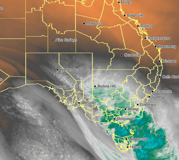
Water vapour imagery of the powerful upper system and associated front & storms.
Firefighters battled emergency warning fires on Monday and Tuesday across the East Gippsland region, with over 12300 acres burnt in the area, and over 220 bush and grassfires across Victoria since Saturday. Fast forward 24 hours and those same fires have nearly been extinguished by heavy rainfalls.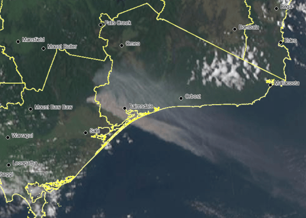
Two emergency warned bushfire burn across the East Gippsland region of Victoria.
In the 24-hours to 9 am Wednesday, widespread falls of 70-150mm have been recorded across parts of central and eastern Victoria with record-breaking October rainfall for numerous sites across the state.
A few notable totals and new October rainfall records include.
- Mount Hotham 197.6mm is a new site daily rainfall total record. This site record dates to 1990.
- Taggerty 106.6mm new daily October record. The previous was 72.8mm in 2001
- Falls Creek 144.8mm new daily October record. Previous 112mm 1998
- Traralgon 83.3mm new daily October record. Previous 40.6mm 2001
- Strathbogie 102mm new daily October record. Previous 73.4mm 2022
- East Sale AP 100.4mm new daily October record (only been in operation since 2017). Previous 23.8mm 2021
- East Sale 99.2mm new daily October record. The previous was 75.7mm back in 1950
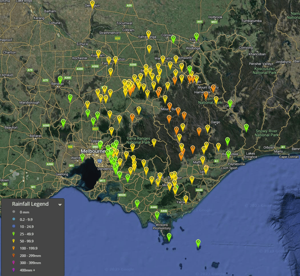 24-hour rainfall totals to 9am 4/10/2023 - widespread falls of 50-200mm. Image via EWN.
Heavy falls haven’t only helped in extinguishing fires across the eastern half of the state - they have alleviated the fire weather threat after several months of very dry conditions.
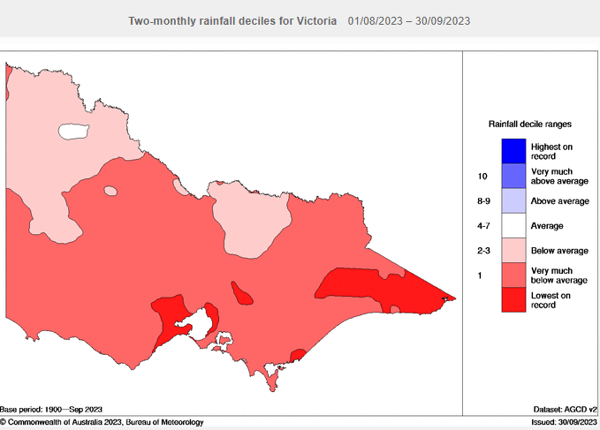 Last two months rainfall deciles indicating parts of eastern Victoria seeing their lowest on record. Image via BoM
Numerous rivers are beginning to flood, with the Macalister River at Licola entering major flooding this morning. The rain will continue to tumble on Wednesday, with further falls of 30-80mm possible across the eastern half of the state, exacerbating ongoing flooding for rivers and creeks.
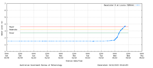 Macalister River at Licola enters major flooding this morning. Image via Bureau of Meteorology.
Residents in the affected areas are advised to stay alert and be prepared for potential severe weather conditions. Early Warning Network offers a variety of forecasting and warning technologies to assist in mitigating the risk posed by severe weather events. Customised flood monitoring is available throughout Australia, and we work with a number of councils to provide timely alerts for severe weather events. Check out our Support page for more information.
After 20 consecutive days without rain, the longest period since a 21-day stretch over May into...
Showers, storms and cooler weather is on the way for many parts of New South Wales and Queensland...
A powerful cold front sweeping across southeastern Australia will generate damaging wind gusts for...