Rain, storms, hail, snow and waterspouts batter Australia
The last few days has been extremely active weather wise acoss southeastern and southwestern...
A powerful cold front sweeping across southeastern Australia will generate damaging wind gusts for parts of southern NSW, Victoria, and Tasmania overnight Wednesday into Thursday.
Widespread gusts of 90-110km/h can be expected for the majority of Tasmania, parts of southern NSW and Victoria, with gusts of up to and exceeding 120km/h expected across parts of the east coast of Tasmania and alpine regions of NSW during Thursday morning.
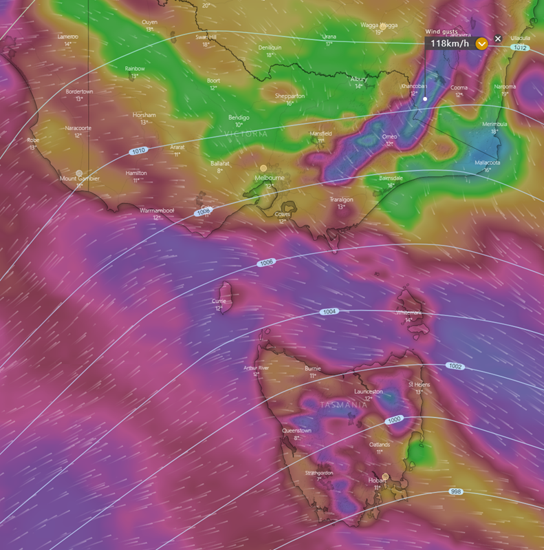
ICON wind gusts 3pm Thursday 25/05/2023. Image via Windy.com
Gusts of this nature can produce downed trees and powerlines, leading to significant power outages, as well as widespread roof damage. Airports across Tasmania are likely to be affected by this system with wind gusts of this nature causing havoc to inbound and outbound flights during the next 24 hours. Building sites, particularly high-rise building sites, may experience significant delays with cranes unable to be used under the stress of such a high wind environment. Large and powerful seas will also develop making boating conditions nearly impossible, with docking for larger commercial boats expected to be hazardous.
Severe weather warnings are currently in place for NSW, Victoria, and Tasmania for damaging wind gusts.
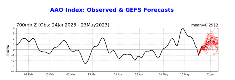
Whilst a strong positive phase of the Southern Annual Mode (SAM) has continued to keep strong cold fronts shunted well south of Australia, a recent dip towards a neutral (even briefly negative) phase has seen a slight uptick in the passage of more vigorous systems traversing southern Australia in the last two weeks.
Southern Annual Mode May 2023. Image via Bureau of Meteorology
Cold temperatures in conjunction with damaging northwesterly winds along this vigorous cold front has led to the Bureau of Meteorology issuing sheep graziers warnings for South Australia, Tasmania, NSW, and Victoria. In the wake of this frontal system, a continuation of gusty southwesterly winds will produce squally showers, small hail, and snow across southeastern Australia. These conditions will pose a significant threat to sheep farmers from late Wednesday through into the weekend with the potential for loss of sheep and lambs.
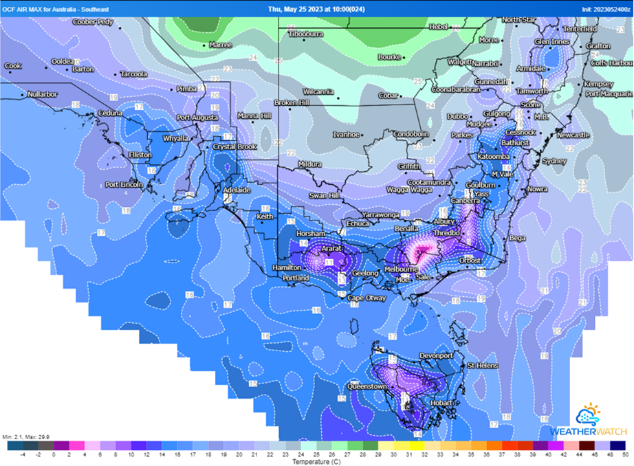
OCF maximum air temperature for Thursday 25/05/2023. Image via Weatherwatch Metcentre
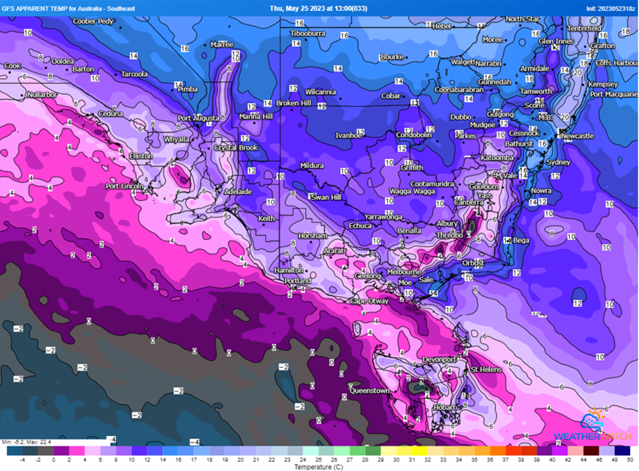
GFS apparent temperature for Thursday 25/05/2023. Image via Weatherwatch Metcentre
The last few days has been extremely active weather wise acoss southeastern and southwestern...
Tropical Cyclone Alfred has now turned towards land, intensifying as it approaches the southeast...
Unseasonably heavy rain is drenching northeast NSW and parts of eastern QLD, bringing the heaviest...