Victoria – from fires one day to flooding the next
Victoria and Melbourne specifically are often known for having four seasons in a day, but how...
After 20 consecutive days without rain, the longest period since a 21-day stretch over May into June of 2021, the off-colour brown grass that resides across SouthEastern Queensland will finally get a drink.
During Wednesday afternoon, isolated storms are expected across the western half of SEQ, extending into the Darling Downs and southern Wide Bay and Burnett region. There is just the slight risk of a localised damaging wind threat developing. Any cloud-to-ground lightning associated with high-based storms may enhance the already significant fire threat across these regions.
However, the chief focus for storms on Wednesday will be across the Mid North Coast, Northern Tablelands, and Northern Rivers of NSW. Instability will increase across this area tomorrow, with the added injection of a southerly change sweeping up the coast. This may see a few storms become severe and produce damaging winds and large hail for some regions.
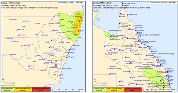
Wednesday afternoon thunderstorm threat maps. Image via Bureau of Meteorology.
This southerly change will continue to work its way up the coast on Thursday, arriving in SEQ during the day as a sharp upper trough begins to move in from the southwest. Increasing wind shear and instability are expected to lead to a few severe storms across western SEQ, with damaging winds and large hail the primary threats.
Whilst seeing some storm action across the region will be the October highlight for many, it’s what happens late Thursday and into Friday that will put smiles on the dials of thousands of people across northern NSW and southern QLD.
Increasing moisture from the southerly change will interact with the rising air of the upper trough. These two will combine to produce cloudy conditions with widespread showers and rain periods, particularly across coastal and adjacent inland areas of northern NSW. Accumulated rainfall totals of 20-50mm may develop, with 10-30mm possible for southern Qld.
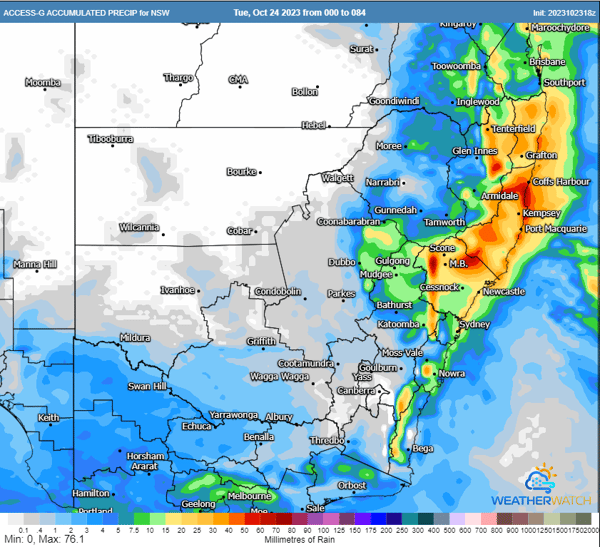
ACCESS G accumulated rainfall totals next 84 hours. Image via WeatherWatch MetCentre
Unfortunately, the majority of this rainfall won’t fall on the fire grounds across the western Darling Downs region, with two large fires continuing to burn causing significant issues, including the loss of houses.
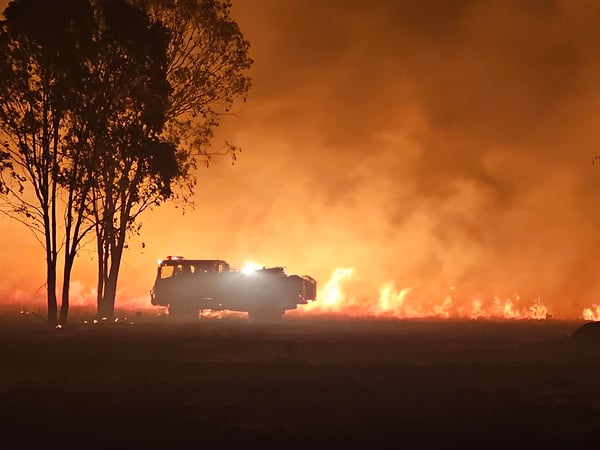 Queensland Fire & Emergency Services have been fighting a number of fires across Darling Downs & the Granite Belt
(Image Credit: Queensland Fire & Emergency Services)
Victoria and Melbourne specifically are often known for having four seasons in a day, but how...
Unseasonably heavy rain is drenching northeast NSW and parts of eastern QLD, bringing the heaviest...
The Early Warning Network is proud to announce a new Corporate Partnership with Bush Heritage...