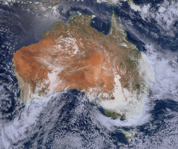
Floods and droughts - the concurrent climate crises in Australia
Australia is facing an extraordinary convergence of extreme climate events in May 2025. On one...
After knocking out power and damaging homes across Adelaide last night, a complex low pressure system is expected to bring widespread severe weather across NSW, VIC and QLD from this afternoon.
 A low pressure system is moving across inland NSW & Qld today. Image via EWN as at 4pm 28 November
Severe thunderstorms are expected to bring large and damaging hail (with some localised giant hail), damaging to destructive winds, heavy rainfall and flash flooding to areas throughout today, with the hardest hit areas predicted to be northwest Victoria, inland New South Wales and southwest Queensland. Tomorrow, the storms will move across southern and eastern New South Wales, and southern and central Queensland. Heavy rain is also expected with the system, with the heaviest falls stretching from central New South Wales into eastern Victoria.
It is likely that this will be the most significant widespread severe thunderstorm outbreak of the season so far.
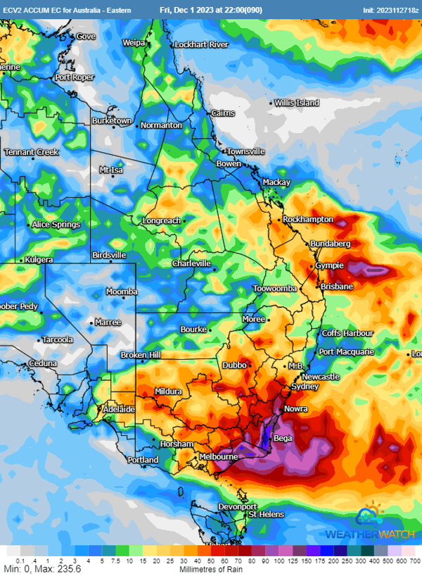 Rainfall accumulation preditions until Friday (Image via WeatherWatch)
The heaviest rainfall is predicted to be over eastern Victoria and southeast New South Wales, where falls of over 200m could eventuate. The Bureau of Meteorology has issued Severe Thunderstorm Warnings, Severe Weather Warnings and Flood Warnings for moderate to major flooding in Victoria, and minor to moderate flooding in NSW. Minor flooding is also predicted for central and northern inland NSW.
Very dangerous storms are forecast for areas in the red zone (Image via BoM)
The widespread nature and timing of the afternoon and evening storms across eastern NSW, QLD and VIC will result in significant operational issues for aviation, including potential rerouting around thunderstorms. There are likely to be widespread delays across all airports throughout tomorrow afternoon and evening, potentially extending into Thursday morning.

In terms of fuel requirements, if thunderstorms are forecast along flight paths, each aircraft needs to carry enough fuel to divert to an alternate airport if necessary. The terms TEMPO and INTER are used to indicate significant temporary or intermittent variations in prevailing flight conditions. For TEMPOs which are present in forecasts for Sydney, Coolangatta and Brisbane airports, (and also Melbourne for rain but not storms), each flight will need to carry 60 mins of extra fuel. This will have significant cost and efficiency implications, given the extended nature of these weather conditions.
As the band of storms will be widespread in nature along the eastern seaboard, this also makes selecting alternate routes problematic, as so many major airports may be affected by severe weather. As a result, flights may be severely delayed or cancelled altogether.
For those in areas who will be affected by the approaching weather, remember to stay up to date with warnings and alerts. Move your car under cover or away from trees, and secure loose items. Keep clear of creeks and storm drains, and don't walk, ride your bike or drive through flood water. Stay vigilant and monitor conditions.
Australia is facing an extraordinary convergence of extreme climate events in May 2025. On one...
An intense thunderstorm outbreak is on the cards for eastern Australia, and while it is still...