An intense thunderstorm outbreak is on the cards for eastern Australia, and while it is still early, this setup may produce the most significant storms for the season, particularly on Christmas Eve, Christmas Day, and Boxing Day.
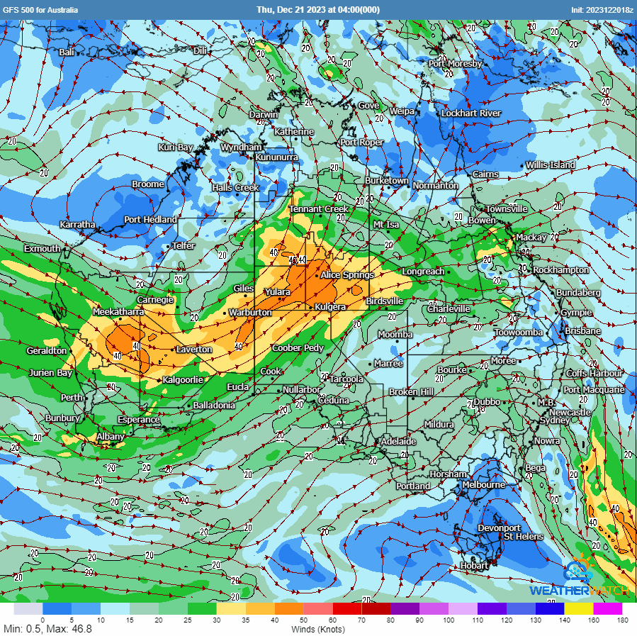
A powerful upper system (cut-off low), deepening surface low and trough will extend through eastern Qld, NSW - sagging into Victoria. A volatile and highly sheared environment will exist to its east - generating widespread storms, with intense, fast-moving thunderstorms.
A cut-off low drifts across NSW with a large swathe of severe weather to its east. Gif via WeatherWatch
Large to locally giant hail, damaging to destructive winds (the outside chance of seeing a weak tornado or two), and heavy rainfall leading to flash flooding can be expected with high-end storm activity - including the threat for supercells. This activity may grow upscale into the evening hours as it progresses east.
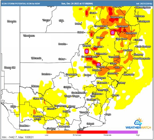
ICON Storm Potential for Sunday 24/12/2023. Image via WeatherWatch
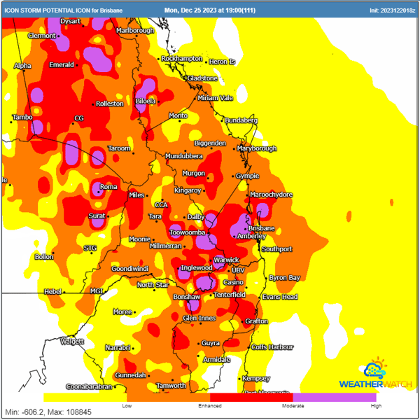
ICON Storm Potential for Christmas Day 25/12/2023. Image via WeatherWatch
There may be complicating factors, including overnight rainfall/storm activity/cloud cover that lingers through the morning hours. These factors would lessen the overall severe threat for some locations, and with days on days of storm activity, how the atmosphere recovers will be something to keep an eye on.
Areas across inland Qld, extending into central and some coastal parts of NSW and northern Victoria, will be a high risk, with coastal regions of Southeastern Queensland a day-to-day proposition for severe storms (from Sunday on).
Not everyone across eastern Australia may see severe storms during this period, but for some that do, they could be rather nasty. Keep an eye on the sky, and heed any warnings as issued.
Heavy rainfall will also develop with convective activity as the surface low and trough deepen and drift east-southeast. Widespread 25-75mm falls are likely, with heavier falls up to and exceeding 100mm possible across parts of Victoria and northeastern Tasmania next week. This may lead to localised flash flooding and some riverine flooding.
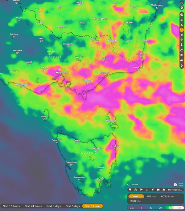
EC Accumulated rainfall totals next 10 days. Image via Windy.com
Stay tuned with EWN updates as this situation will be closely monitored and updated over the coming days.
Recent Articles
Major weather pattern turnaround sees coasts of southern QLD and northern NSW receive huge drenching.
In what's become much more like a classic La Nina pattern in summer, the stable synoptic pattern...
Heavy rainfall and flooding likely for Sydney to the South Coast this weekend
It’s Groundhog Day for NSW.