Damaging winds, heavy rain, hail and snow to develop for Eastern Australia
The first major winter event is set to develop across southeastern Australia this week, with...
Parts of Victoria, NSW, SA and Tasmania are expected to experience damaging to locally destructive winds gust overnight Tuesday into Wednesday, as a strong cold front sweeps across the southern states.
Fresh to strong northerly winds will increase during Tuesday afternoon and evening as the strong front approaches from the west, with wind gusts possibly exceeding 100km/h in some areas.
A band of heavy showers are expected as the front passes through. In the wake of the cold front, an upper cold pool of air will move into the region, with thunderstorm activity possible across western and southern Tasmania early Wednesday before spreading across most of the state. Small hail is likely with showers and thunderstorms for coastal Victoria and Tasmania during Wednesday.
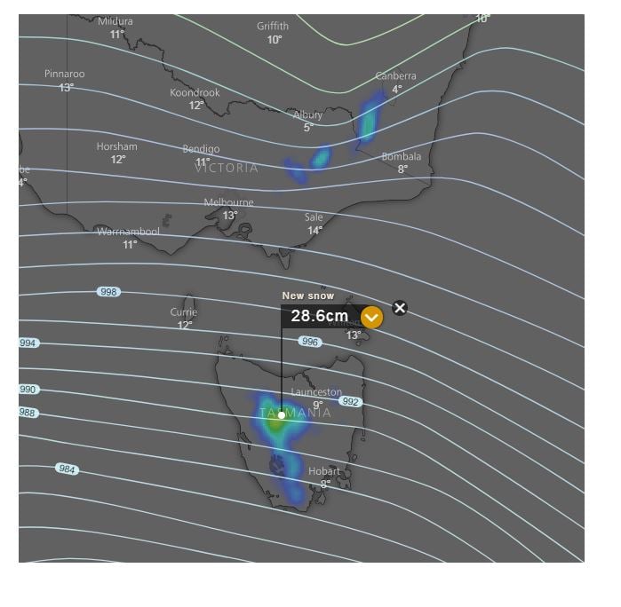
Further snow falls are likely, with Alpine regions of Tasmania expected to see another 15-30cm during the next three days. Ski resorts in NSW and Victoria should see a further 5-10cm over the coming days.
Severe weather warnings have been issued for South Australia, Victoria, NSW and Tasmania.
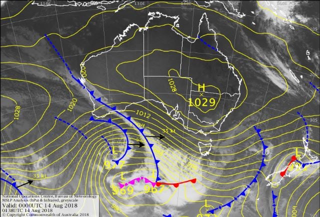
Image 1. EC wind gusts, 5am Weds morning, windy.com. Image 2 EC wind gusts, VIC and NSW, 5am Wednesday. Image 3, Latest colour, mean sea level pressure analysis chart from the Bureau of Meteorology. Image 4, Snow accumulation for the next 3 days
.png?width=769&name=Southern%20Australia%20braces%20for%20damaging%20to%20destructive%20winds%201%20(1).png)
.png?width=769&name=Southern%20Australia%20braces%20for%20damaging%20to%20destructive%20winds%202%20(1).png)
The first major winter event is set to develop across southeastern Australia this week, with...
Eastern Australia can expect to see summer like temperatures throughout the first week of...
A Tasman low will bring a wet, windy and dreary weekend to eastern Victoria and the southern and...