Widespread thunderstorm outbreak brings destructive winds and large hail to NSW and VIC
Severe thunderstorms lashed Victoria and New South Wales yesterday in one of the most intense...
An intense upper cold pool of air/cut off low will continue to drift north across NSW on Tuesday, in association with a surface trough and cold front. This is generating a band of showers, thunderstorms and rain periods across central NSW and inland Queensland this afternoon, with showers and weak storms across inland NSW possibly generating accumulations of small hail. As the evening progresses, some of this activity will extend into South East Queensland and North East NSW overnight, with infrequent lightning expected.
During Wednesday morning, the upper system will enter southern Queensland, with showers, rain periods and isolated storms. How long this activity lingers will have a significant baring on whether severe storms strike parts of South East Queensland (including Brisbane). Should morning activity linger longer than expected, the threat of significant severe storms will be suppressed.
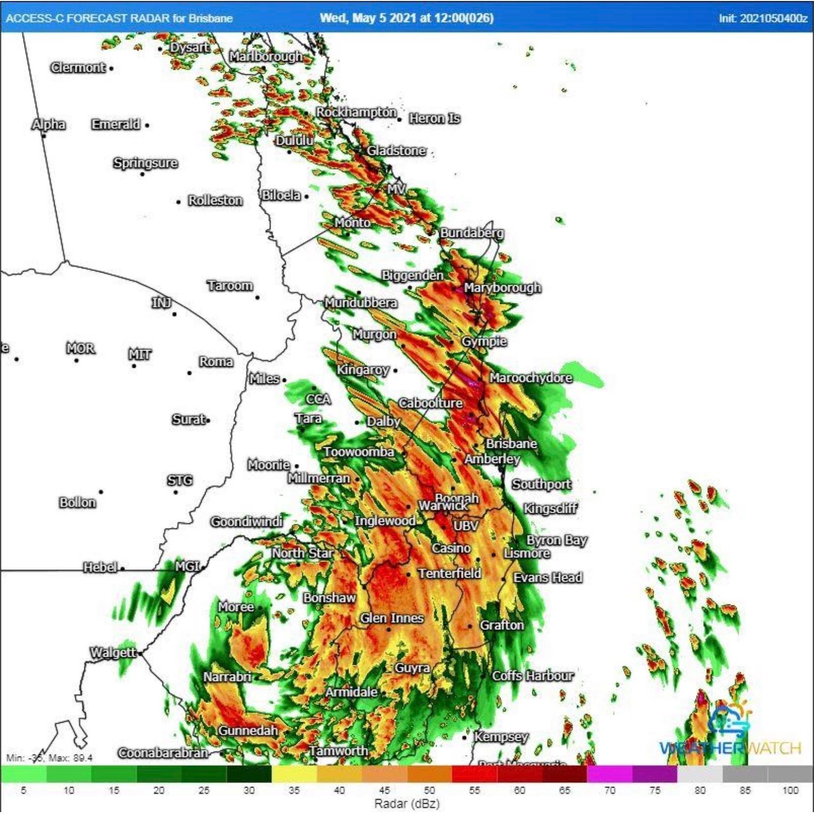
If morning activity clears early, and sufficient heating can occur, strong wind shear and increasing instability with the upper cold pool of air will lead to a few severe storms capable of producing damaging winds, large hail (2-4cm) and heavy rainfall, particularly for areas from Toowoomba – Brisbane – Gympie.
Further west and south, hail accumulation will be possible with showers and storms across the Darling Downs and northern NSW where weaker wind shear under the upper low will be favourable for small hail accumulations.
Image 1: Water Vapour satellite imagery showing the current position of the upper low over southwestern NSW.
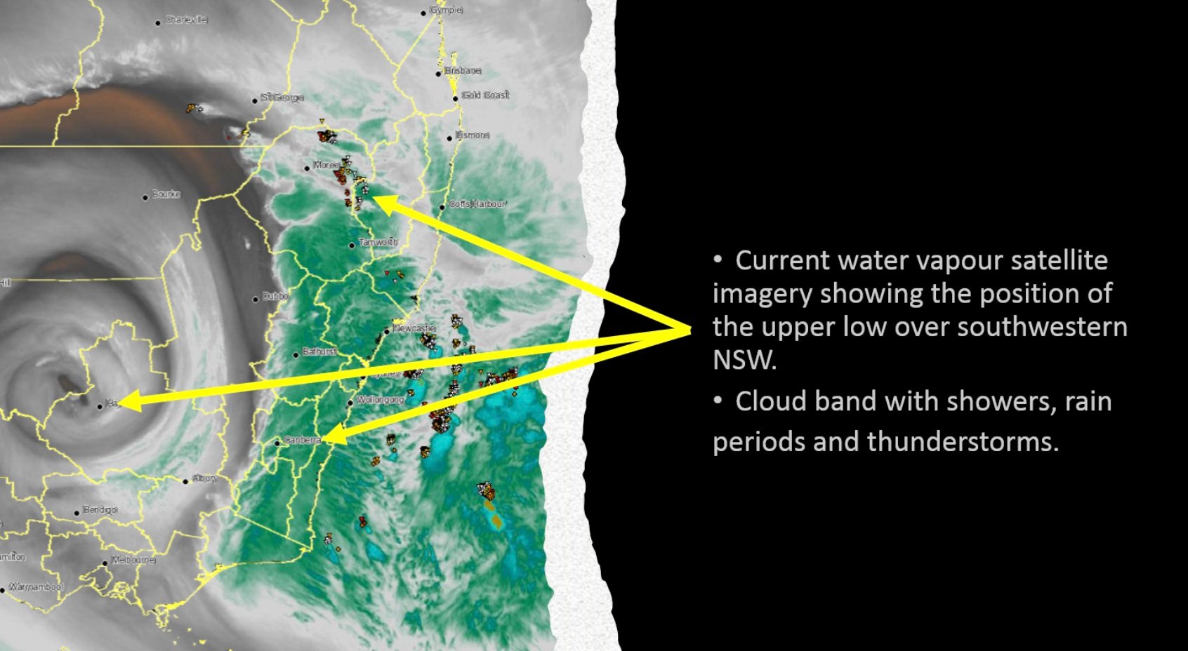
Image 2. Position of the upper low/intense cold pool of air over southern Queensland. 1pm Wednesday 5/05/2021. Images via WeatherWatch Metcentre.
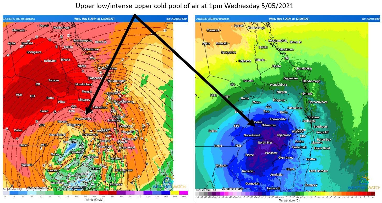
Image 3: ACCESS C high resolution forecast radar for 12pm Brisbane, Wednesday 5/05/2021. Image via WeatherWatch Metcentre.
Severe thunderstorms lashed Victoria and New South Wales yesterday in one of the most intense...
The afternoon of Thursday 28 September will see thunderstorm activity return to South East...