The Biggest Storm System of the Season is Coming
After knocking out power and damaging homes across Adelaide last night, a complex low pressure...
A thunderstorm outbreak will commence on Wednesday afternoon for eastern Queensland and NSW - spanning through until Friday evening where several severe cells are likely across each day this week.
An upper trough will move across eastern Australia on Wednesday and interact with a surface trough to generate an increasingly unstable environment to its east. Storm activity will develop in response, with high-based storms likely across central-inland Qld extending into central NSW.
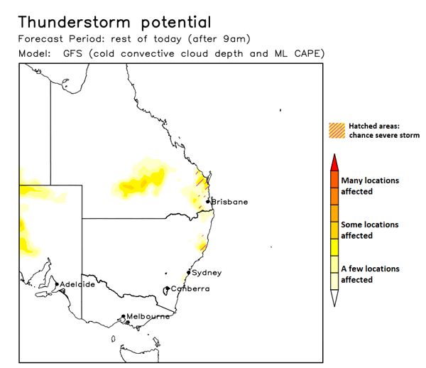
Thunderstorm potential for Wednesday afternoon. Image via Ken Kato.
Further east, storms are likely to fire across the Western Ranges and Border Ranges of SEQ – extending south across the higher terrain of northern NSW. An initial threat of damaging winds and large hail will develop before storms are pushed in an east-northeasterly direction.
A strong cap will be present for coastal areas as the afternoon sea breeze pushes inland, cooling surface temperatures. This may inhibit storms from reaching the coastal fringe, however, strong wind shear is expected to advect these to coastal areas – albeit in a weakening fashion into the early evening.
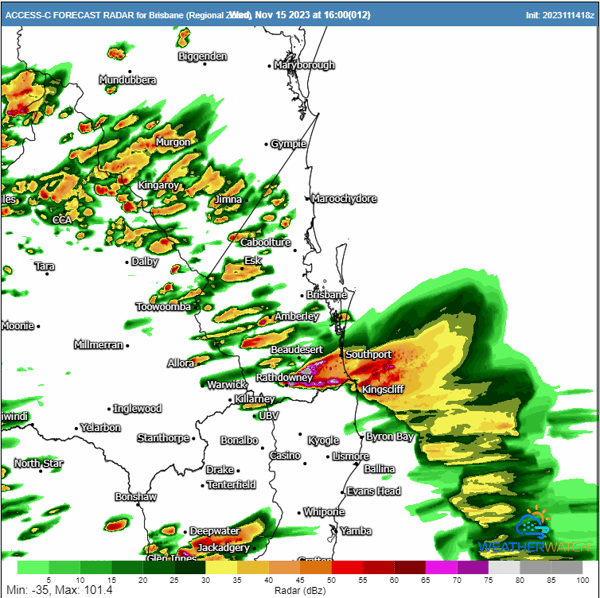
High resolution ACCESS C forecast radar for 4pm Wednesday afternoon. Image via WeatherWatch MetCentre.
Storms will reload on Thursday although a couple of variables will play key roles on how the day pans out.
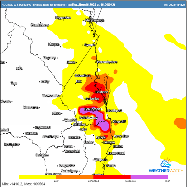
Thunderstorm potential from ACCESS G for 4pm Thursday afternoon. Image via WeatherWatch MetCentre.
Further mystery surrounds Friday with the added injection of a southerly change sweeping up the NSW coastline. Southeasterly changes help enhance the threat of high-end storm activity across Southeastern Queensland - with Friday potentially being significant for some.
For now, this change will move through the Gold Coast in the early morning hours, before reaching Brisbane just before lunchtime. This situation will see the threat of severe thunderstorms shift further north and west of Queensland’s capital, with cooler air stabilizing areas from Brisbane south to the Gold Coast. Showers and a weak storm or two may still develop, but high-end damaging storms are less likely unless the change stalls.
Thunderstorm potential from ACCESS G for 4pm Thursday afternoon. Image via WeatherWatch MetCentre.
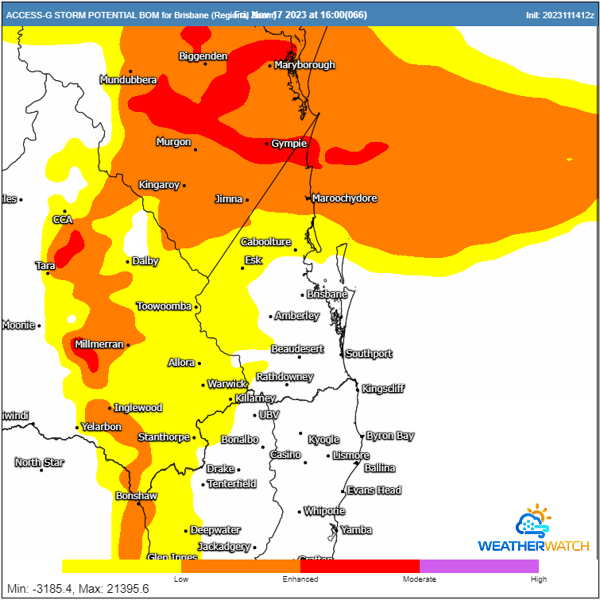
Areas from Caboolture – Hervey Bay – Kingaroy will be more favoured to see severe storms during Friday afternoon, with a localised destructive wind and giant hail threat possible with any storms riding the southerly change during the late afternoon hours.
After knocking out power and damaging homes across Adelaide last night, a complex low pressure...
A weekend of storms looms for parts of Australia, with significant large hail activity forecast for...