A weekend of storms looms for parts of Australia, with significant large hail activity forecast for a number of states, putting many businesses and homes in the firing line of damaging hail.
Northeast NSW and Southeast Queensland got a head start on the action yesterday, with very heavy rain and gusty winds throughout the evening, and over 150,000 CG lightning strikes recorded, damaging properties in the process.
Much of Queensland has been sweltering through a heatwave this week with temperatures reaching 44 degrees Celsius in Longreach yesterday. Coastal areas of Northeast NSW and Southeast Queensland however, can look forward to the heat lessening, and will see more storms develop today due to a South East change which will bring supercells and large and damaging hail for these areas. The more populated areas from Sunshine Coast - Brisbane - Gold Coast will be particularly at risk due to the drier air present through the Darling Downs / Western Southeast Coast district.
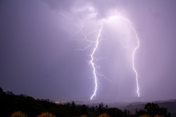 McLeans Ridges last night, just after 8pm. Taken by EWN's Michael Bath
Central inland Australia will also very likely see large hail and isolated supercells today, with parts of Northwest South Australia and Southwest Northern Territory in the firing line for hail sizes of over 4cm. Hail and storm threats will remain throughout Saturday as well.
Over the past two weeks in particular, there have been hailstorms which have caused significant damage to businesses across the country, which highlights the danger that these supercells can bring. A "freak hailstorm" in the Lockyer Valley cost farmers in the region over $50 million in lost crops and infrastructure damage, and has resulted in calls for assistance from residents.
Destroyed farming equipment and crops in the Locker Valley last week (Image: ABC News)
Just this week over in Western Australia, another farming region was hit with damaging hail which farmers say has wiped out entire crops and delayed harvests in other areas. This is a timely reminder that while large hail doesn't regularly occur outside coastal areas in eastern Australia, damaging events can happen almost anywhere. The image below from Climatics shows the last ten years of damaging hail events of 3cm+ in diamater throughout Australia (indicated in blue). Using this data, we can identify areas which are most at risk of damaging hail and ensure proactive measures are taken to reduce risks.
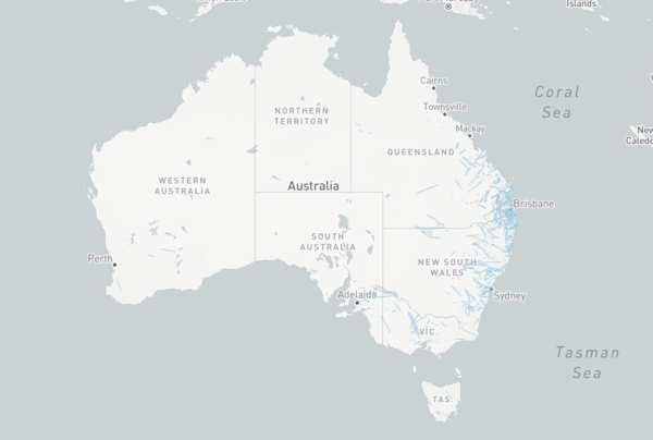
Significant hail events over the last 10 years. (Image source: Climatics)
Along with agriculture, solar farms are particularly at risk of hail damage, with the storms over the next few days putting 17 solar farms at risk of significant damage in NSW and QLD alone. One hail storm last year in Southeast Queensland caused over $28 million dollars worth of damage to just one solar farm. With so much on the line for businesses, and livelihoods in many cases, it is critical that steps are taken to minimise the risk of any damage that could be caused by a hail event.
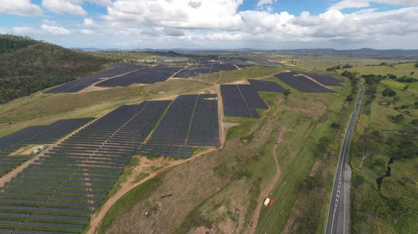 Woolooga Solar Farm in Queensland is one of the 17 solar farms at risk of damage from hail this weekend (image: Courier Mail)
Early Warning Network lead the Australian weather industry in providing forecasting, alerts and real-time tracking of hail events for our customers. By using this technology, we can give them adequate notice of potential events and alert those in the line of the hail storm to ensure they are clear of danger, and can implement operational procedures to minimise damage, such as moving solar panels in a stow position. We work closely with our clients and are proud to save them millions of dollars each year though customised tracking and alerting of severe weather.
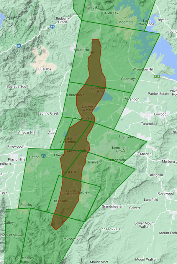
The Lockyer Valley hail event on 12 November 2023 from EWN's Hail Tracker. The green polygons show the areas which alerts were active for, and the red is the track of the actual hail produced by the storms.
For those in the path of the storms this weekend, ensure you stay safe and dry. If you would like to talk to our team about how we can help you mitigate the risk storms could pose to your business, please get in touch with our team.
Recent Articles
Severe storms to hammer eastern Australia on Christmas and Boxing Day
An intense thunderstorm outbreak is on the cards for eastern Australia, and while it is still...
Monster clean-up begins after damaging storms across the Christmas period
It has been a severe weather period to forget for many across the eastern seaboard, as numerous...