Welcome rainfall on the way for northern NSW and southern Queensland
After 20 consecutive days without rain, the longest period since a 21-day stretch over May into...
A volatile thunderstorm day will unfold across Victoria on Wednesday, with highly populated areas centring around the Melbourne CBD at risk for severe storms.
With hot and muggy conditions, a powerful upper trough and surface trough will lie across Victoria on Wednesday. A moderate to strongly unstable environment, coupled with strong wind shear, will lead to explosive thunderstorm development during the afternoon and evening.
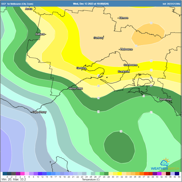
OCF forecast maximum temperatures for Wednesday. Image via WeatherWatch
Strong vertical wind shear will aid storm organisation, with the potential for several intense storms to develop (learn more about how wind shear affects thunderstorms and Tropical Cyclones here).
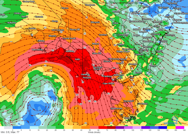
GFS 500mb winds for Wednesday afternoon. Image via WeatherWatch
Central parts of Victoria are at the highest risk on Wednesday, with areas east of line from Bendigo to Port Campbell at significant risk for severe storm activity, which includes the Melbourne CBD, Geelong, and Frankston.
Damaging to locally destructive winds, large hail, and heavy rainfall will be a concern with storms, with the potential for a few supercells across the day.
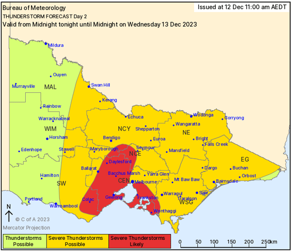
Bureau of Meteorology Day two thunderstorm threat map. Image via BoM
After 20 consecutive days without rain, the longest period since a 21-day stretch over May into...
Much of southeast Australia is bracing for a significant cold outbreak as a polar blast sweeps...
Thunderstorms are on the menu for southern Queensland and NSW this week. Kicking off late Thursday...