Southern Australia braces for a series of strong cold fronts
A series of cold fronts are expected to move across parts of South Australia, Victoria, New South...
The hottest conditions seen so far this spring will affect parts of South Australia, Victoria, New South Wales and Queensland over the coming days, with some areas likely to exceed 40 degrees.
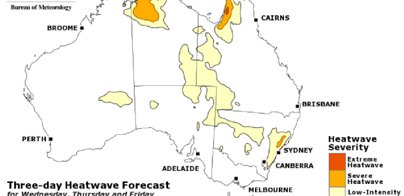
A slow moving low pressure trough will drag a hot airmass from northwestern Australia across the nation's east and southeast, with the Bureau of Meteorology predicting low-intensity to severe heatwaves affecting parts of the region.
Across much of VIC and coastal parts of SA, the heat will be relatively short-lived, with maximum temperatures pushing into the mid 30s.
However, northern parts of these states and southern NSW will see maximum temperatures reaching the high 30s and into the low 40s, with potential for dangerous bushfire conditions on Thursday and Friday, before cooler conditions develop from the weekend.
The hot airmass will then be pushed over the interior and northern NSW and QLD from the weekend, with potential for well above average temperatures to persist until mid-next week. It is over these areas where severe heatwave conditions are most likely.
Current indications suggest the very hot conditions will be followed by widespread rain and cool conditions, which will spread gradually north from early next week.
Image 1: 3-day Heatwave Forecast (Weds, Thurs, Friday) - October 31st, 2018
A series of cold fronts are expected to move across parts of South Australia, Victoria, New South...
An extreme fire danger is forecast for the Darling Downs region of Queensland on Tuesday and parts...
Parts of South East Queensland will begin to clean up the mess left after savage May thunderstorms...