Thunderstorms flaring up across NSW and Victoria
Thunderstorms are sparking up across New South Wales and Victoria today as a low pressure trough...
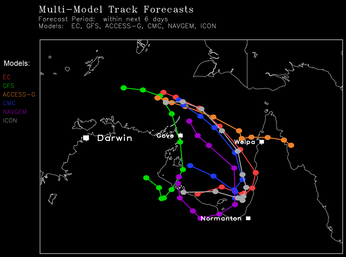
Before reading any further, the golden rule about the Gulf of Carpentaria is that it's notoriously unpredictable when it comes to trying to forecast where a tropical cyclone might head, and how weak or strong it'll be. This means forecasts can sometimes change dramatically at the drop of a hat. So all the information below is HIGHLY subject to change.
At time of writing this, the scenario that's currently more likely than the others is for a tropical low to drift SE past the northeastern tip of the NT (Arnhem Land coast) while gradually intensifying. Then by around Friday (but allow a leeway of a day either side of this), it's likely to become a tropical cyclone. If it does become a cyclone, its name will be Nora. By the weekend, the system should enter the waters in the Gulf, intensifying further and possibly into a significantly intense tropical cyclone. From late weekend onwards is when the uncertainty about what happens to it well and truly kicks in. It's quite possible that it hovers erratically for a bit in the Gulf before curving south or southwest & coming ashore along the Gulf coast.
BUT one thing to always remember about the Gulf is that if a tropical system shifts too close to land, it can interfere with the system's ability to strengthen into a major tropical cyclone. It doesn't always happen but it does happen sometimes.
Here's a map showing a range of possible scenarios for this tropical system's tracks within the next 6 days from a range of computer models. Note that it doesn't show what may happen beyond those 6 days and it also doesn't mean the system will be a tropical cyclone along the entire length of those tracks. You can see that there's an overall trend of the system curving to the south into the Gulf in the next few days.
Thunderstorms are sparking up across New South Wales and Victoria today as a low pressure trough...
A destabilising atmosphere across northern NSW brought some showers and very isolated thunderstorms...
It has been a refreshingly cool summer across southeastern Australia so far as persistent rain...