Dry Lightning Strikes: Aggravating Southern Qld Bushfires
An extreme fire danger is forecast for the Darling Downs region of Queensland on Tuesday and parts...
A stunning contrast in temperatures exists over NSW this afternoon, with an extremely hot airmass situated across northern NSW, as frigid air pushes through southern NSW.
Temperatures into the mid-30s are being recorded across the Northern Rivers and parts of the Mid North Coast ahead of a vigorous frontal system pushing through the state. Evans Head hit a whopping 37.5°C at 12:56 pm, with Casino touching 37.3°C at 1:53 pm. Strong northwesterly winds are also impacting the region, with widespread gusts of 50-70km/h being recorded across northern NSW.
Conversely, an extremely cold airmass has moved into southern NSW, with Thredbo Top Station hitting just 0.6°C at 8:41 am, Perisher Valley at 3.7°, and Cabramurra at 5.1°C. Snow has returned to the region, with Jindabyne and even Cooma seeing snow flurries.
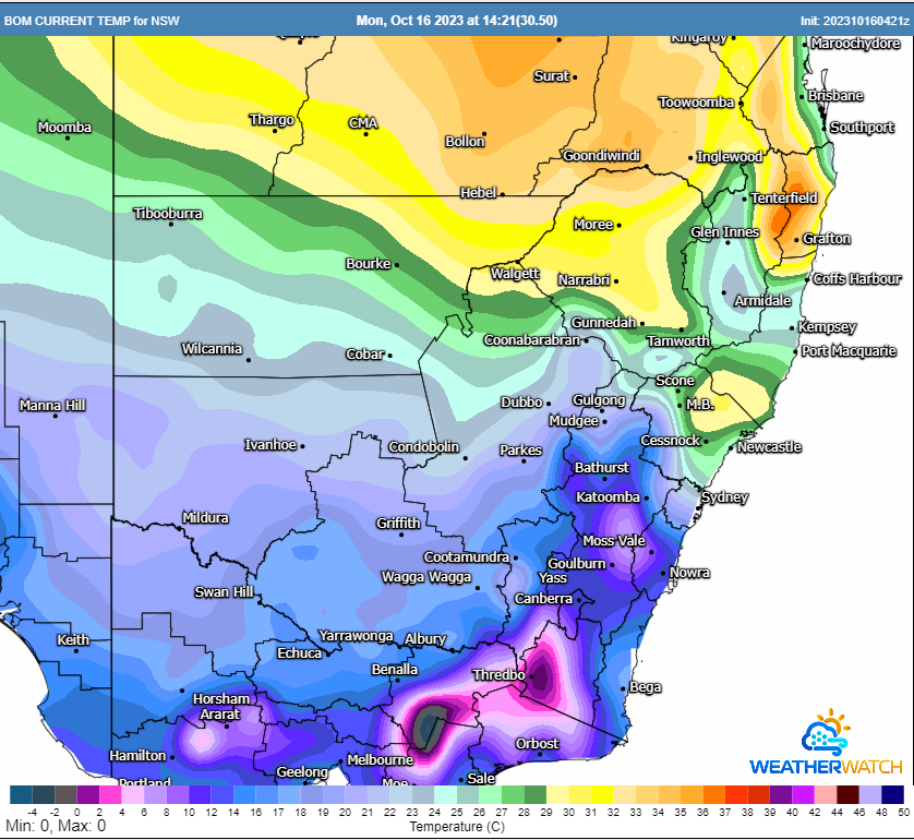
Current BoM temperatures across NSW Monday afternoon. Image via WeatherWatch MetCentre.
Locally damaging wind gusts have been developing across southern NSW in the wake of this front with Gabo Island registering a 107km/h gust at 9:22 am, Mount Boyce 98km/h, Bellambi 95km/h, Ulladulla 98km/h, Camden with 98km/h with feels like temperatures plummeting across southern NSW this afternoon in response.
These winds, combined with hot temperatures and very dry conditions are fuelling several intense fires across NSW this afternoon. Two fires with Emergency level warnings continue across NSW with three Watch and Acts ongoing.
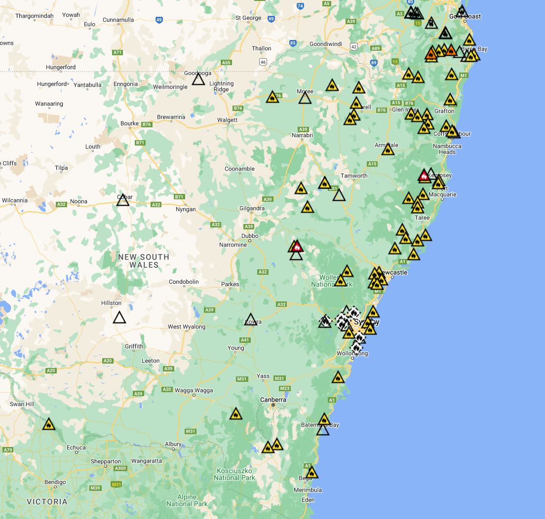
Current map of fires ongoing across NSW. Image via NSW Rural Fire Service
Thankfully, conditions will ease this evening and overnight, although gusty southeasterly winds will continue across central and northern NSW on Tuesday. Southeasterly winds will see a slight increase in moisture on Tuesday, with cooler maximum temperatures.
Early preparation is vital to ensure that your home, family and pets remain safe. Leaving your home early is an essential part of surviving bushfires. Whilst these measures may seem extreme, they may one day save you and your family's life. Be sure to tune in to your local media to ensure you are up to date with warnings.
An extreme fire danger is forecast for the Darling Downs region of Queensland on Tuesday and parts...
Some windy and very wet weather looks set to affect the southern half of the New South Wales coast...
A powerful cold front sweeping across southeastern Australia will generate damaging wind gusts for...