What is a Microburst and why are they so dangerous?
During the last two weeks, there have been dangerous thunderstorm events in both NSW and Queensland...
It has been a severe weather period to forget for many across the eastern seaboard, as numerous severe storms left a trail of destruction across parts of Queensland, NSW, and eastern Victoria.
A powerful cut-off low (EWN’s Christmas storm outlook here), strong surface low, and low-pressure trough draped across eastern Australia was the trigger, with volatile conditions providing the perfect breeding ground for violent thunderstorms.
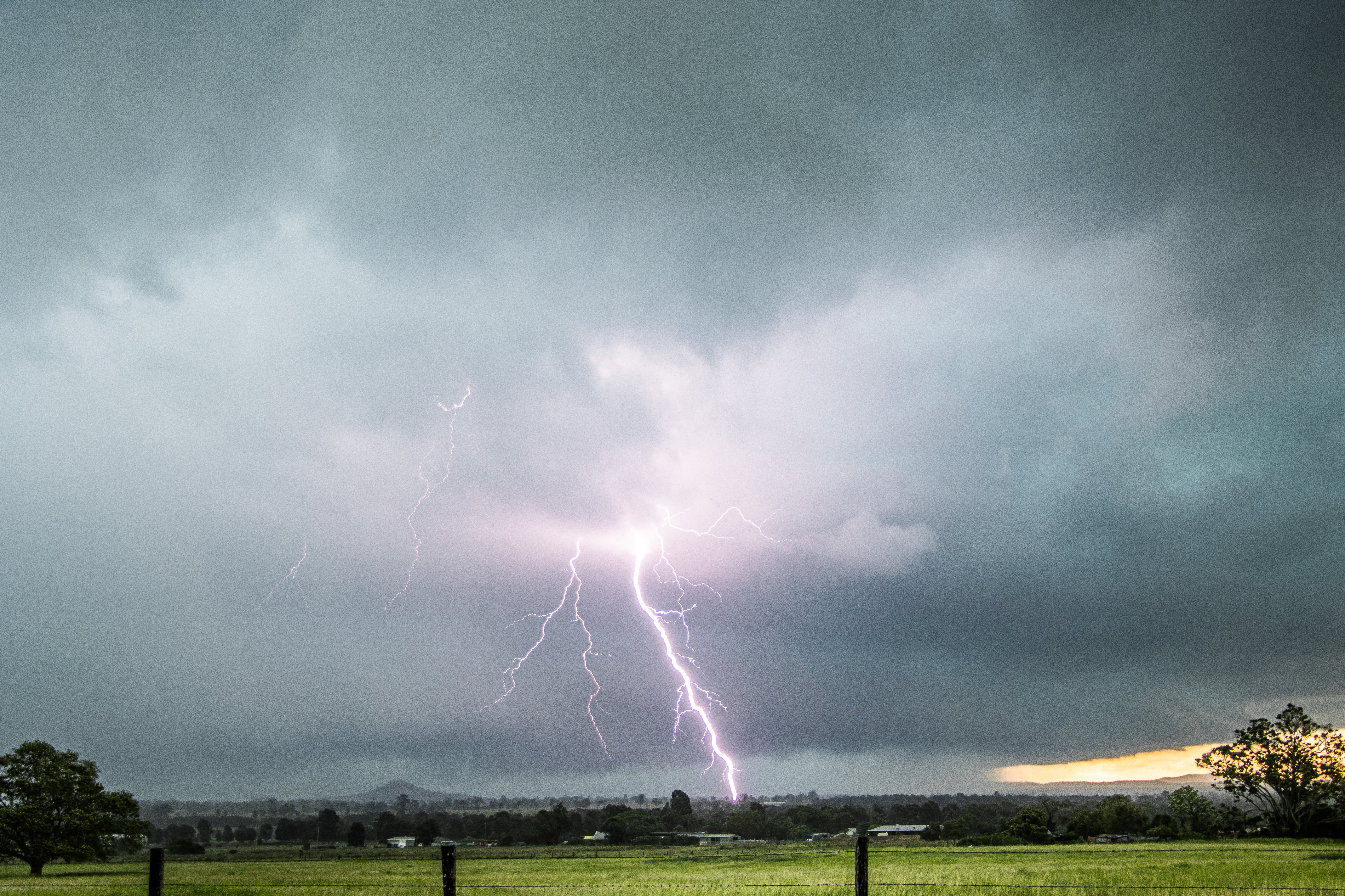
A powerful high precipitation thunderstorm impacts the Brisbane Valley Sunday morning. Image via Justin Noonan
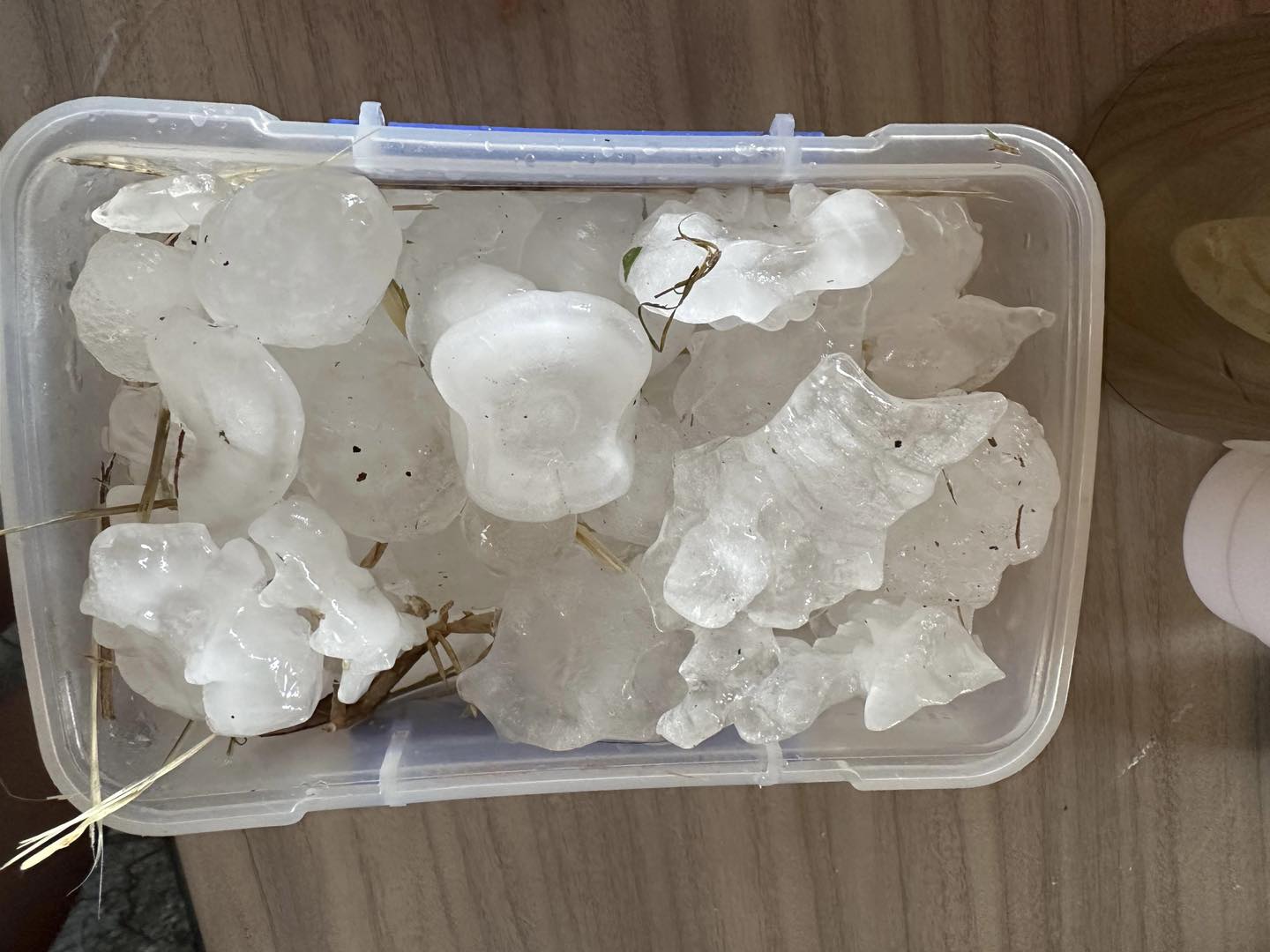
It all erupted Saturday night, with a violent supercell thunderstorm impacting Gatton in Southeastern Queensland, where giant hail fell across the town. Roofs were damaged, windows blew out, and cars were severely battered as hail stones up to 13cm in diameter plummeted from the sky.
Sadly, this was the beginning of what would unfold over the next 48-72 hours.
Early Sunday morning, a line of storms tracked east into Southeast Queensland again, strengthening into a high precipitation supercell as it moved through the Brisbane Valley and northern Brisbane suburbs. Damaging straight-line winds and giant hail of up to and exceeding 10cm across the Burpengary and Dayboro vicinity were observed.
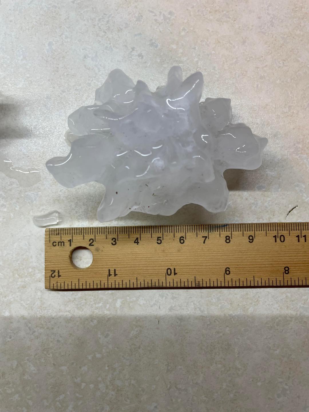
Giant hail of 9 - 10cm recorded at Burpengary Sunday morning. Image via Clare R on Facebook.
Sydney Airport turned into a river on Sunday as 64mm fell in just one hour, as heavy storms battered the area, with Koolewong picking up 55mm in an hour and Little Bay 56mm in an hour.
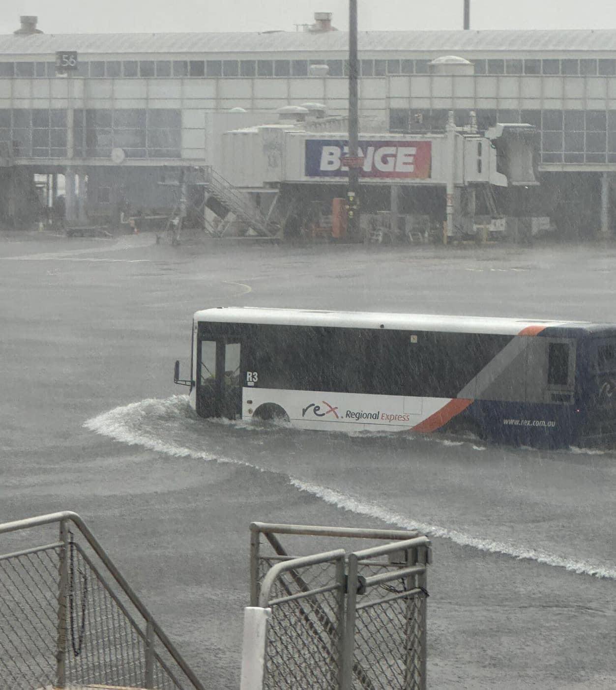
Sydney Airport goes underwater. Image via Bob Dunn on Facebook.
However, Mother Nature was yet to show its full fury.
While Christmas Day had started spectacularly, with clear, sunny skies, it was about to undergo a quick and violent change. Severe storms developed across the Warrego and Maranoa of Queensland, extending into the North West Slopes and Plains, and Northern Tablelands of NSW. Large hail of 6cm was reported in Goondiwindi, as winds gusted to 126km/h in Charleville, toppling trees onto cars and blowing over fences.
Inverell witnessed a damaging storm, too, with a wind gust of up to 103km/h, with large to locally giant hail impacting Orange, where 5cm hailstones were reported.
This was an early warning shot for what was about to unfold.
As a large cluster of storms moved into the Darling Downs, damaging wind gusts began to impact Automated Weather Stations across this region. Dalby registered a 93km/h wind gust, Oakey 96km/h, Toowoomba 93km/h. Ahead of this line, an isolated supercell pumped the Scenic Rim region of Southeast Queensland, with giant hail of 8cm registered at Rathdowney during the late afternoon.
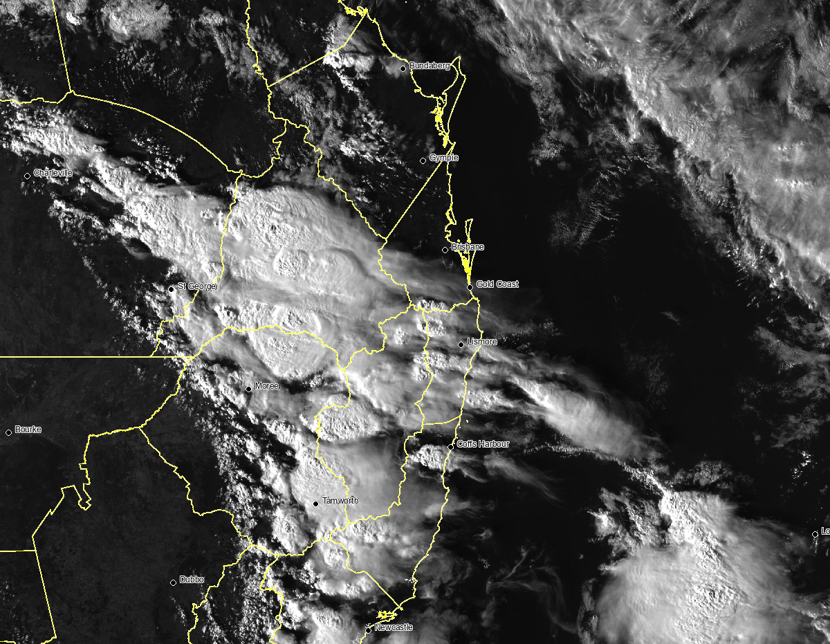
EWN Satellite imagery as explosive thunderstorms develop Christmas Day.
Once storms entered western areas of Southeast Queensland, they began to congeal into a large line, fanning out from Central Queensland into northern NSW. A particularly intense storm drifted east-southeast from Ipswich. This storm left a horrific trail of destruction across parts of Jimboomba, Cedar Vale, Cedar Creek, Mount Tamborine, Oxenford, and Coomera. On top of Mount Tamborine, a private weather station recorded an unofficial wind gust of 158km/h.
Considering the sheer amount of damage across this vicinity, wind gusts of this strength seem plausible. Several houses were utterly destroyed, with roofs ripped off others and tossed, trampolines thrown, and monster trees snapped and uprooted, some crashing into homes and cars.
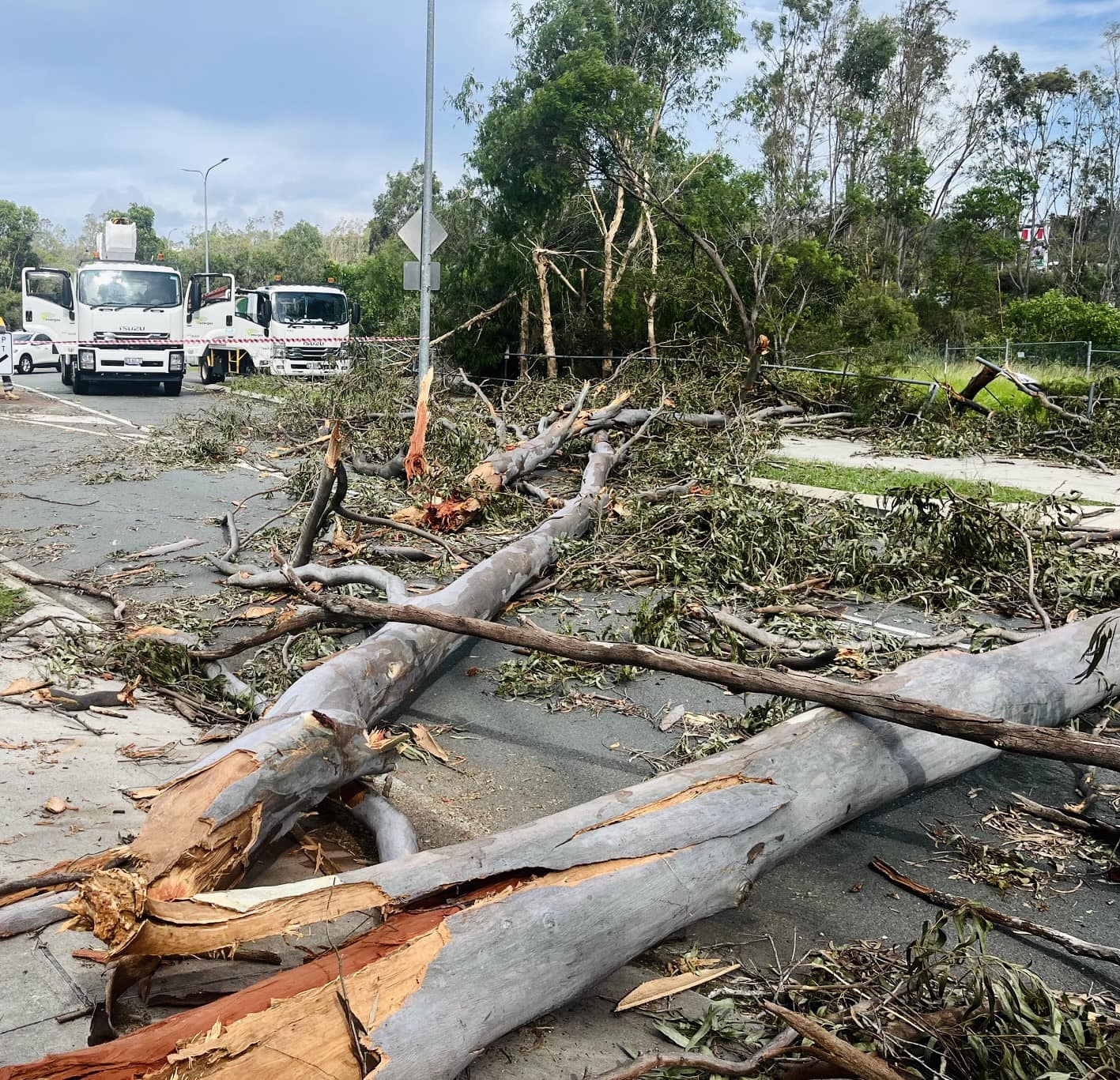
Significant damage across the Gold Coast region. Image via Energex
Another factor that may have helped enhance damage and localised wind speeds through this area was the potential for one or two weak, brief tornadoes along the leading edge - a QLCS or Quasi-Linear Convective System. These types of tornadoes differ significantly from the ones you see across the Great Plains of America. Generally, tornadoes form under deep rotating updrafts called mesocyclones form supercells. However, QLCS events are usually later at night and tend to be weaker and short-lived in comparison.
As it stands, no tornadoes have been confirmed from this storm.
Radar reflectivity and velocity Monday night with storms across the Gold Coast. Video via Radarscope
At the height of Monday night events, Energex has described this event as “unprecedented,” with over 1000 powerlines confirmed down or snapped.
- 122,000 people were without power, including 84.5k around the Gold Coast, 15.6k in the Scenic Rim, 13.6k in Logan LGA, 9300 in/around Brisbane, and 3000 in the Redlands at the height of the storms Christmas night.
- More than 125 crews were on the ground, working to make more than 1000 damaged sites safe.
Conditions didn’t get any better on Boxing Day. Severe storms fired across the Hunter and Metropolitan region of Sydney, with large to giant hail recorded (5-8cm) around the Portland / Cumberland Reach northwest of Sydney. Hail of 3-5cm was reported to Nabiac, and hail of 4-6cm was reported at Aberglasslyn and Maitland.
Large hail reported at Nabiac. Image by Mel H on Facebook.
Further north into Queensland, Gympie registered a 100km/h wind gust, with a 96km/h gust at Blackwater, 4cm hail at Zillmere, and 4-6cm hail at Scarborough. Meanwhile, Manly State School in the eastern suburbs of Brisbane lost its roof as powerful winds battered the area with severe storms.
Around 1,898,433 lightning flashes have been detected across central and northern NSW and central and southern Queensland alone since December 23rd, with 912,990 cloud-to-ground lightning strikes and 985,443 cloud-to-cloud flashes during this period.
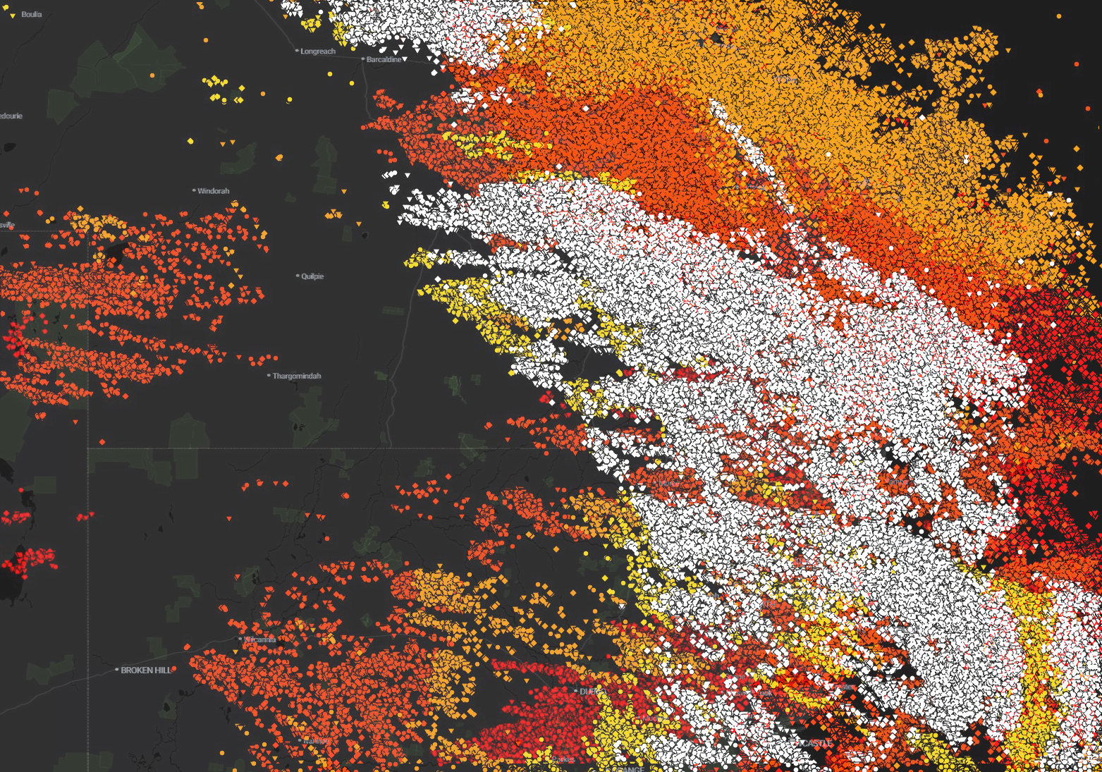
EWN Lightning tracker from Saturday 23rd December to Wednesday 27th December.
Large to Giant hail reports:
- 4-6cm hail Scarborough
- 10-13cm stones Saturday night at Gatton
- 4cm hail Zillmere Tuesday afternoon
- 6-8cm hail at Rathdowney and surrounding areas Monday afternoon
- 4-6cm hail at Goondiwindi Monday
- 5cm hail at Orange Monday
- 10-13cm hail Burpengary Sunday morning
- 5-8cm hail at Portland / Cumberland Reach northwest of Sydney Tuesday
- 4-6cm hail near Maitland Tuesday
- 4-6cm hail at Aberglasslyn Tuesday
- 3-5cm hail at Nabiac Tuesday
Reported Wind Gusts:
- 126km/h gust at Charleville Monday
- 169km/h wind gusts at Archerfield on December 15th
- 102km/h Wellcamp Monday
- 96km/h Oakey Monday
- 93km/h Dalby Monday
- 93km/h Toowoomba Monday
- 103km/h Inverell Monday
- Widespread gusts above 120km/h from Jimboomba – Tamborine – Coomera Monday evening – including 158km/h wind gusts recorded on a private weather station at Mount Tamborine.
- 106km/h Gold Coast Seaway Monday night
- 96km/h Blackwater Tuesday night
- 100km/h Gympie Tuesday afternoon
More storms will develop on Wednesday afternoon, albeit more isolated across Queensland - however, these storms will still pack a significant punch. An isolated supercell or two will once again be possible.
During the last two weeks, there have been dangerous thunderstorm events in both NSW and Queensland...
The relentless humidity levels that have been plaguing parts of Queensland and northeast New South...
As of tonight , Wednesday, May 21st, 2025, communities across the Mid-North Coast and Hunter...