Showers and thunderstorms drop much needed rain over NSW
Thunderstorms flared up across central and northern New South Wales yesterday afternoon, bringing...
A wintry blast is set to sweep across southeast SA, Victoria and Tasmania on Tuesday and Wednesday of this week, bringing a burst of strong winds, showers, isolated thunderstorms, small hail and snow to some areas.
A cold front and associated low pressure system will be the drivers behind this change, with the low set to cause an increase in wind across southeastern SA tomorrow morning, before spreading across Victoria and Tasmania during the day and into Wednesday morning. These winds will be strongest in more exposed areas such as the coast and ranges where gusts may reach 90-100km/h at times, however widespread gusts of 60-80km/h are likely, substantial enough to bring down trees and powerlines.
The system will be associated with a sharp drop in temperature, with Melbourne expected to reach 26 degrees on Tuesday, before struggling to reach the mid teens on Wednesday and Thursday. Hobart is forecast to reach just 13 degrees on Wednesday, and Adelaide 16 degrees.
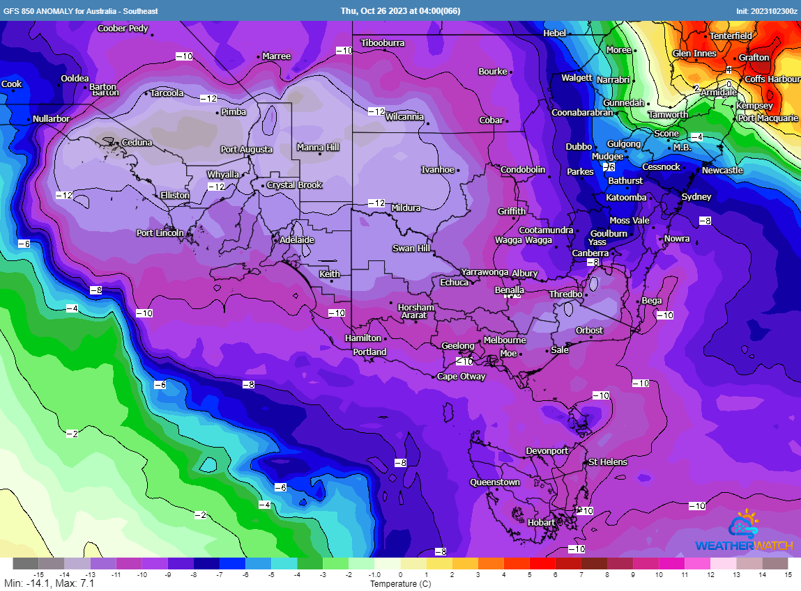
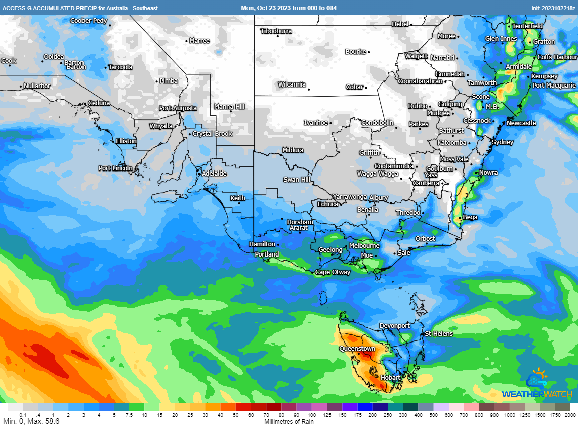
Showers will accompany the system from Tuesday evening but particularly on Wednesday, although for many areas falls will be relatively light (5-15mm). Over some parts of western and southern TAS, rainfall totals of up to 50mm are likely. Due to the very cold airmass associated with the system, small hail is likely in some showers, which will fall as snow in some areas. Snow could fall as low as 500-600 metres on Wednesday, although Tasmania will see the heaviest falls of snow due to higher moisture, where 10-25cm of fresh snow is likely in the west. In Victoria, only light snowfalls are likely but they could fall on the Otways, Grampians and the northeast ranges.
A few isolated thunderstorms are also likely, most likely over southeast SA and the southern VIC coast. These 'cold air' storms will be relatively brief, but may contain small hail and gusty winds.
A large high will cause a rapid easing of conditions from Thursday.
Thunderstorms flared up across central and northern New South Wales yesterday afternoon, bringing...
After knocking out power and damaging homes across Adelaide last night, a complex low pressure...
Much of southeast Australia is bracing for a significant cold outbreak as a polar blast sweeps...