Solid rain on the way for NSW and QLD
Shower activity increased across eastern NSW and QLD during Wednesday with 10-20mm falling across...
Wet weather is expected to finally return across eastern NSW and southern QLD this week, with the potential for moderate falls to develop across the NSW coastline.
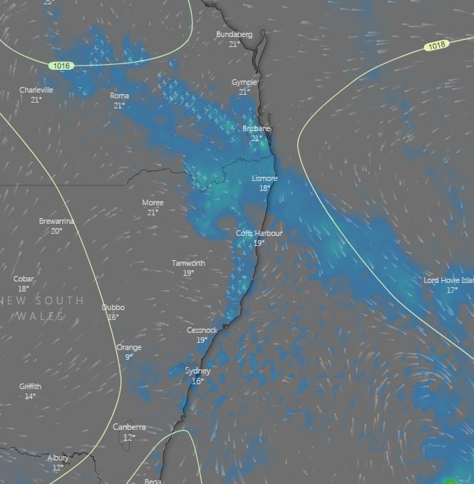
Monday through to Wednesday, a surface trough and upper trough will combine to produce weak instability across northern NSW and southern QLD. This is expected to lead to afternoon showers and weak storm activity. Small hail may develop, particularly during Wednesday, as very cold air aloft associated with the upper trough moves over the region.
During Thursday, a cut-off low is expected to shift north-east into NSW, potentially inducing a small low pressure system/coastal trough off the central NSW coastline. Should the scenario unfold, showers, rain period and isolated thunderstorms would be expected with moderate to locally heavy falls possible.
Widespread falls of 10-25mm are expected for coastal regions from the Hunter south to the Victorian border, with the potential for localised falls exceeding 100mm during the next 7 days.
Whilst most of the more significant rainfall will be confined to coastal regions and adjacent inland locations, light falls are expected for inland locations.
Strong winds and powerful surf conditions will once again pound the southern NSW coastline as that weak low develop, before moving off into the Tasman Sea towards NZ next weekend.
Image 1, Accumulated precipitation next 5 days (Source: Windy)
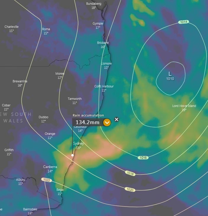 Image 2, Large cut-of low across NSW (Source: Weather.us)
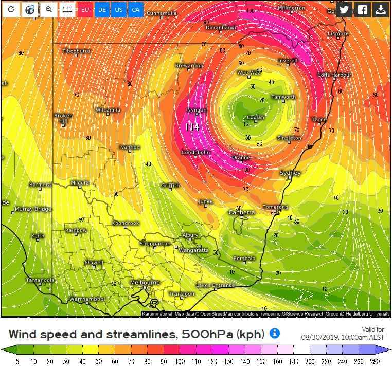 Image 2, Afternoon showers and storms across northern NSW and southern QLD (Source: windy)
Shower activity increased across eastern NSW and QLD during Wednesday with 10-20mm falling across...
18 October 2021: Severe thunderstorm potential
Of note, severe thunderstorms are already underway...
A surface trough and cold front that swept across eastern Australia during Tuesday producing an...