Early Warning Network Partners with Bush Heritage Australia
The Early Warning Network is proud to announce a new Corporate Partnership with Bush Heritage...
Parts of South-East Queensland have been lashed by severe thunderstorms over the last 24 hours, with parts of the Sunshine Coast bearing the brunt of activity.
A southerly change worked its way through northern NSW and parts of the Gold Coast during the morning hours, helping to trigger showers and localised thunderstorms during the late morning hours. This change continued to surge further north and stall through the Sunshine Coast and southern Wide Bay and Burnett.
A large cluster of storms developed and remained stationary for several hours while dumping hundreds of millimetres of rain.
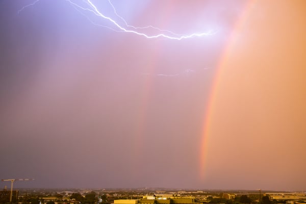
Thunderstorms moved across Brisbane during Monday.
Poona Dam copped a whopping 250mm as severe storms battered the region. However, it wasn’t the only location to see heavy falls.
- Mapleton 229mm
- West Woombye 225mm
- Maroochy Intake Weir 206mm
- Eerwah Vale 201mm
- Coolabine Creek 142mm
- Wappa Dam 137mm
While these extreme totals were confined to the Sunshine Coast, moderate totals were recorded across parts of the Border Ranges and Gold Coast, extending west to Toowoomba.
Upper Springbrook picked up a handy 70mm, 56mm at Upper Tallebudgera, and 60mm at Biggera Creek Dam. Further west, Main Camp Road scored 93mm, Upper Tenthill 84mm, and Ma Ma Creek 50mm.
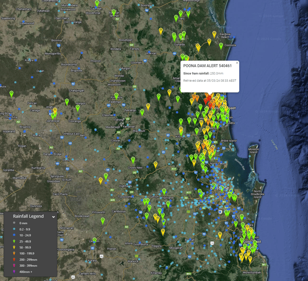 Rainfall totals since 9am Monday 4th March 2024. Image via EWN
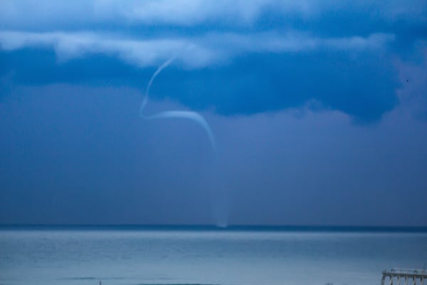
Meanwhile, Brisbane’s CBD only saw a 7mm fall in the gauge, but residents at Redcliffe, Scarborough, and Shorncliffe to the Airport were treated to a spectacular waterspout.
A large, long-lived waterspout was captured as it danced through Moreton Bay, getting very close to coastal areas around Redcliffe before dissipating. EWN’s own Justin Noonan captured the entire life-cycle of this event, with the waterspout lasting over 20 minutes in an extraordinary display.
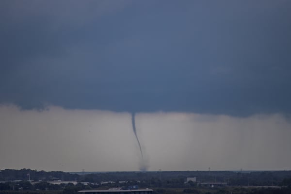
Spectacular waterspout dances in Moreton Bay. Image via EWN's Justin Noonan.
How do waterspouts form?
While waterspouts are from the tornado family, they form in a completely different manner. Tornadoes are formed from supercell thunderstorms that consist of a deep area of rotation throughout the updraft column called a mesocyclone.
Waterspouts, on the other hand, are slightly different. Two forms can be categorized: a tornadic waterspout and a fair-weather waterspout.
Tornadic waterspouts are tornadoes over water associated with severe thunderstorms (mesocyclones).
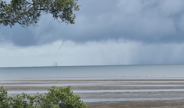
Beautiful waterspout moves across Moreton Bay back on 26th January 2022. Image via Justin Noonan.
Fair-weather waterspouts, however, are associated with an extensive line of flat, dark bases of developing cumulus clouds.
Waterspouts require warm ocean temperatures, which isn't a problem across eastern Australia and tend to be most common in late Summer and Autumn.
Unlike tornadoes associated with supercells, waterspouts first develop at the surface, where converging winds (two areas of wind collide) creating an area of rotation at the surface. As air can't go through the earth's surface, thus this air is forced upwards. This air column is then stretched into this developing line of cumulus clouds. Once a funnel is visible, a waterspout has neared maturity.
A series of waterspouts (8 waterspouts) developed off Coolangatta back in May 2020. Image via Justin Noonan
Fair-weather waterspouts aren't as powerful as tornadoes, although they can still produce winds in excess of 100km/h, which is more than powerful enough to flip boats. They do, however, put on a special show for onlookers watching.
The Early Warning Network is proud to announce a new Corporate Partnership with Bush Heritage...
As the tropical low in the Coral Sea intensifies, it's crucial for residents in eastern Queensland...
As of tonight , Wednesday, May 21st, 2025, communities across the Mid-North Coast and Hunter...