Temperatures plunge across New South Wales
After a relatively mild start to July when many areas experienced record early July warmth, the...
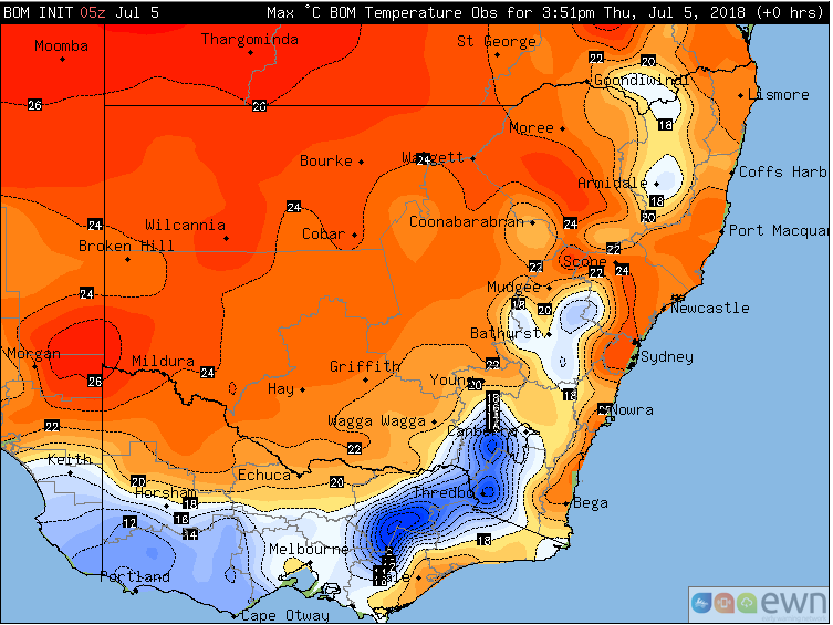
New South Wales is bathing in unseasonably warm mid-winter weather, with some areas experiencing their warmest day on record this early in July today.
Northerly winds ahead of a strong cold front (due to arrive this weekend) are dragging the airmass down from northern Australia, with temperatures soaring five to ten degrees above average across the state.
Lowland areas of the state have seen temperatures reaching the the low-to-mid 20s, whilst the tablelands have reached the mid-to-high teens, more typical of early spring than mid-winter.
Whilst no long term monthly records (longer than 30 years) have been broken, the warmth is especially unusual this early in July, with the coldest weeks of the year typically from the winter solstice through until mid-July. Sydney had its hottest day on record during the first week of July, reaching 25.2 degrees.
The warm airmass will continue to linger over the state tomorrow, especially over central-east and northeastern parts, where temperatures will reach the low-to-mid 20s again.
A strong cool change will push through from Saturday, causing much cooler conditions across NSW.
Observed maximum temperatures across NSW on Thursday 5th July, 2018
After a relatively mild start to July when many areas experienced record early July warmth, the...
Winter is set to briefly depart from Queensland over the next few days, as a low pressure trough...
Southeastern Australia is currently enjoying some mid-March warmth as temperatures reach push into...