Record November heat over Western Australia - set to move east
An incredibly hot airmass for November is building over Western Australia, which is likely to see...
Winter is set to briefly depart from Queensland over the next few days, as a low pressure trough drags a warm airmass over the state causing temperatures to push into the 30s across some areas.
Today, the warmest part of the airmass is focused over the far west of the state, however on Thursday and Friday (and in some parts on Saturday) will see temperatures soar 3-8 degrees above normal for this time of the year.
The south of the state will only climb a few degrees above average due to cloud cover limiting temperatures. Brisbane is predicted to reach 25 degrees on Thursday and Friday (with a mild minimum of 17 degrees on Friday) before a westerly change during Friday afternoon brings some showers and possible thunder, with a drier and cooler airmass in its wake.
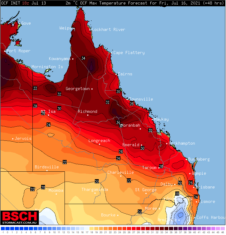
Central parts will feel the warmth the most (relative to normal) with temperatures forecast to reach 30 degrees at Rockhampton on Friday, 31 at Proserpine, 29 at Biloela, 32 at Collinsville, and 31 at Emerald. For some of these locations these temperatures will challenge July site records, including Emerald airport (current record 31.1) and Collinsville (current record 32.0 degrees). For other locations, this is likely to be the warmest July day since at least 2015. On Saturday, Townsville is expected to reach 30 degrees.
Humidity levels will also be above average during this warmth, causing well above average minimum temperatures than normal, and for it to feel more similar to October or November rather than July.
However, the warmth will be short lived as a strong cold front brings a much drier and cooler airmass over the weekend, with some of the chilliest nights of the year so far expected from early next week.
Image: OCF Forecast Maximum temperatures for Friday 16 July, 2021 (Source: BSCH Stormcast)
An incredibly hot airmass for November is building over Western Australia, which is likely to see...
It has been a refreshingly cool summer across southeastern Australia so far as persistent rain...
Southeastern Australia is currently enjoying some mid-March warmth as temperatures reach push into...