A complex low pressure system will bring a burst of strong winds, heavy rainfall and thunderstorms to parts of southeastern Australia over the weekend, whilst New South Wales receives another dose of hot, dry and windy weather prime for bushfires.
As of Friday, this low pressure system currently resides over southeast South Australia, and will deepen as it moves southeast towards Tasmania overnight and into early Saturday morning with the effects of this system really being felt across Saturday and Sunday.
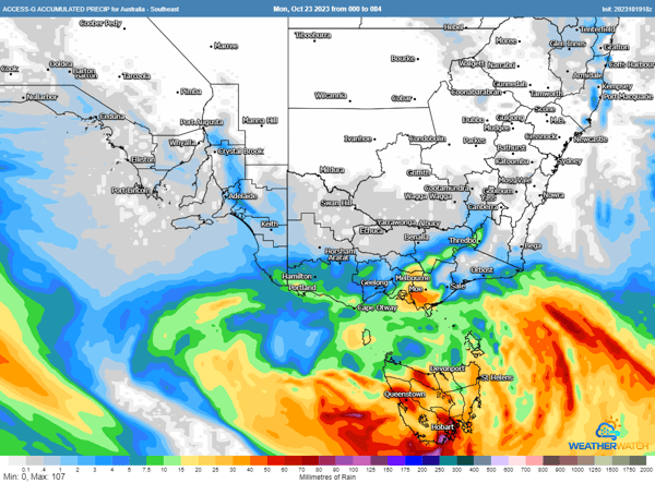
Rain and thunderstorms will be the main features for Tasmania, with widespread moderate to heavy falls expected, whilst the worst of the winds will be confined to the west and northwest of the state and northern islands, Many places will see rainfall totals of 20-50mm, however some areas in the south will see up to 100mm. A flood watch is current for widespread minor flooding and isolated moderate flooding. Thunderstorms may contain localised flash flooding as well as strong winds.
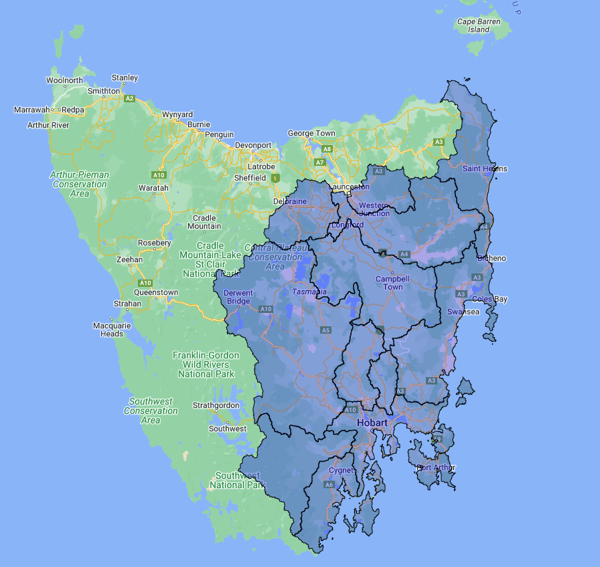
Conditions for Tasmania will worsen, and see a wet and wild weekend ahead
On the northern flank of the low over southeast South Australia and Victoria, rainfall totals are likely to be significantly lower although showers are still likely, particularly over more coastal areas and the northeast ranges where widespread falls of 5-20mm are likely, with localised heavier falls. Winds, however, are likely to be stronger than those in Tasmania, with gusts likely to reach up to 70-90km/h over the southeast SA coast, southern VIC and the northeast VIC ranges. These winds will be felt over southeast SA and western VIC on Saturday, before spreading east on Sunday.
For the MotoGP being held at Phillip Island this weekend, this will likely cause some issues on Sunday with gusts likely to exceed 80km/h, bringing back memories of Miguel Oliveira being blown off course by a strong gust of wind back in 2019.

Thunderstorms are also likely to develop over eastern Victoria on Saturday afternoon and evening, which are likely to be fast moving and also bring the risk of damaging winds.
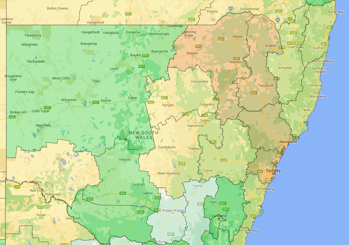
Further north in NSW, little if any rainfall is likely as severe drought continues to grip large parts of the state. The low further south and an associated trough is expected to drive hot and dry and gusty westerly winds across the state, with fire danger likely to reach extreme levels across the Hunter and Sydney regions and parts of the north.
Conditions will ease from Monday as a high pressure system moves over.
Recent Articles
Australia’s May–July 2025 Weather Outlook
As we transition into the cooler half of the year, the Bureau of Meteorology (BoM) has released its...
More Frosty Conditions to hit NSW, Queensland, Victoria and Tasmania
Much of southeast Australia is bracing for a significant cold outbreak as a polar blast sweeps...