Are you prepared for the upcoming hailstorm season?
As Australia enters the months of peak hail activity, it is crucial to recognise the increasing...
Just days after severe storms smashed much of NSW, a brief but powerful system swept across Sydney last night, causing damage to homes and businesses, stopping an A-League soccer match and forcing the evacuation of over 20,000 patrons at a major music festival just as the headline act was on stage.
The storms delivered half of Sydney's December's average rainfall in just 20 minutes, which created localised flash flooding in areas. Hail was also reported, with sizes ranging between 2-4cm and falling in irregular shapes due to the storm's turbulent conditions.
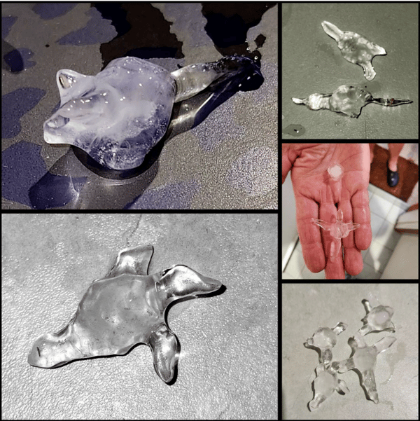
Hail shapes found in Penrith storm (Image via facebook)
Along with our leading severe weather event forecasting, the Early Warning Network provides Australia's leading hail forecasting, alerting and tracking technology. Our tracked this particular storm and issued our first thunderstorm alert to clients in its path at 6:42pm. This was more than 30 minutes before the BoM started issuing warnings.
The extra lead time provided by EWN ensured that our clients could take precautionary measures to minimise damage to assets and ensure their staff were safely inside to avoid injury.
The image below shows the path the storm took across Sydney, with the green polygons indicating the areas we produced hail alerts for. EWN's team specialises in creating accurate alert areas which are generally smaller than traditional alert areas. This ensures that our clients aren't taking precautionary measures or implementing safety protocols when they aren't required.
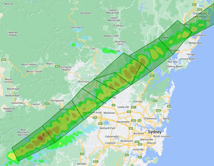 EWN hail alert polygons over storm track for the storms on 2 December (Image via EWN)
Today has seen another day of large and giant hail, this time across areas of Queensland. Gympie and Maryborough have both been in the path of severe hailstorms, with a large amount of damage estimated. Hail with a diameter of at least 5cm can cause significant damage to vehicles, buildings, people and agricultural crops. Our team is continuing to monitor events and advise clients of damaging hail where required.
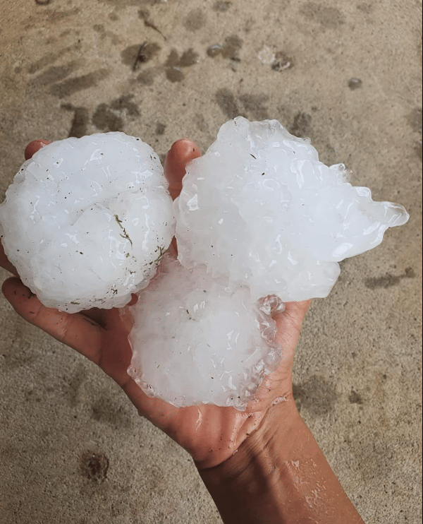 Giant hail has smashed Gympie this afternoon and is continuing its path north (Image via Facebook)
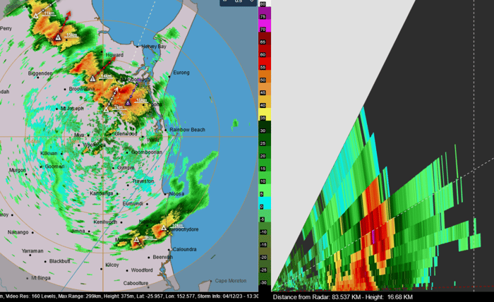
Storm radar and cross section of hailstorm heading to Maryborough today (Image via HailTracker)
If you would like to speak to our team to find out more about our leading hail services, head to our contact page and we will organise a demonstration for you.
As Australia enters the months of peak hail activity, it is crucial to recognise the increasing...
A weekend of storms looms for parts of Australia, with significant large hail activity forecast for...
Many areas of Australia are now entering the time on the calendar where there’s the highest risk of...