Rare Ex-Tropical Cyclone to cross Sydney overnight Monday into Tuesday; Ex-Tropical Cyclone Kirrily incoming
After tormenting eastern Australia for the better part of two weeks, we are finally about to see...
If you're attending the State of Origin 2024 opening match tomorrow night at Sydney's Accor Stadium, pack a poncho.
After a spate of wet weather events during the past several weeks, the last thing Sydney wants is more rain – particularly with the NRL's most prestigious event about to kick off.
An onshore south-to-southeasterly flow will be south of Sydney by Wednesday afternoon and meet more easterly winds. These two masses of air will collide, generating a small convergence zone. These two air masses will be forced upward because they cannot go through the earth's surface. This will be the focal point for showers, rain periods, and potentially severe thunderstorms during Wednesday afternoon and evening, leading to heavy rainfall.
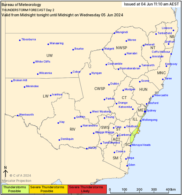
Bureau of Meteorology's Thunderstorm map for Wednesday 5/06/2024
Thankfully, the heaviest rain and storms look to remain south of Sydney, although some variability remains. The chief area of concern will be from Bellambi south to Batemans Bay. High-resolution ACCESS C forecast accumulated rainfall totals suggest some locations along this stretch of coast may see 50-100mm over the next 36 hours.
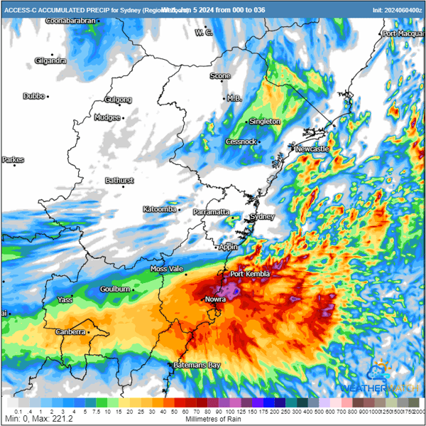
ACCESS C high-resolution accumulated rainfall totals the next 36 hours. Image via WeatherWatch MetCentre.
Another upper cut-off low moving through northern NSW will further aid this lift. This low will help induce a small surface low off Sydney overnight Wednesday into Thursday. Rain and storms on the southern side of the developing low will increase during Thursday morning.
Whilst heavy falls are not expected across western Sydney on Wednesday, some localities may see 5-15mm from shower activity and isolated storms, including Accor Stadium. NSW are always trying to curb Queensland's excellence in this arena, and there is no better way than to douse our speed advantage with rainfall.
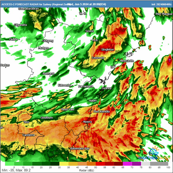
ACCESS C predicted radar image for 8pm kick off time. Image via WeatherWatch MetCentre.
Pack the poncho, hope any shower activity clears quickly, and let the best team win.
This Queenslander hopes for a 16-8 victory.
Written by Justin Noonan, Early Warning Network
After tormenting eastern Australia for the better part of two weeks, we are finally about to see...
Australia’s Tropical Cyclone season has officially begun, running all the way through until April...
Western Australia’s South West Land Division has been peppered with showers, severe storms, and...