Heat records continue to fall in NSW and VIC, but relief in sight
Yesterday saw another day of record breaking heat across New South Wales and northern Victoria,...
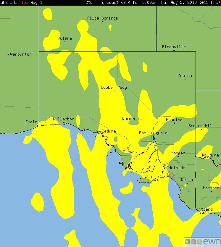
A vigorous cold front will move across South Australia today bringing strong to locally damaging wind gusts, showers and isolated thunderstorms with small hail.
Strengthening northerly winds ahead of the approaching front are likely to produce strong to locally damaging wind gusts of up to 100km/h. These strengthening northerly winds will drag down warm air from northern Australia, which will result in maximum temperatures reaching above the August average for many locations across central and eastern South Australia today. This will present a slightly enhanced bushfire risk across these regions during Thursday afternoon.
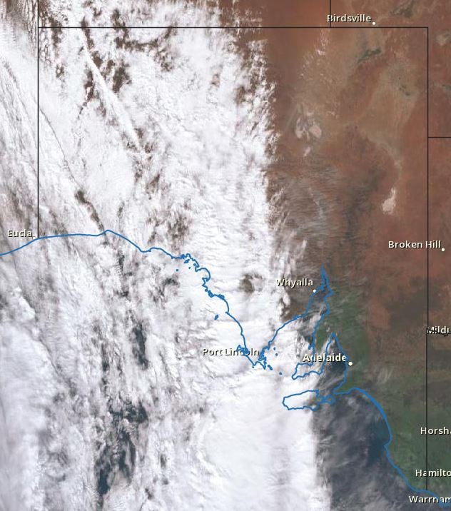
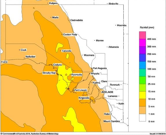
A large cloud band is currently moving its way across the state, producing showers, rain periods and isolated thunderstorm activity. Rainfall totals are expected to remain fairly light, with falls in the 5-10mm range expected, however isolated falls of up to 20mm cannot be ruled out.
Late this afternoon and overnight a large upper cold pool of air will move in from the west with a secondary round of showers and thunderstorms. Gusty winds and small hail are expected with activity, chiefly across coastal locations and adjacent inland regions. Adelaide may see some brief storm activity throughout Thursday night or during the early hours of Friday morning.
During Friday, fresh to gusty west to south-westerly winds will gradually turn north-westerly during the day ahead of a secondary front. Further shower activity is expected across coastal locations late Friday into Saturday, where an isolated brief coastal thunderstorm cannot be ruled out.
Image 1, BoM Himawary current satellite. Image 2, PME rainfall, Thursday 2nd August. Image 2, GFS storm probabilities. Image 2, EC wind gusts 6pm, wind.com
Yesterday saw another day of record breaking heat across New South Wales and northern Victoria,...
Record November heat, strong winds and dust are set to impact parts of Queensland over the next...
Spring in Australia was a mixed bag across the country and varied considerably from month to month,...