Heaviest rain since summer for Adelaide, parts of South Australia
Much-needed rain will fall over parts of South Australia on Wednesday and Thursday, with many areas...
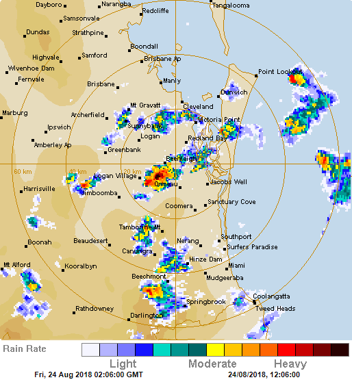
Heavy showers and isolated thunderstorms have fired up across southern parts of Queensland northern parts of New South Wales today, with some locations even reporting small hail.
Cold upper level air and a low pressure trough combined to trigger the showers and storms, which developed during the late morning and increased during the afternoon.
Lightning was not widespread or even frequent, however thunder was reported in parts of Brisbane, the Gold Coast, Scenic Rim and Lismore areas.
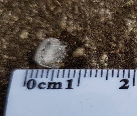
Some of these showers and storms became briefly intense, and were associated with heavy downpours and small hail, with confirmed reports coming from the Lismore area, Sunnybank, near Beenleigh and Mount Tamborine.
The showers and storms will linger for the remainder of the day, although there should become more isolated after sunset. Further showers and storms are possible over the weekend.
The thunderstorms are a reminder that spring is just around the corner, with the start of the region's storm season only a little over a month away.
Image 1: Small hail near Lismore, New South Wales. Image 2: Radar image taken from midday Friday 24 August, 2018
Much-needed rain will fall over parts of South Australia on Wednesday and Thursday, with many areas...
A dangerous mix of severe weather will strike western and southern parts of Western Australia...
Over the past 24 hours, central and southern parts of Queensland have experienced widespread,...