Rain spreading across SA, VIC and TAS
Patchy rain is starting to spread across Tasmania, Victoria and southern parts of South Australia...
Spring has certainly sprung across southeastern Australia with the second day of September seeing many centres reach into the mid 20s and 30s, before widespread rain spreading across the region from tonight.
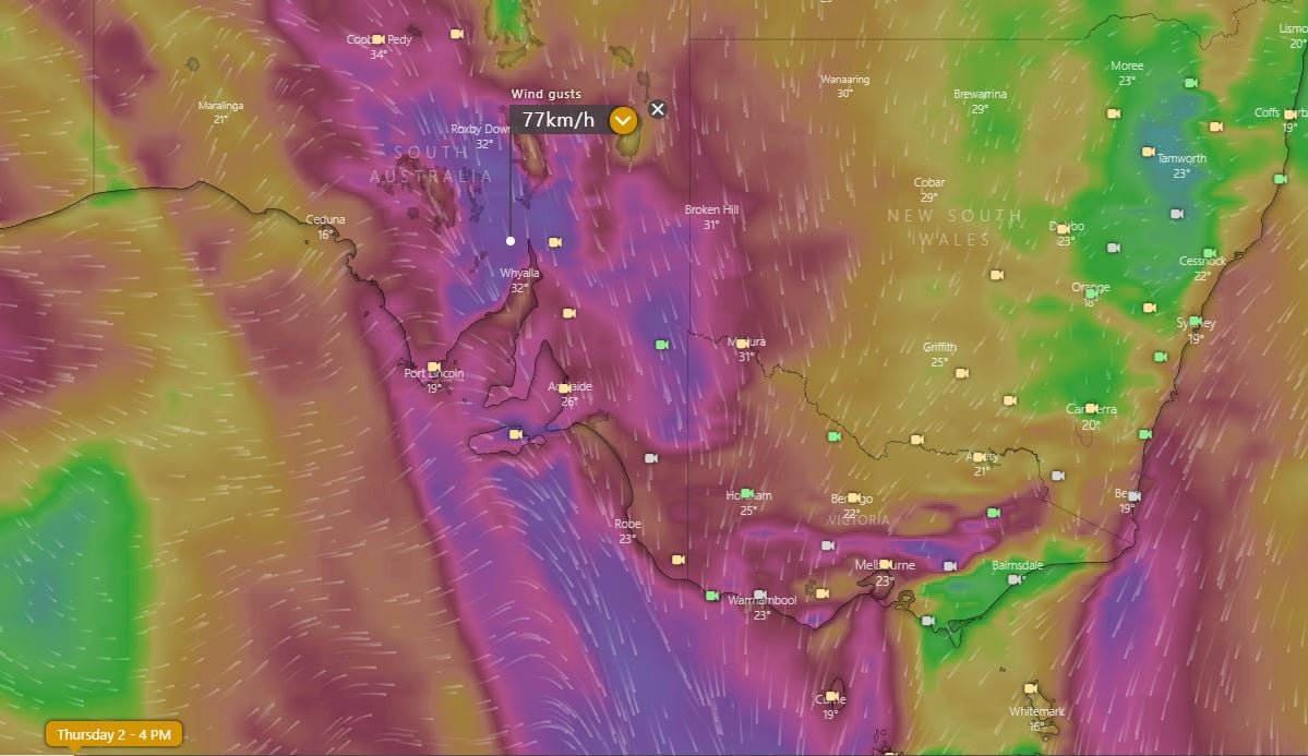
A strong frontal system is dragging warm, strong and gusty northerly winds across South Australia, Victoria, Tasmania and parts of New South Wales today, with severe weather warnings issued for parts of SA and VIC for wind gusts reaching 90-100km/h.
Temperatures have soared well above average for this time of the year, with a number of locations seeing record breaking heat for this early in the warming season (more typical of late September), including Hobart (26.0c), Adelaide (31.2c) and Melbourne (26.6c). A warm night is also in store for those ahead of the change.
Widespread rain and much cooler conditions will push in from the west this evening and focus on eastern SA, inland NSW, VIC and TAS on Friday, and push across NSW, far inland QLD and the southern NT over the weekend. Widespread falls of 10-30mm are likely with the system, with isolated higher totals particularly over the NSW and VIC alpine areas where totals in excess of 100mm are likely. Minor flooding and isolated moderate flooding is possible in these regions as well as isolated minor flooding in parts of TAS.
More settled and warmer conditions will return from next week as a high pressure ridge pushes over the region.
Image 1: Accumulated rainfall predictions from the GFS Model across the next 96 hours (Source: Weatherwatch Metcentre)
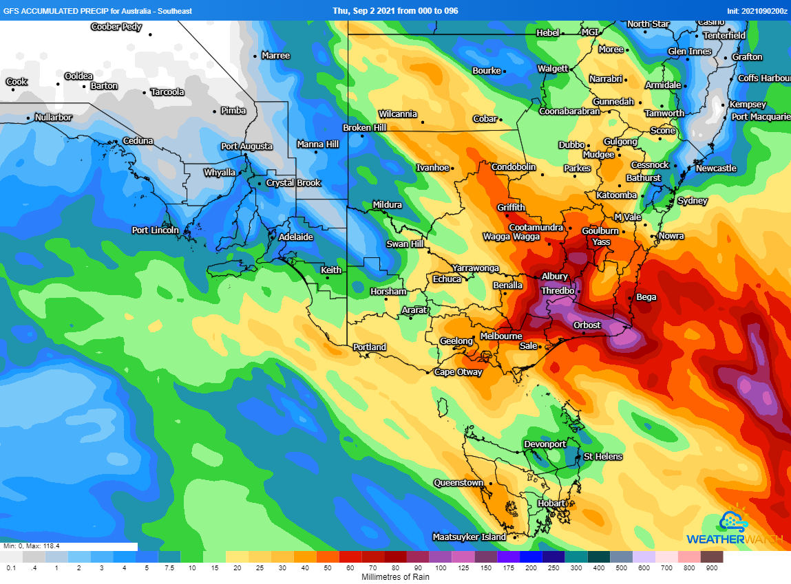
Image 2: Temperature anomalies across Australia for Thursday 2 September, 2021 (Source: Wxcharts.com)
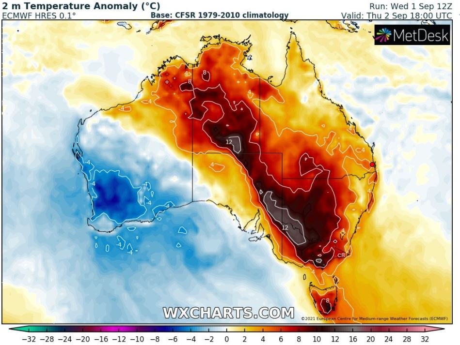
Image 3: Forecast wind gust at 4pm EST over parts of southeast Australia (Source: Windy.com)
Patchy rain is starting to spread across Tasmania, Victoria and southern parts of South Australia...
Temperatures are soaring across South Australia today with large parts of the state pushing into...
Temperatures are soaring into the mid to high 30s and 40s across southeastern Australia today,...