Rain, storms, hail, snow and waterspouts batter Australia
The last few days has been extremely active weather wise acoss southeastern and southwestern...
Southeast Queensland, Australia, is bracing for severe weather conditions this week. The forecast includes severe thunderstorms, damaging wind gusts, and localised large hail, particularly affecting the region on Wednesday.
Showers and storms are likely to extend to parts of southeast Queensland this afternoon before merging with showers and rain areas starting to spread down from the northwest overnight tonight and particularly during tomorrow.
This will be ahead of a secondary upper trough moving across the area.
Some areas throughout the state are expected to receive heavy falls of 50 to 100mm over the next 48 hours, with locally higher totals possible.

GFS forecast rain totals (Source: Weatherwatch MetCentre)
Interestingly enough, high-resolution model data (ACCESS C) is showcasing falls of 100-200mm across parts of South East Queensland during this time. While some local flash flooding is possible in the areas where the heavier falls occur, widespread extreme flooding is not expected.
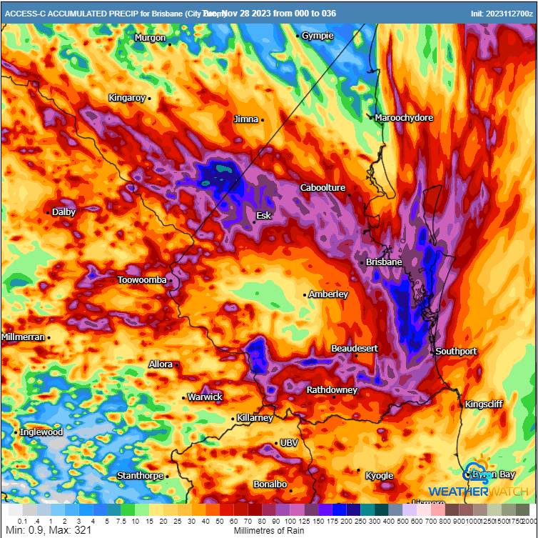
High resolution ACCESS C accumulated rainfall totals next 42 hours. Image via Weatherwatch MetCentre
Tuesday will also see a significant thunderstorm outbreak across western NSW and far eastern regions of South Australia. A powerful upper low will interact with a surface low, and potentially weak warm front. Strong speed and direction wind shear will result in a scattering of supercells to develop, with damaging to locally destructive winds, large to giant hail, and heavy to locally intense rainfall.
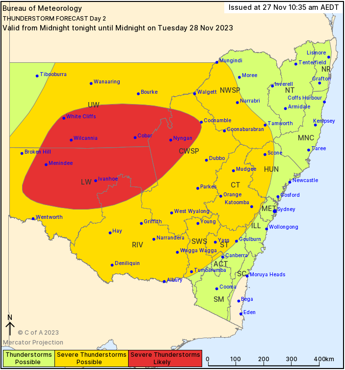
Bureau of Meteorology Day 2 thunderstorm threat map.
This same system will shift east on Wednesday, affecting the more heavily populated regions of eastern Australia. A large squally line, or broken line of severe storms is expected, spanning a vast region of NSW into central Queensland.
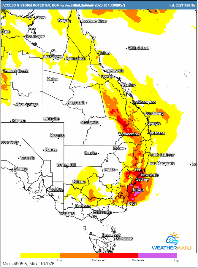
ACCESS G storm potential for Wednesday afternoon 29/11/2023. Image via Weatherwatch MetCentre
Showers and thunderstorms will persist across many parts of eastern and northern Australia during the next week. This period could bring widespread soaking rainfall for the region almost every day next week.
The recent rain events have thankfully cleared all bushfire warning levels from Queensland, and lessened the danger in NSW, with some areas now peaking at a Moderate fire danger rating.
The last few days has been extremely active weather wise acoss southeastern and southwestern...
A powerful cold front sweeping across southeastern Australia will generate damaging wind gusts for...
Tropical Cyclone Alfred has now turned towards land, intensifying as it approaches the southeast...