Parts of Australia to see their warmest average maximum July temperatures on record
Parts of Australia are on track to register their warmest July days on record as persistent clear...
After a spell of warm weather, NSW is set to experience a significant shift from today as a gusty cool change and rain spreads across the state, with some places also likely to experience thunderstorms and snow.
Much needed rain is beginning to make its way across NSW from today as a trough and cold front move across the state. Ahead of this change, westerly winds will cause another warm day with elevated fire danger for central and northern parts of the state, however temperatures will rapidly drop as the change hits.
Large parts of the state's south will at least record some rainfall, although only a small amount is expected to fall inland. However, those on the coast and ranges are likely to experience significantly more rainfall.
By tomorrow morning, many parts of south-east and central-east NSW are likely to have recorded 10-to-20mm, with isolated higher falls of 30-to-40mm.
On Tuesday and into Wednesday, models suggest a low might form within the trough, and bring heavy rainfall to the central and mid-north coasts, with potential for 24 hour totals in excess of 50mm, with isolated totals of 100mm. In far northeast NSW and into southeast QLD, thunderstorms may develop and with stronger wind shear near this low, there is potential for some of these thunderstorms to become severe.
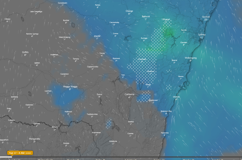
The cold front is also expected to bring an airmass cold enough for snow, with snow possibly falling as far north as the NSW central tablelands on Tuesday morning.
The system will clear away from Thursday, however another front and cloud band may bring further rain from Friday and into the weekend.
Image 1, Forecast rain accumulation over the next 66 hours to 4pm Wednesday over NSW
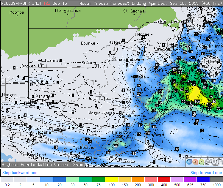 Image 2, Thunderstorm forecast from EC model on Tuesday 17th September evening across NSW (Source: Windy)
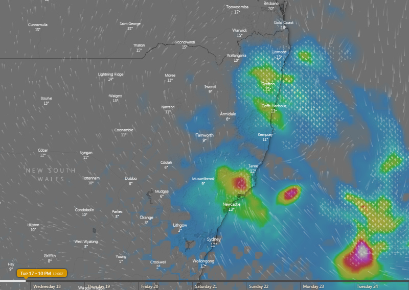 Image 3, Snow forecast from EC model on Tuesday 17th September morning across NSW (Source: Windy)
Parts of Australia are on track to register their warmest July days on record as persistent clear...
Spring is set to start off quite warm across Australia with September likely to be a warm one...
The first in a series of cold fronts has been sweeping across South Australia, Victoria and...