4 Data-Driven Strategies Insurers Should Use for Hail Preparedness
When severe hailstorms strike, the difference between a costly, reactive claims scramble and a...
On Friday, July 18, a combination of atmospheric forces brought an unexpected burst of severe weather to South-East Queensland. A surface trough intersected with an upper-level system, triggering severe thunderstorm activity that swept across the region during the afternoon and evening.
The resulting instability marked a rare winter event, and the first severe thunderstorm warning issued for Brisbane in July since 2017. The storm system brought moderate rainfall of around 20–35mm across south-east Queensland and north-east New South Wales, along with large accumulations of small hail across Brisbane. In some areas, this hail covered entire roadways and formed drifts in gutters and drainage systems, creating hazards more commonly seen in icy winter road conditions overseas.
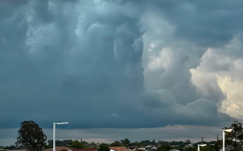
The hailstorm approaching suburbs around Brisbane (image by EWN's Ken Kato)
Reports of 2–3cm hailstones came in from Moorooka, Oxley, and Laidley, with hailstones reaching up to three centimetres in some pockets of Brisbane’s south. While these sizes don’t reach "giant hail" classifications, they’re certainly large enough to cause damage to vehicles, rooftops, and solar infrastructure.
After the intense burst of weather, conditions rapidly improved. By Saturday morning, Brisbane woke to clear skies, with temperatures climbing to a mild 21°C.
.png?width=600&height=522&name=Untitled%20design%20(30).png) Hail tracks are evident over SE Brisbane and N Ipswich on Friday 18 July (image via HailAWARE)
Hail tracks are evident over SE Brisbane and N Ipswich on Friday 18 July (image via HailAWARE)
While most Australians associate hail with spring and summer storms, hail can and does occur in winter but the dynamics behind it differ significantly.
During warmer months, rising hot air fuels powerful updrafts, which lift raindrops high into the atmosphere. There, in the supercooled upper levels, droplets freeze and collide with others to form hailstones. The stronger the updraft, the larger the hailstone, as it cycles up and down in the storm cloud until gravity wins.
This is why Australia’s largest hail events typically occur between November and January, when surface temperatures, humidity, and storm energy (or CAPE—Convective Available Potential Energy) are at their peak.
Winter hail often behaves differently. While the atmosphere still needs unstable conditions and strong convection, the storm energy is typically lower, and hailstones don’t have as much time to grow before falling. That means you’re more likely to see smaller hail in larger volumes, sometimes covering roads and properties completely.
These events can be highly hazardous, not due to size but due to accumulation. Roads become slick and icy, and piled hail in drainage systems can lead to localised flash flooding.
It’s also important not to confuse hail with sleet. While sleet forms when rain freezes as it falls through a cold air layer (common in winter), hail forms in thunderstorms when supercooled droplets are lifted and frozen multiple times in convective updrafts.
 An example of a winter hail drift
Unseasonal hail events like the July 18 storm reinforce the need for year-round hail monitoring, not just in traditional “hail season.”
At Early Warning Network, our new HailAWARE solution provides a full-spectrum hail intelligence solution, including:
Hail Forecasting – Pinpoint predictions based on storm energy, wind shear, and convection.
Real-Time Hail Tracking & Alerts – Immediate detection of hail and live updates for on-ground teams.
Post-Event Reporting – High-resolution maps and impact data to assist insurers, emergency services, and asset managers.
Whether you’re managing risk for an insurer, operating a solar or construction site, or protecting critical infrastructure, HailAWARE helps you stay ahead of every hail event, from small winter bursts to giant summer outbreaks.
Friday’s storm was a reminder that hail doesn’t follow the calendar. As climate patterns shift and extremes become more frequent, tools like HailAWARE offer critical foresight, ensuring businesses and communities are ready, no matter the month.
Talk to an Embargo or Hail Specialist today to learn how HailAWARE can strengthen your weather risk strategy.
When severe hailstorms strike, the difference between a costly, reactive claims scramble and a...
Hail has long been treated as a difficult but familiar weather peril. It arrives quickly, damages...
As Australia heads into hail season, the atmosphere is already showing signs of ramping up. Hail...