Record hailstorms lash Central Queensland
Destructive thunderstorms lashed parts of Central Queensland on Sunday afternoon, with numerous...
Showers, isolated thunderstorms and heavy rain areas are expected to contract off the central and south-eastern coastal districts of QLD during later today, with conditions easing and clearing into Sunday as an upper level trough exits the region.
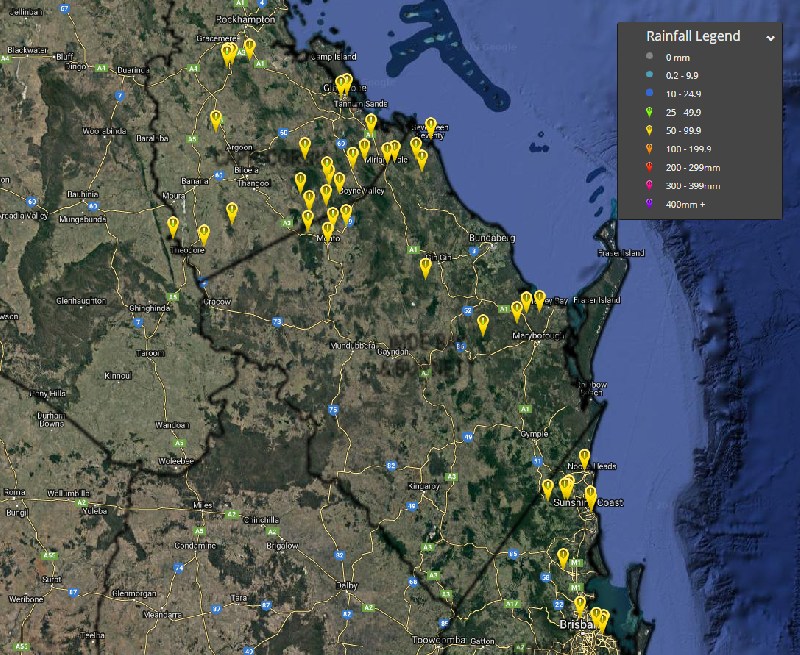
A few locations, especially around the Capricornia and Wide Bay and Burnett coastal and adjacent inland districts received greater than 50mm of cumulative rainfall over the past 24 hours.
Capricornia and Wide Bay and Burnett: >50mm of rainfall (24 hours to 9am today):
Southeast Queensland: >50mm of rainfall (24 hours to 9am today):
Remember to keep up-to-date with all warnings and severe weather alerts via The Early Warning Network (Email, SMS, Facebook and Twitter). #ewnalerts #earlywarningnetwork
Image 1: Capricornia and Wide Bay and Burnett Rainfall Observations >50mm. 24 hours to 9:00am - October 12th, 2019
Destructive thunderstorms lashed parts of Central Queensland on Sunday afternoon, with numerous...
Twenty-six years ago, on the evening of April 14, 1999, Sydneysiders watched in awe as a seemingly...
Australia hasn’t been alone this past season in experiencing catastrophic flooding.