WA, SA, Tasmania, NSW, and Victoria will feel the wrath of severe weather this week
The blocking pattern, which has been responsible for the essentially unchanging weather across most...
While we saw extreme heat across the country over the weekend, this week will see the return of significant severe weather, which will impact a vast region of central, southern, and eastern Australia.
A strong cold front and a powerful upper trough are moving through the region, helping to induce a significant surface low across NSW, which will slide off the eastern Victorian coastline late Wednesday, bringing dangerous fire weather before widespread areas of rain and storms. High temperatures in the late 30s in many areas were up to 15° above average.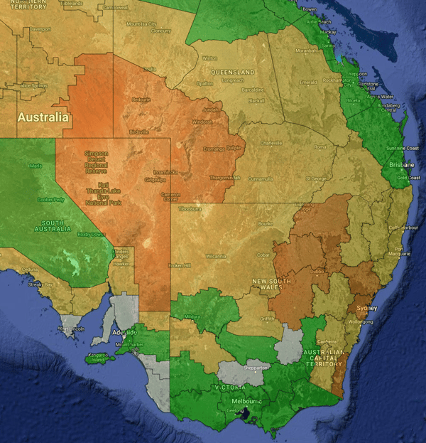
Current day 2 fire weather warnings forecast for Tuesday 3/10/2023.
Strong and gusty winds, along with intense lightning activity, have also affected SA throughout the last 24 hours, with mass power outages due to storm damage. Additional winds throughout western NSW and northwest VIC are also causing extreme fire danger and a significant fire weather threat over these areas. In the wake of this trough, strong winds to 90km/h will affect the southern WA coast. 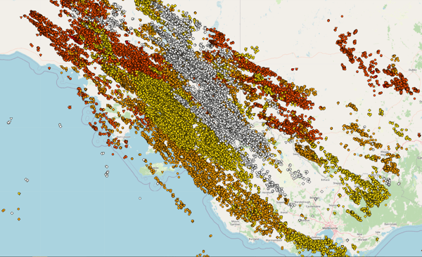 Lightning activity for 24hrs up to 11am 3 October
Today, the heat and fire threat has shifted east to NSW, inland QLD and far northeast SA as temperatures again soar into the mid to high 30s in many areas, with extreme fire danger affecting many areas including the NSW South Coast, Sydney area and the Hunter. Strong winds will affect the southeast of NSW and northeast VIC, with gusts to 90km/h, reaching up to 110-120km/h in alpine areas.
However, the good news is heavy rain and isolated thunderstorms will begin to spread across central and eastern VIC as well as inland NSW. This is much needed, with several dangerous and destructive fires hitting these states in the last couple of days. The rain and storms will shift east and north across NSW and VIC as a low pressure system spins up and deepens.
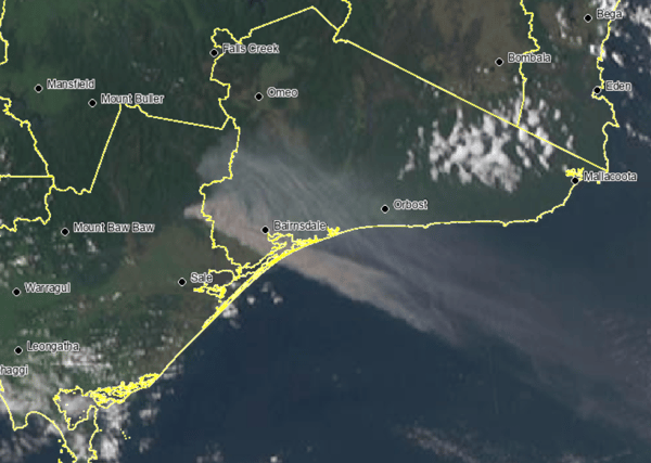 Satellite imagery from emergency warned fires in eastern Victoria Sunday 1st October 2023
Widespread and potentially severe storms will develop across central and northern NSW and parts of southern QLD from early Wednesday morning and spread east throughout the day, reaching the coast by later in the afternoon and evening. The low pressure system will generate very strong wind shear in its vicinity, with thunderstorms bringing potential for very heavy rainfall and damaging to destructive winds, with one or two tornadoes possible over central and southern NSW.
Across eastern VIC and southern NSW, widespread falls of 30-80mm are likely, however over northeast VIC some areas will receive up to 100-200mm (possibly higher localised falls), bringing areas of minor to moderate flooding, including the risk of localised major flooding. Unfortunately, the system will not bring as much rain to central and northern NSW and southern QLD, where falls of 5-20mm are likely to be more commonplace. By Thursday and Friday, the system will have contracted to central east QLD where falls of 10-20mm are likely (localised heavier falls), before clearing offshore.
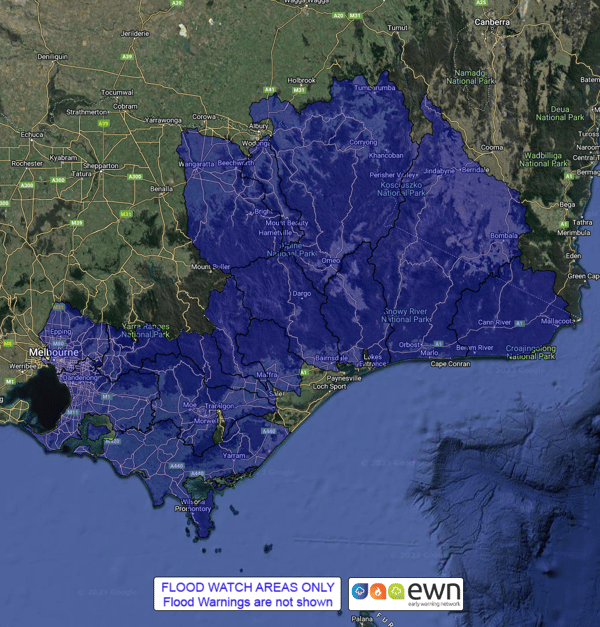 BoM issued flood watches for Victoria and NSW.
Residents in the affected areas are advised to stay alert and be prepared for potential severe weather conditions. Early Warning Network offers a variety of forecasting and warning technologies to assist in mitigating the risk posed by severe weather events. Customised wind and thunderstorm alerts give you timely information about locations in the path of storms before they are impacted, and our hail defence services are the leading hail forecasting and alerting products in Australia, protecting assets and people from damaging hailstorms.
If you would like to talk with our team about how these and other products can help you prepare for severe weather and hazards, chat to our team today.
The blocking pattern, which has been responsible for the essentially unchanging weather across most...
For those in the logistics industry, where precision and timing are critical, weather conditions...
The November 2025 hailstorms across south-east Queensland triggered more than 27,800 insurance...