Low pressure system bringing showers, thunderstorms and strong winds to southern WA
The effects of an unseasonably strong low pressure are being felt across the southwest of Western...
Whilst southern Queensland is accustomed to blustery southwesterly winds during the later winter, Tuesday will bring the threat of widespread gale force winds.
A cold front and trough will push off the NSW coast this evening whilst deepening with southwesterly winds strengthening in its wake.
Widespread wind gusts of 50-70km/h are expected, including the Brisbane CBD, with localised damaging winds gusts to 90km/h possible for the Western Ranges around Cunningham's Gap, extending north to Toowoomba, the Bunya Mountains and southeast to the Border Ranges.
It won't just be the winds that affect the region, with a sharp drop in temperatures likely. Brisbane's heading for a top of 29°C today, dropping significantly to 24°C on Tuesday, with 'feels like' temperatures up to 10°C cooler.
Fire danger will rise dramatically on Tuesday despite the cooler temperatures, as a drier airmass combines with gale force winds. At least Very High fire danger is expected for most of the state, with the potential for pockets of severe fire danger in some regions.
A southerly change may bring the threat of an isolated shower or weak storm across the southern Border Ranges and Coolangatta region late Tuesday, with small hail possible as a very cold airmass passes by.
The good news is winds will ease rapidly into Wednesday, with temperatures steadily increasing in the latter half of the week, with plenty of sunshine to finish the first week of school holidays.
Image 1: Potential wind gust Tuesday afternoon. EC and ICON. Images via Windy.com
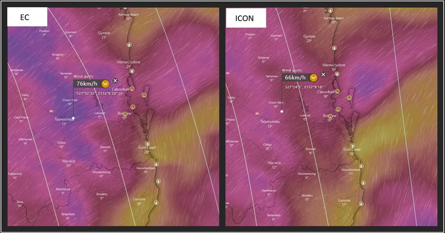 Image 2: GFS apparent or 'feels like' temperatures 1pm Tuesday 21/09/2021. Image via WeatherWatch MetCentre.
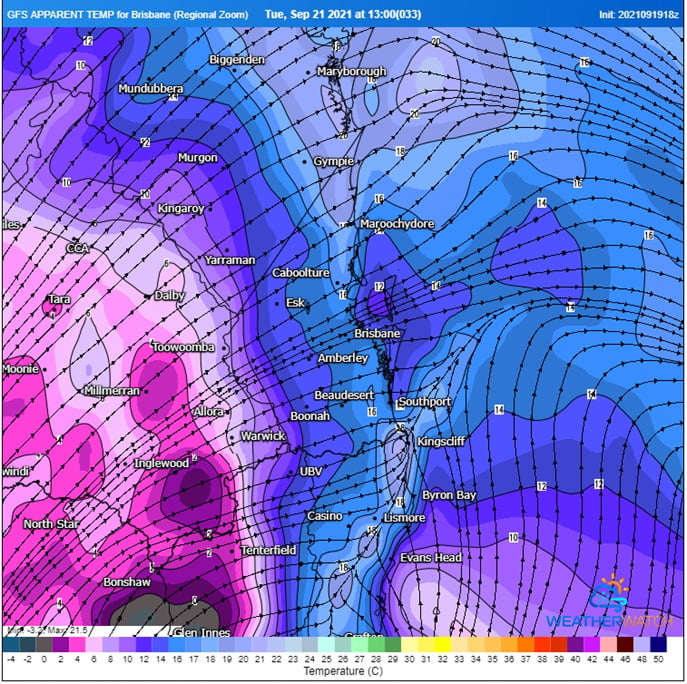 Image 3: Current fire danger ratings for Monday and Tuesday. These will be updated later this afternoon. Image via QFES.
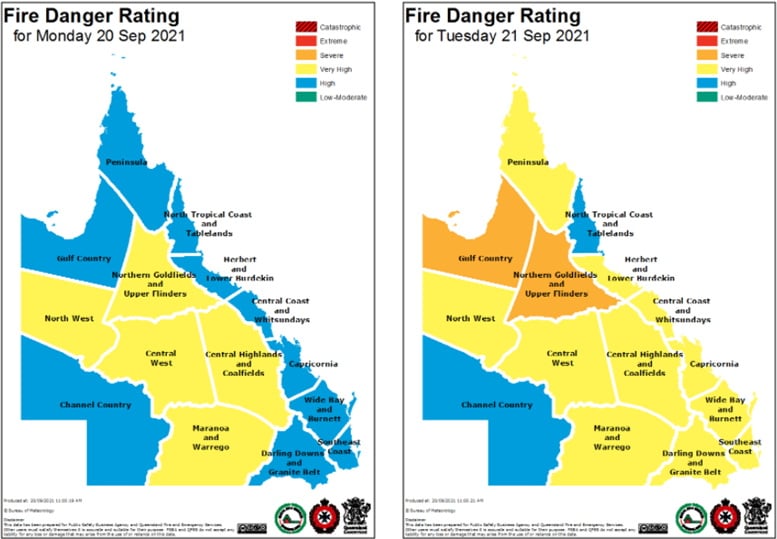
The effects of an unseasonably strong low pressure are being felt across the southwest of Western...
A strong cold front is dragging a hot airmass and strong winds once again over southeastern...
A strong cold front is beginning to move across southeastern Australia, causing strong northerly...