Severe thunderstorms and heavy falls across central Queensland
Another bout of severe weather impacted Queensland on Saturday afternoon, with severe thunderstorms...
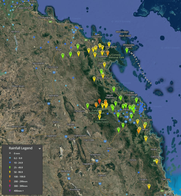
A surface and upper trough has caused widespread 25 to 50 mm falls across much of the Southeast Coast forecast district of Queensland as well as the Northern Rivers district of New South Wales and parts of the Mid North Coast district late yesterday into this morning.
Isolated falls over 50 mm have been recorded among these areas.
There have also been some falls of 10 to 25 mm in parts of the southern and western interior of Queensland as well as the New South Wales Northern Tablelands and eastern interior.
Occasional showers and some patchy rain areas are expected to persist in these areas today. Isolated storms are also possible today in parts of the southeastern interior and Wide Bay and Burnett districts of Queensland.
A very cool day is also expected in these areas with maximum temperatures below average due to the cloud cover, rainfall and cooler airflow.
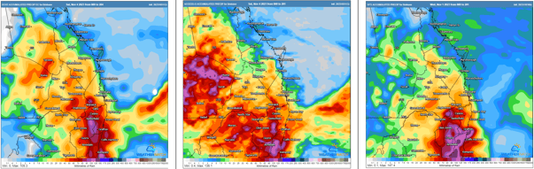
Image 1 and 2: Observed rain amounts between 9am yesterday and 8am today (AEDT).
Another bout of severe weather impacted Queensland on Saturday afternoon, with severe thunderstorms...
Severe thunderstorms erupted across Eastern Queensland on Wednesday afternoon with severe flash...
Wednesday afternoon saw multiple severe thunderstorms develop across central Queensland, bringing...