Snow showers and blizzard conditions inbound for Victoria, Tasmania and New South Wales early next week
A high pressure system situated over the eastern portion of the Great Australian Bight is directing...
Showery conditions are expected to return across the South West Land Division of WA during Tuesday and into Wednesday.
A cold front and associated trough will generate showers across coastal regions during Tuesday morning, becoming more widespread during the afternoon and spreading east into inland regions.
During Wednesday, very cold upper level temperatures will interact with increasing moisture to generate cloudy conditions, scattered showers, rain periods and isolated thunderstorms.
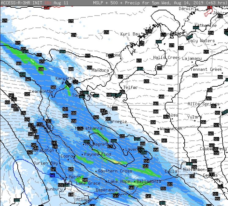
A small surface low may develop during Wednesday, with widespread falls of 10-15mm are expected, with isolated falls to 30mm, particularly with thunderstorm activity during the afternoon.
Conditions will gradually clear during Thursday, before the next frontal system approaches the South West late on Friday, with showers and isolated thunderstorms increasing.
These falls are likely to be extremely welcome across the Agricultural districts, with some areas potentially seeing up to 50mm during the next 7 days.
Image 1, BoM PME 8 day rainfall accumulation.
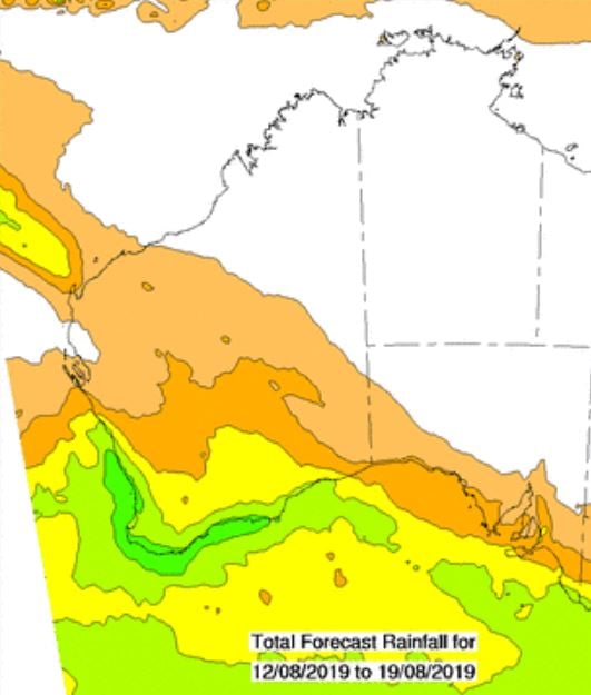 Image 2, EC rainfall totals, next 10 days (windy.com).
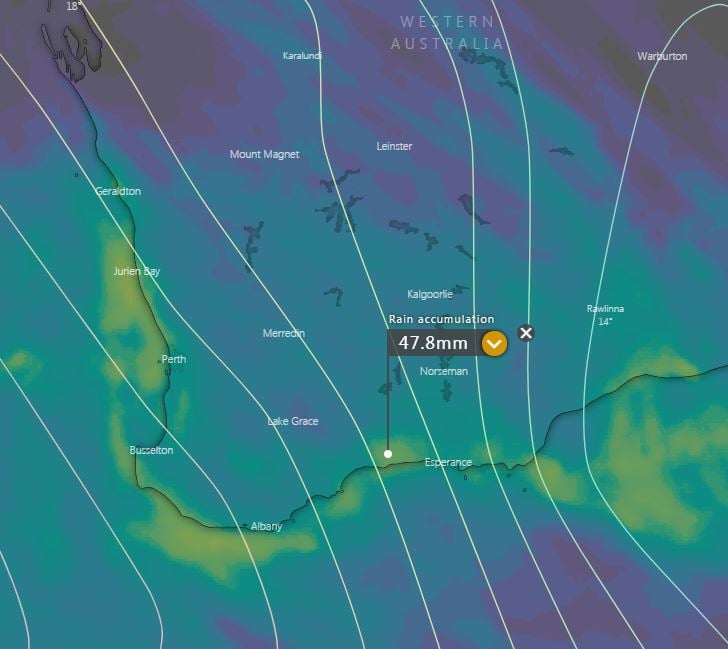 Image 3, Access R precipitation values, Wednesday afternoon.
A high pressure system situated over the eastern portion of the Great Australian Bight is directing...
A multi-day severe weather event kicked off in South Australia on Tuesday, with damaging to...
Temperatures are soaring more than 15 degrees above average across inland parts of Western...