Severe storms to lash Victoria, New South Wales and Queensland
During Tuesday, a surface trough will deepen across New South Wales and Victoria in response to a...
Wet conditions are expected to return to eastern Queensland and northern NSW later this week, as an upper trough combines with a surface trough and southerly change.
Late Wednesday and into Thursday, a southerly change will move through northern NSW and southern QLD bringing increasing moisture with scattered showers and gusty winds.
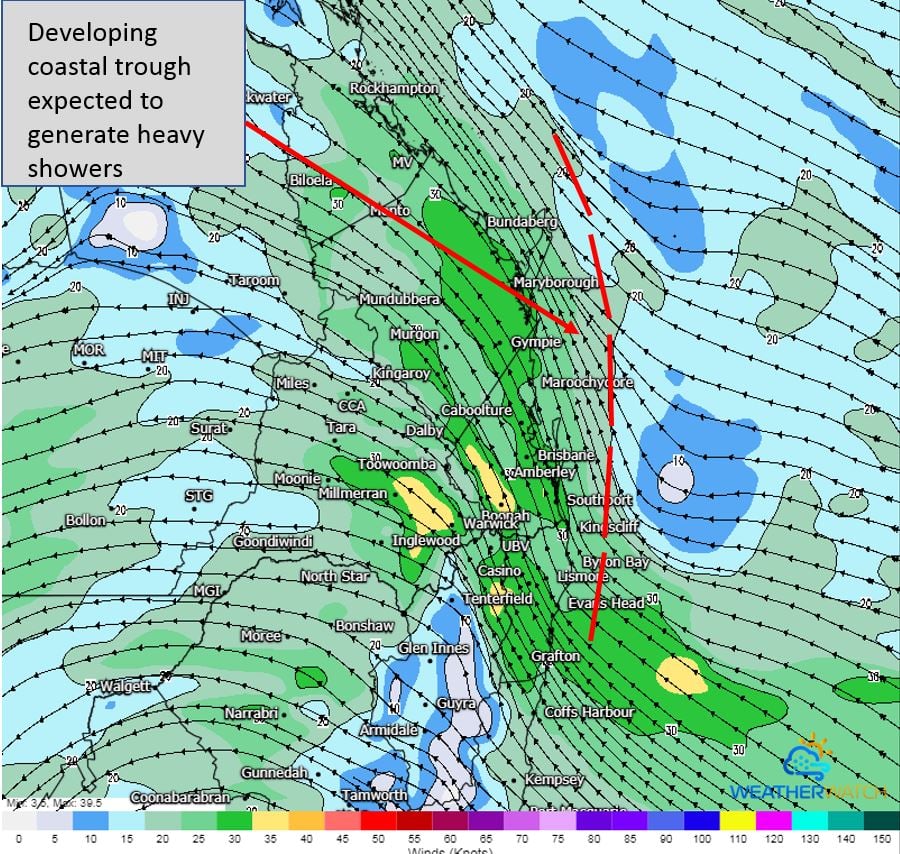
This upper system will move into South Eastern Queensland overnight Thursday and into Friday, combining with increased moisture from the southerly change with the potential for a small coastal trough to develop.
Image 1: Small coastal trough, as seen on GFS Friday morning 11/09/2020. Image via WeatherWatch MetCentre.
In response, scattered showers, tending to rain and isolated thunderstorm will be possible from the Mid North Coast of NSW to the Wide Bay and Burnett region in QLD, with localised heavy falls to 100mm across coastal regions. Areas 10-20km inland are expected to see lighter falls, with 5-15mm possible.
Image 2: GFS accumulated precipitation next 5 days. Image via WeatherWatch MetCentre.
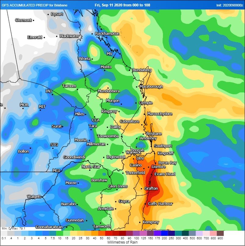
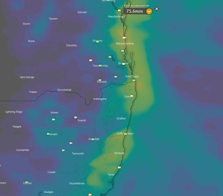
Image 3: EC accumulated precipitation next 5 days. Image via Windy.com
Shower activity should gradually clear from the south on Saturday, with clearer conditions and fresh easterly wind developing across the weekend.
During Tuesday, a surface trough will deepen across New South Wales and Victoria in response to a...
Thursday is looking rather stormy and damp across western Queensland, with the potential for storms...
The next few days look set for showers, isolated thunderstorms and heavy rain periods that may lead...