Wet week for western Tasmania
A wet and windy end of the week is set to develop for the western half of Tasmania.
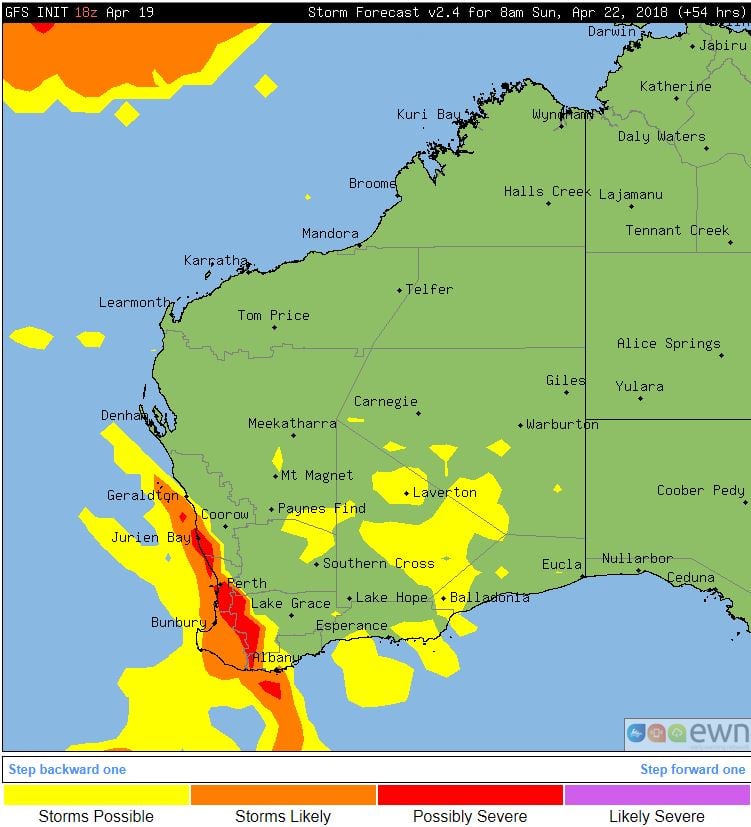
A low pressure system to the south of WA and associated cold front will sweep across south-western parts of the state from Saturday into Sunday with increasing instability.
Overnight Saturday into Sunday a large band of showers, rain period and thunderstorms stretching from Geraldton down to Albany are expected to develop along the advancing cold front..
A few thunderstorms are likely to be severe and capable of producing damaging winds, frequent cloud-to-ground lightning and the potential for hail thanks to the cold upper level temperatures associated with this system. Areas of moderate to locally heavy falls will also be possible with activity over the weekend.
During Sunday conditions should gradually improve, however showers likely to persist with gusty onshore winds. Conditions should become fine with slightly warmer temperatures early to mid week.
A wet and windy end of the week is set to develop for the western half of Tasmania.
Eastern Tasmania saw wet conditions across the weekend, as a low pressure system off the southern...
At 8:57am Western Standard Time, the Bureau of Meteorology issued the first Tropical Cyclone Advice...