Winter deluge on the way for central QLD
A rare dry season rainfall event is set to unfold across parts of the Central QLD coast over the...
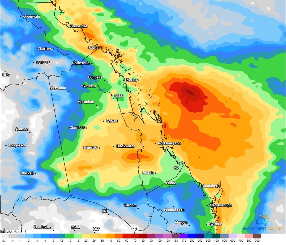
Solid winter rainfall is expected to develop across parts of Central Queensland this week, with localised falls to 50mm possible.
An upper trough will move across western QLD on Tuesday, increasing cloud cover across central and eastern Queensland, with southeasterly winds pumping moisture into the region.
During Wednesday, this upper trough is expected to help deepen a surface or coastal trough, increasing rain across central Queensland, with the potential for isolated thunderstorms.
Moderate to locally heavy falls will be possible for coastal regions, particularly if a coastal trough develops. Falls of 20-40mm will be likely, with isolated heavy falls, which may lead to localised flash flooding.
Further inland, patchy showers and light rain periods may develop with 5-15mm possible for some regions.
Whilst this could be quite and unseasonable event, winter rain will be a welcome relief for many, particularly farmers across Central Queensland.
Image 1: 96 hour rainfall accumulation (GFS). Image via WeatherWatch
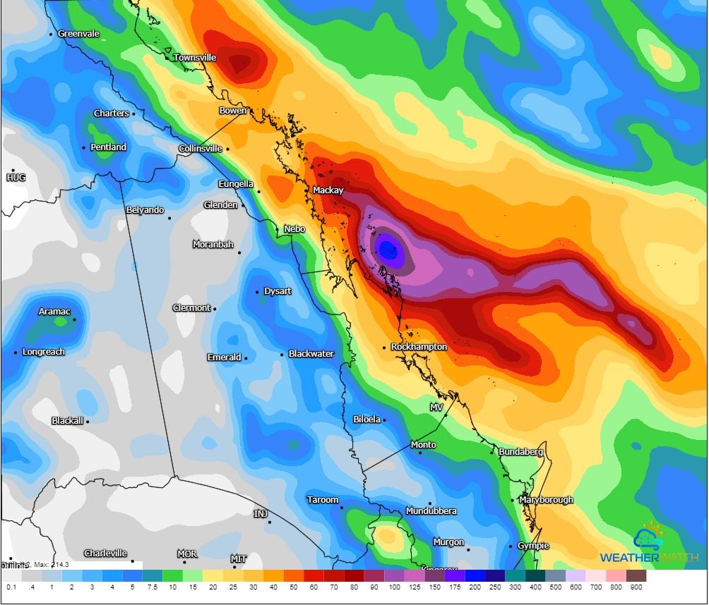 Image 2: 84 hour rainfall accumulation (ACCESS G). Image via WeatherWatch
A rare dry season rainfall event is set to unfold across parts of the Central QLD coast over the...
March 2020 was a mixed bag across Australia, as many parts of the southeast had cooler and wetter...
The South West Land Division of WA has experienced a very stormy last 4 weeks, with an impressive...