Gusty, warm conditions lead to increasing fire dangers for southern QLD and NSW
An advancing cold front will shift off the east coast of Australia today, with north-westerly winds...
After a cold and wet spell across large amounts of WA, temperatures will soar several degrees above average on Thursday before a complex weather event unfolds on Friday and over the weekend, bringing more rain, storms and potentially strong winds as well.
Temperatures plummeted earlier this week due to a strong cold front, with snow falling on the Stirling Ranges, and Perth having its coldest May day since 2013 topping out at 14.7 degrees. In contrast, temperatures in the Perth area and surrounds and along the south coast (except the far southwest where it will be several degrees cooler) are expected to reach in the mid 20s tomorrow, whilst those along the Central West and Gascoyne Coasts will see temperatures rise into the high 20s, even cracking 30 degrees in some areas.
The warmth will be relatively short lived, with a complex low pressure system beginning to affect the west coast from late Thursday, but especially from Friday. Areas of rain and storms will spread over the state from Exmouth to the southwest, reaching the South East Coastal and Goldfields areas on the weekend. Most storms will be high based and non-severe, however localised damaging winds are possible as well as localised flash flooding over parts of the Pilbara and Gascoyne.
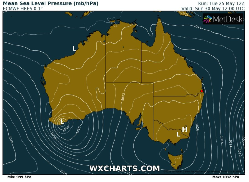
Patchy rain will shift to the far east of the state on Sunday and clear most other parts, however some models indicate a low pressure system will deepen over the southwest of the state. Depending on where this system forms and the movement, heavy rain is possible on Sunday and into Monday with most models indicating the heaviest falls affecting between Albany and Margaret River. Depending on how intense the low is, wind gusts to 100km/h are also possible near the centre.
At this stage, widespread falls of 10-20mm are likely, with those areas affected by storms seeing 20-40mm. If the low does develop, falls in excess of 100mm are possible over parts of the southwest, with similarly heavy localised falls possible in the Exmouth area under storms.
Image 1: Accumulated rainfall across the next 96 hours from the GFS Model (Source: Weatherwatch Metcentre)
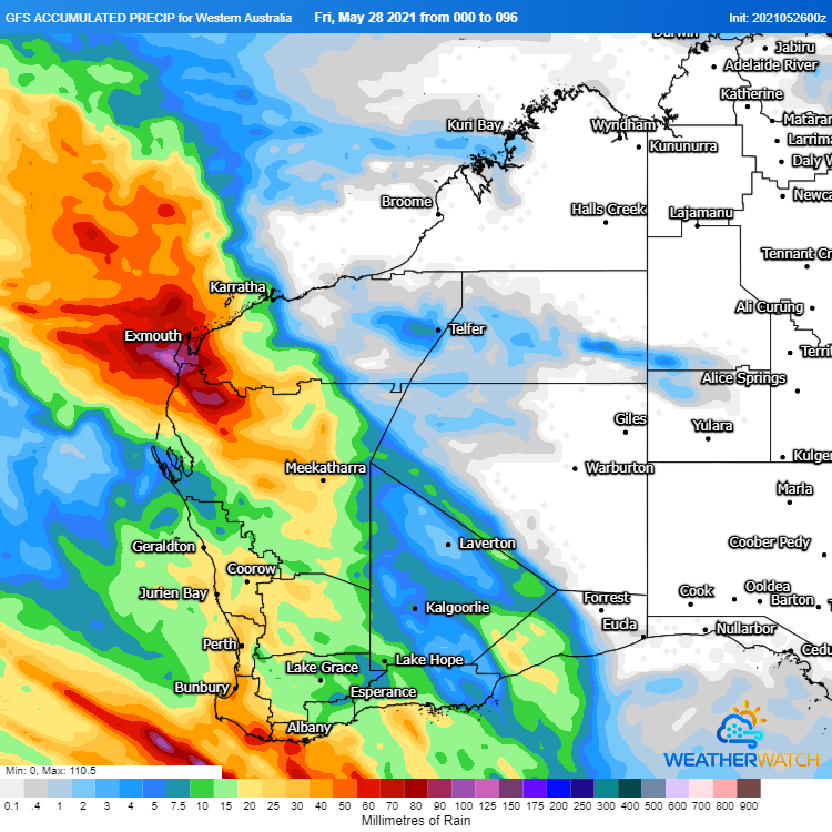 Image 2: Wind gust forecast for Sunday afternoon/evening from the ECMWF Model, in the event a low pressure system forms (Source: Windy.com)
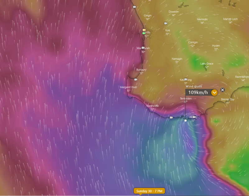
Image 3: Synoptic chart for Sunday 30th May, 2021 showing the low pressure system over southwest WA
An advancing cold front will shift off the east coast of Australia today, with north-westerly winds...
Sunny skies and record August warmth has affected southwest parts of Western Australia today,...
A low pressure system and strong cold front moved through the South West Land Division of Western...