Spring warmth and early bushfire conditions for northern NSW and southern QLD
Warm, dry and windy conditions will cause fire danger to spike across northern New South Wales and...
Temperatures are warming up this week after a cold blast affected the nation's southeast last weekend, although this won't last for long as another cold blast is set to arrive late on the weekend and into early next week.
The cold front last weekend caused snow to fall to low levels across parts of Tasmania, Victoria and New South Wales, with snow extending up close to the Queensland border.
Some parts of NSW Central Tablelands saw in excess of 20cm of snow, with satellite images showing a visible cover days after the event finished. Spencers Creek has now reached 2 metres for the first time this season, slightly earlier than when this depth was reached last year.
Conditions will be much more settled and warmer this week, with temperatures reaching into the mid-to-high teens over VIC and TAS, low 20s in SA, and low-to-mid 20s across NSW. Those in northeast NSW and southeast Queensland will see temperatures reaching the high 20s by the weekend or early next week, with some locations possibly reaching into the low 30s.
However, the cold blast, which is expected to be not as strong as the last system, will sweep across the southern states on Sunday, before reaching the remaining states by Monday or early Tuesday. Ahead of the front, strong dry and gusty winds are likely, with bushfire danger also elevated.
With and behind the change, showers, thunderstorms, small hail and snow are likely, with snow possibly falling to low levels again across parts of VIC, TAS and NSW (although it is not expected to extend as far north as the previous system).
Unfortunately, the system is not expected to bring widespread or significant rainfall, with the highest totals likely about the coast and ranges of TAS, VIC and southern NSW.
Image 1, snow visible on satellite image over the NSW Central Tablelands
.jpg?width=615&name=1565766811ct-snow-(1).jpg) Image 2, OCF Forecast temperatures on Sunday 18 August, 2019
Image 2, OCF Forecast temperatures on Sunday 18 August, 2019
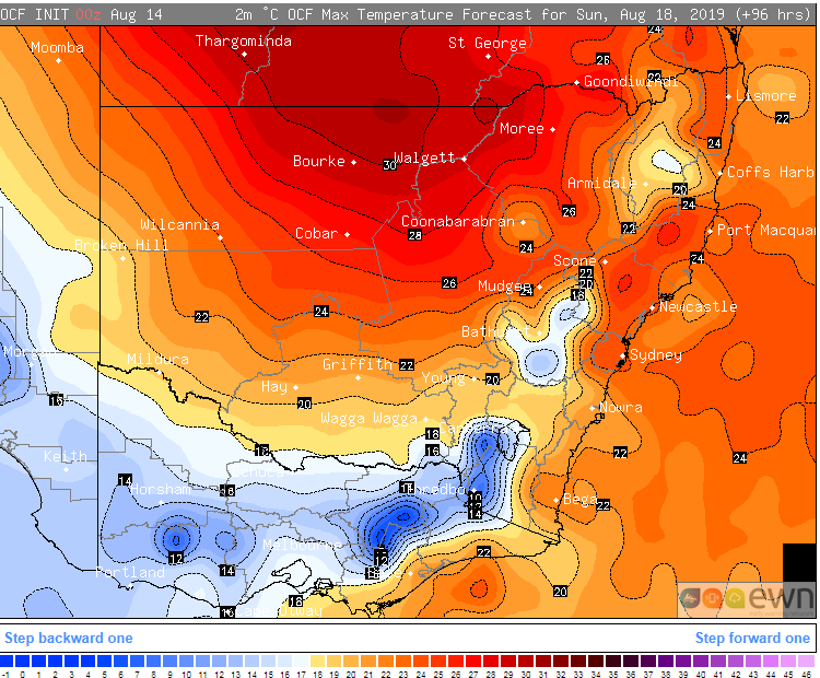 Image 3, 850mb forecast temperatures over southeastern Australia on Sunday 18 August, 2019
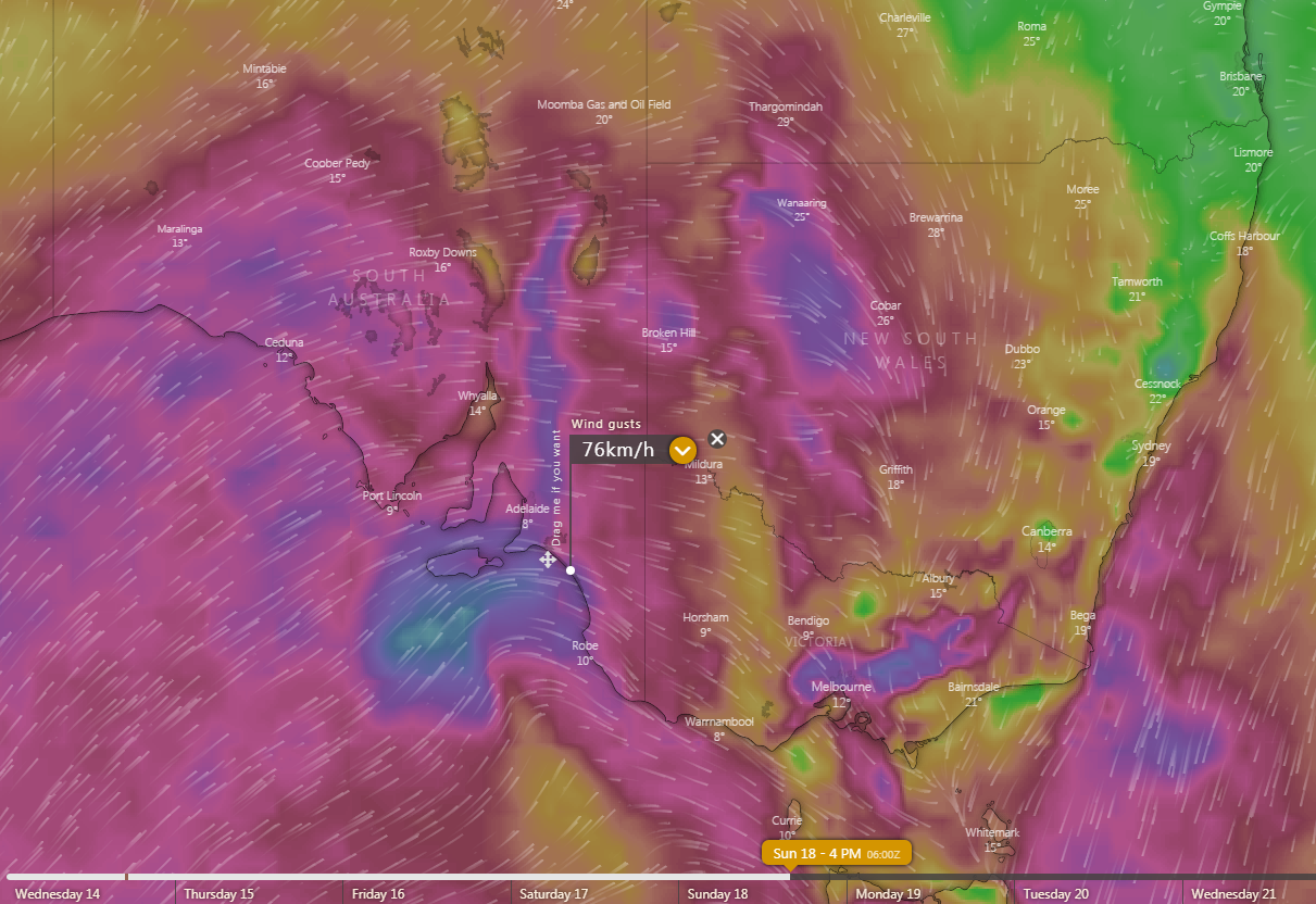
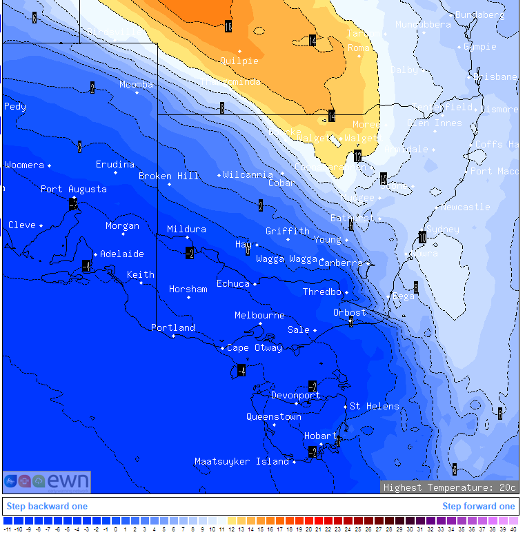 Image 4, Forecast wind gusts for Sunday 18 August, 2019
Warm, dry and windy conditions will cause fire danger to spike across northern New South Wales and...
A late spring blast of cold, wintery weather is affecting southeastern Australia from today and...
A complex low pressure system and associated cold fronts have produced a stunning polar blast...