Unseasonable instability to bring rain and storms for inland Queensland and NSW
Unseasonable instability is set to develop across northern and inland Queensland extending into NSW...
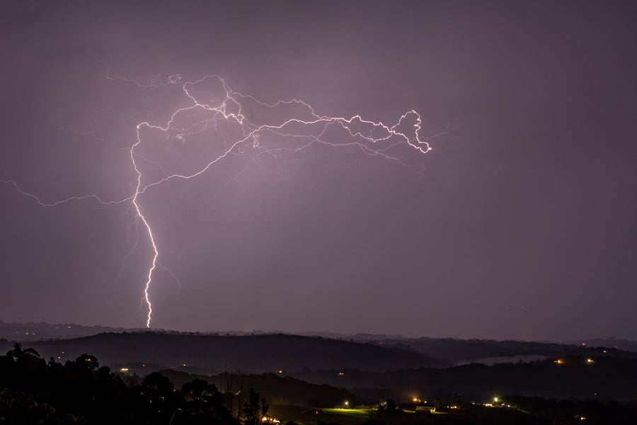
An unseasonable thunderstorm outbreak is underway across Eastern Queensland and NSW, with numerous lightning active storms rolling through the region on Sunday afternoon and evening.
The threat of severe storms will return for parts of Eastern Queensland and NSW on Tuesday into Wednesday as a strong upper trough and surface trough pushes into the region.
Overnight Monday and into Tuesday, showers and thunderstorms are expected to develop across Southern Queensland and Northern NSW, moving in an east-southeasterly direction. This activity should clear around mid-morning allowing for a potentially stronger band to develop later Tuesday.
During Tuesday afternoon, instability and wind shear will increase across the Eastern Seaboard as an upper trough continues to slowly move north, interacting with increasing moisture to its east. This is expected to lead to scattered storm activity across Eastern Queensland and NSW during Tuesday afternoon and evening, with the likelihood of a few storms becoming severe and capable of producing locally damaging winds, large hail and heavy rainfall, particularly for eastern parts of the Darling Downs, western parts of South East Queensland and Northern NSW.
This upper trough will amplify further into Wednesday with widespread showers and thunderstorms expected to continue. Favourable wind shear will help with storm organisation during the day, particularly across Central Queensland however the amount of cloud and showers may suppress more significant severe storm potential for South East Queensland and Northern NSW.
Regardless, the potential for a few isolated severe storms will exist, with damaging winds and moderate falls likely (20-40mm for some locations). Whilst the threat of large hail will be somewhat reduced on Wednesday due to a more saturated atmosphere/ongoing shower activity, this cannot be entirely ruled out.
Image 1: BoM day 2 storm outlook for NSW. High resolution ACCESS C Forecast Radar 4pm & 8pm Tuesday 11/05/2021. Images via BoM and WeatherWatch MetCentre.
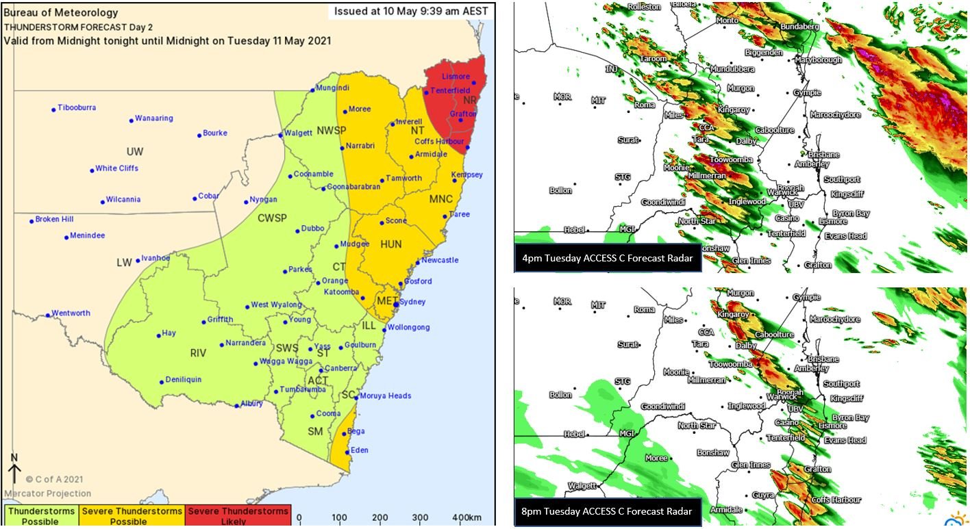
Image 2: EC rain and storms for Tuesday and Wednesday. Images via Windy.com
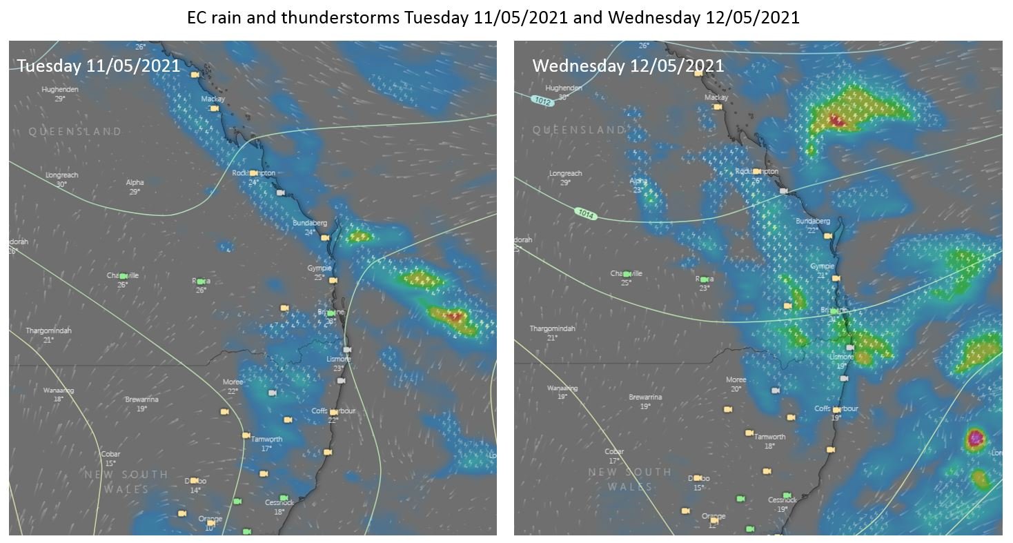 Image 3: EWN's own Michael Bath captures a cracking cloud to ground strike in Northern NSW Sunday evening.
Unseasonable instability is set to develop across northern and inland Queensland extending into NSW...
A dynamic weather situation is unfolding across southern and eastern Australia, as a upper level...
Thunderstorms will return to Eastern NSW from Thursday onwards, as a multi-day thunderstorm...