Tropical Cyclone and flooding risk for north Queensland
Tropical north QLD will face an increasing risk of flooding from Wednesday as a tropical low...
The low, which formed over the southern Daly district in the NT on Tuesday, has been producing widespread falls of 50-100mm across the last few days as it moved over the WA Kimberley region, prompting flood warnings advising of impassable roads and isolation of communities.
The system, which is currently located over the northern Kimberley, will continue to produce widespread heavy rain over the region today and into the weekend. A severe weather warning is in place for widespread 24 hour falls of 50-100mm and isolated totals in excess 200mm bringing the risk of flash flooding and riverine flooding, with potential for accumulated falls in excess of 400mm over the next few days.
On Sunday, the low is expected to move off the west Kimberley coast and rapidly intensify, developing into a tropical cyclone later Sunday evening or on Monday morning. A cyclone watch is current from Cape Leveque to Pardoo. The next tropical cyclone to develop in Australian waters will be called 'Lucas' (with another cyclone also likely to form over the Coral Sea later in the weekend or early next week making it difficult to determine the name).
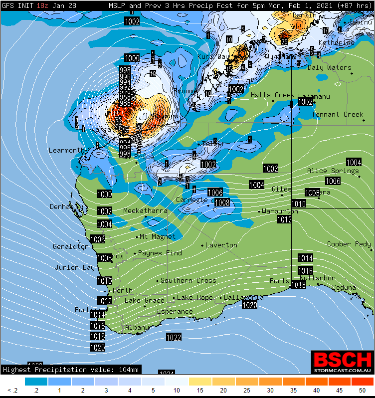
Into next week the outlook for the track of this system looks more vague, with some model situations having the system tracking close to the Pilbara coast, and others out to sea. If the system tracks close to the coast, widespread heavy rainfall and destructive winds are would be possible along the Pilbara Coast.
Image 1: Track Map for the Tropical Low from the Bureau of Meteorology (at 9am WST Friday 29 January, 2021)
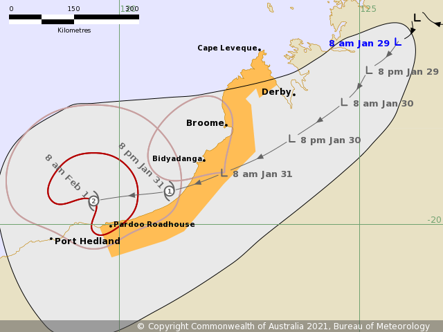
Image 2: Accumulated rainfall over northern WA across the next 3 days from the ECMWF Model (Source: Windy.com)
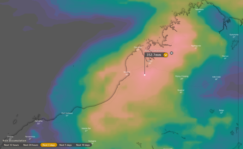
Image 3: Model output from the GFS Model of the position of the system on Monday 1st February, 2021
Tropical north QLD will face an increasing risk of flooding from Wednesday as a tropical low...
Tropical Cyclone Yasa was officially named overnight as the tropical low that has been developing...
After tormenting eastern Australia for the better part of two weeks, we are finally about to see...