Widespread severe thunderstorms continue for Queensland
Severe thunderstorms have been the major focus for Queensland and New South Wales this past week...
More thunderstorms have sparked up across parts of New South Wales today in a run of several days of thunderstorms, bringing the threat of heavy rainfall, damaging winds and large hail.
A slow-moving low pressure trough has been feeding off moist onshore winds from the Tasman Sea, and has caused thunderstorms to fire up during the afternoons and evenings since earlier this week.
On Tuesday, a spectacular shelf cloud swept across the NSW South Coast and Illawarra, with reports of very heavy rainfall, strong winds and small hail, while on Thursday intense thunderstorms on the Central Tablelands produced 47mm of rain at Bathurst airport (including 15mm in 10 minutes), and hail up to the size of golf balls in the region.
Thunderstorms are again sparking up today across the region, with the risk of heavy rainfall, damaging winds and large hail. Goulburn Airport has already recorded 26mm in 30 minutes between 1:15pm and 1:45pm today and small hail, while heavy rain and hail has also been reported in the Blue Mountains.
Thunderstorms will continue to remain a threat throughout the afternoon and into the evening, with southern, central inland regions and the far nrothwest most at risk.
From tomorrow and into the weekend, thunderstorms will become much more isolated as instability decreases, however high based thunderstorms are likely over the far west and on higher ground, although no significant rainfall is expected.
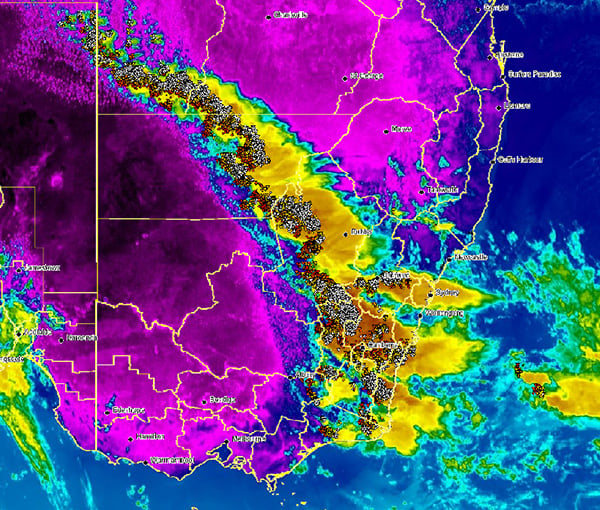
Image 1: NSW Thunderstorm with lightning overlay satelitte image.
Severe thunderstorms have been the major focus for Queensland and New South Wales this past week...
Severe thunderstorms lashed Victoria and New South Wales yesterday in one of the most intense...
Image 1: EWN Lightning Tracker Archive detailing the Boonah/Beaudesert Storm Track and new...