Extreme fire danger to impact Greater Sydney and Hunter regions
Much of NSW is seeing extreme temperatures across the state this week, with a catastrophic fire...
Near-record breaking temperatures are expected across a large portion of the country over the next several days as an intense heatwave develops for Southern and Eastern Australia.
For weeks, persistent upper ridging has allowed intense heat to build across the north of the country with dry conditions continuing for many locations.
A low pressure trough traversing the country will drag this heat south into central and eastern parts of the nation, with record to near-record November temperatures likely.
Many locations across inland South Australia, New South Wales, Queensland, Northern Victoria and parts of the Northern Territory will see temperature soar into the 40's. The Operational Consensus Forecast even has a small area of 50°C being reached in Central South Australia. Whilst this isn?t likely, mid to high 40's is expected. Adelaide is expecting a top of 40°C today, 38°C on Saturday before a cool change move through the state.
Temperatures will soar across the capital cities, with Brisbane expecting 33°C Sunday, 32°C Monday, 33°C, Tuesday before a scorcher on Wednesday topping out at 37°C. Western parts of South East QLD may seen temperatures into the low 40's, with parts of the Darling Downs into the mid 40's.
Sydney will also feel the extreme heat this weekend. On Friday, a pleasant top of 26°C is expected, increasing to 36°C on Saturday increasing to 38°C on Sunday.
Relief is on the way, as a gusty southerly change sweeps up the coast on Monday for NSW before reaching southern QLD on Wednesday. This southerly change will drop temperatures by up to 13°C for some locations.
Image 1: Operational Consensus Forecast max air temperature for Saturday 28/11/2020. Image via WeatherWatch MetCentre.
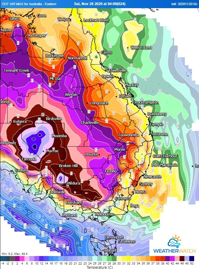
Image 2: Operational Consensus Forecast max air temperature for Sunday 29/11/2020. Image via WeatherWatch MetCentre.
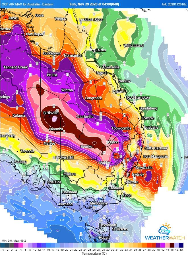
Image 3: Operational Consensus Forecast max air temperature for Monday 30/11/2020. Image via WeatherWatch MetCentre.
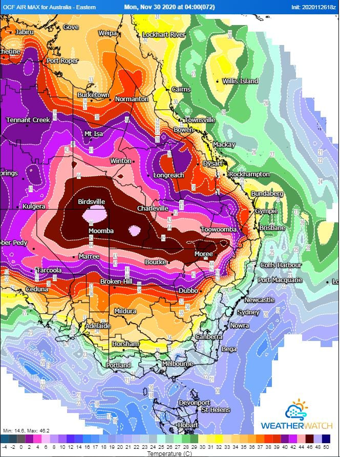
Image 4: Operational Consensus Forecast max air temperature for Tuesday 1/11/2020. Image via WeatherWatch MetCentre.
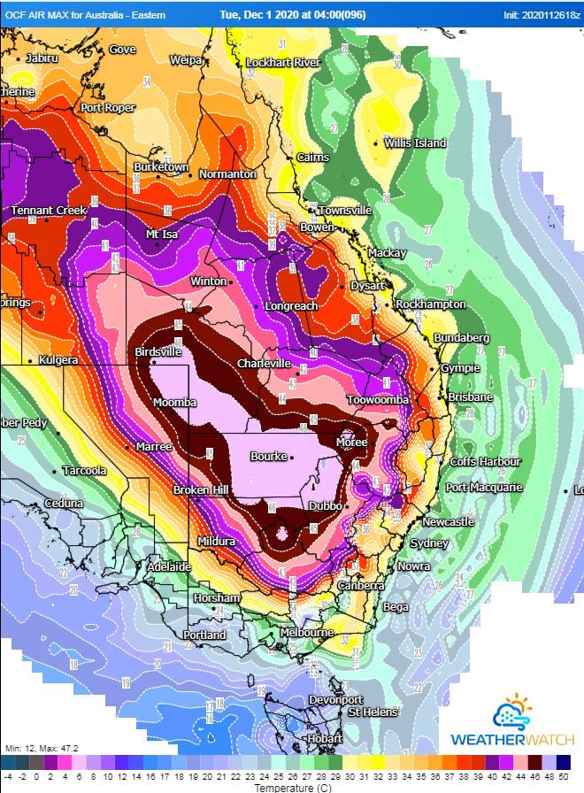
Image 5: Operational Consensus Forecast max air temperature for Wednesday 2/12/2020. Image via WeatherWatch MetCentre.
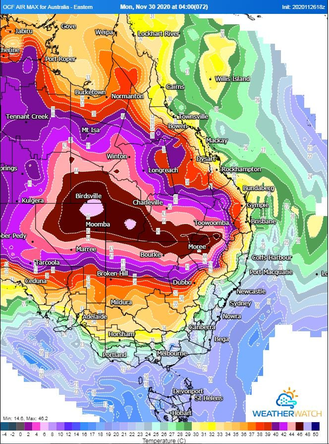
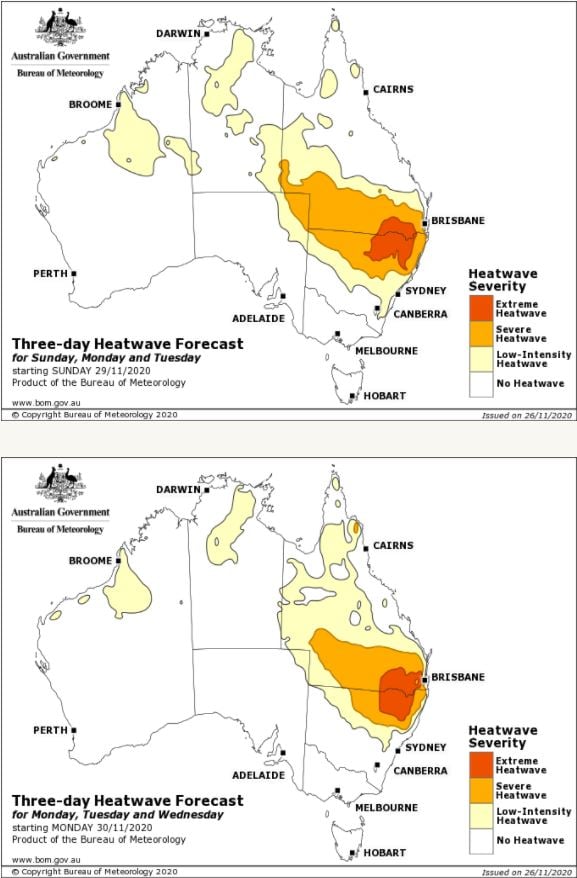
Image 6: Bureau of Meteorology Heatwave maps. Sunday-Tuesday, Monday-Wednesday.
Much of NSW is seeing extreme temperatures across the state this week, with a catastrophic fire...
The first week in February is likely to be a wet week across the eastern seaboard with showers,...
Large swathes of eastern Australia were hit by wild weather yesterday as a low pressure system...