Flash flood risk for NSW South Coast
Some windy and very wet weather looks set to affect the southern half of the New South Wales coast...
A strong southerly buster is sweeping through the greater Sydney, Hunter and Mid North Coast region of NSW during Thursday as a low pressure system deepens off the NSW coastline.
Wind gusts are expected to average 60-70km/h across the coastal fringe during Thursday, with locally damaging gusts to 90km/h possible, particularly for exposed coastal locations and elevated terrain.
A large southerly swell will also develop throughout the day, with waves in the 3-5m range expected just offshore.
Winds should gradually ease from the south overnight Thursday and into Friday as this low rapidly moves east towards New Zealand. A severe weather warning is in place for damaging winds.
Image 1: Bureau of Meteorology severe weather warning for damaging winds. Image via BoM.
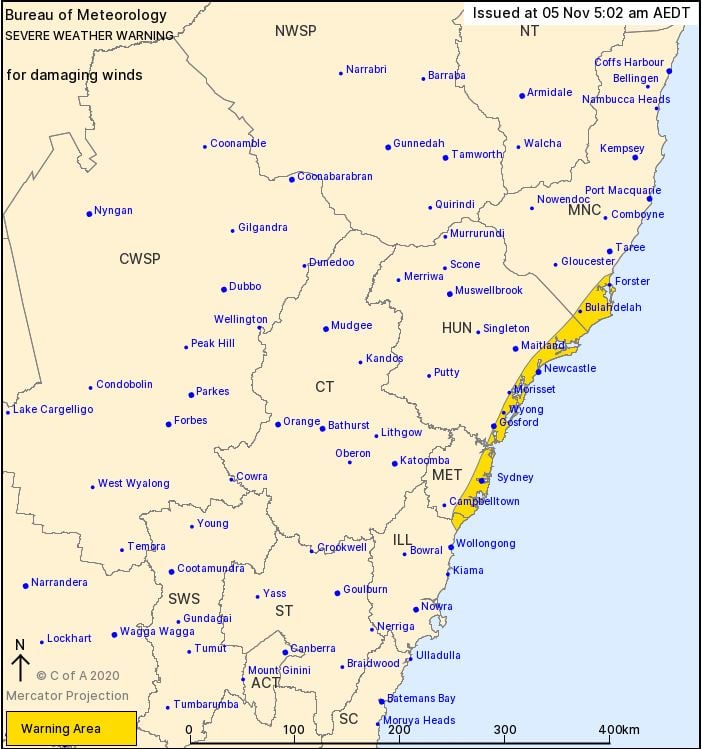
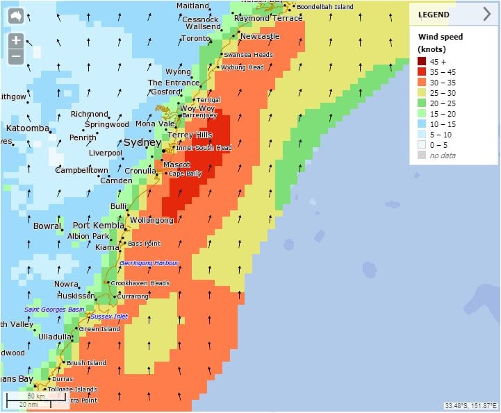
Image 2: BoM Meteye wind graphic. Valid 1700 5/11/2020
Some windy and very wet weather looks set to affect the southern half of the New South Wales coast...
Eastern Tasmania saw wet conditions across the weekend, as a low pressure system off the southern...
Wet weather is expected to finally return across eastern NSW and southern QLD this week, with the...