Weather News Archive 2019 December
Image 1: NSW fire storm across the South Coast. 31/12/2019
Parts of South East Queensland will begin to clean up the mess left after savage May thunderstorms rocked the region on Wednesday evening.
Over a 72-hour period (Monday to Thursday morning), over 250,000 lightning strikes were recorded across Eastern Queensland and Northern NSW, with over 180,000 strikes recorded on Wednesday alone. More than 17,000 homes and businesses lost power with more than 50 powerlines brought down, chiefly across parts of the Sunshine Coast.
The spectacular light show wasn’t just confined to Wednesday, with a savage round of lightning and localised damaging winds moving through the southern suburbs of Brisbane overnight Monday into Tuesday morning, waking many residents just after 1am.
Wednesday’s severe storms comes on the back of consecutive thunderdays beginning on Monday, with Toowoomba seeing 3 hailstorms during this period, with the largest hail of up to 4cm recorded at Wellcamp Tuesday night. Hail of up to 5cm was recorded south of Toogoolawah Wednesday afternoon, with large hail causing issues on the Sunshine Coast with Sunshine Plaza shoppers evacuated as water poured through the shopping centre ceiling.
72-hour rainfall totals ranged from 50-100mm for many locations, with the eastern suburbs of Brisbane registering the highest totals. Ransome received 84.7mm, Wynnum Bowls Club 76.7mm and Manly 77.3mm and Brisbane CBD 32.6mm. Mt Mowbullan in the Bunya Mountains topped the rainfall for the last 72-hours with 122.5mm, with Grandchester in the Lockyer Valley scoring 78.6mm. Low-lying Brisbane suburbs of Moorooka, Salisbury and Woolloongabba were also impacted with flash flooding.
The unusual May thunderstorms were produced by a large upper level system, bringing very cold air aloft across the Eastern Seaboard, mixing with a very humid airmass to its east. The upper level system responsible has now moved off the East Coast with a cooler, drier airmass expected to invade the region over the coming days.
Image 1: Intense thunerstorms move across the Brisbane region Wednesday evening. Image via EWN's Justin Noonan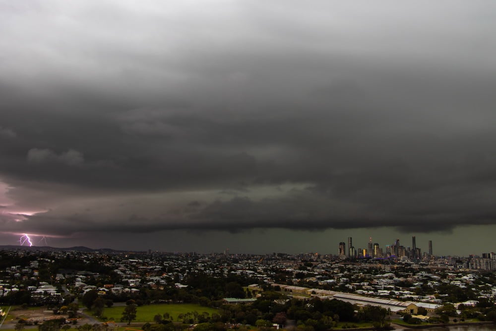
Image 2: Large hail at Toowoomba Tuesday night. Severe warned storm west of Millmerran Tuesday. Images via EWN's Cameron Hayes 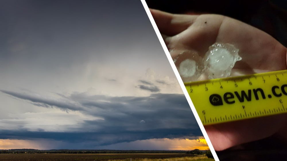
Image 3: Last 72hrs of lightning strikes/rainfall totals for Eastern Queensland. Images via EWN.
![]()
Image 1: NSW fire storm across the South Coast. 31/12/2019
Image 1: Forest Fire Danger Index for South Australia for 31 October, 2019 (Source: Bureau of...
Image 1, Current EWN Radar w/lightning overlay (12.45pm)